Tropical Cyclone Report
Tropical Depression Seven
25 - 27 July 2003
Richard J. Pasch
National Hurricane Center
30 November 2003
Tropical Depression Six dissipated as it approached
the Lesser Antilles on 21 July. However, the parent tropical wave
continued westward, and an area of deep convection associated with
the wave moved across Hispaniola on 23 July, and approached the
southeast coast of Florida on 24 July. Radiosonde data and
satellite images suggest that a mid- to lower-tropospheric
circulation associated with the convection then moved northward
near the east coast of Florida, and by 1200 UTC 25 July, satellite
images and surface observations indicate that Tropical Depression
Seven had formed about 50 n mi east of Daytona Beach, Florida. The
system was embedded in an environment characterized by high surface
pressures and, as it moved north-northwestward over the cooler
shelf waters near the northeast Florida and Georgia coasts, its
maximum winds did not strengthen beyond 25-30 kt. The cyclone made
landfall along the central Georgia coast about 35 n mi south of
Savannah around 0600 UTC 26 July, and dissipated over Georgia about
a day later.
The "best track" positions and intensities are listed
in Table 1, and a map of the tropical depression's path is given in
Figure 1. Rainfall totals of two to three inches were reported over
portions of Georgia and South Carolina. There were no reports of
damage or casualties associated with this depression. The
depression was not forecast to strengthen into a tropical storm,
and no watches or warnings were required for this system.
Table 1: Best track
for Tropical Depression Seven, 25-27 July 2003.
Date/Time
(UTC) | Position | Pressure
(mb) | Wind Speed
(kt) | Stage |
Lat.
(°N) | Lon.
(°W) |
| 25 / 1200 | 29.3 | 80.1 | 1017 | 25 | tropical
depression |
| 25 / 1800 | 30.1 | 80.5 | 1017 | 25 | " |
| 26 / 0000 | 30.7 | 80.8 | 1016 | 30 | " |
| 26 / 0600 | 31.5 | 81.3 | 1018 | 25 | " |
| 26 / 1200 | 32.3 | 82.0 | 1022 | 20 | " |
| 26 / 1800 | 32.8 | 82.6 | 1022 | 15 | " |
| 27 / 0000 | 33.0 | 83.0 | 1022 | 15 | " |
| 27 / 0600 | | | | | dissipated |
| 26 / 0000 | 30.7 | 80.8 | 1016 | 30 | minimum pressure |
| 26 / 0600 | 31.5 | 81.3 | 1018 | 25 | landfall near St. Catherines
Island, Georgia, about 35 n mi south of Savannah |
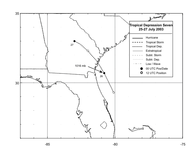
Figure 1:
Best track positions for
Tropical Depression Seven, 25-27 July 2003.
|


