|
Data Products ››
 Data set maintenance is important to accurately reflect current ground conditions. Satellite imagery serves as a key component in the development of LANDFIRE existing vegetation and fuel layers; however, some of these data originated as far back as 1999. Yet wildland fires have substantially changed vegetation and fuels in many areas of the West since 1999. Consequently, existing vegetation and fire behavior fuel layers are being updated through the LANDFIRE Rapid Refresh to reflect changes resulting from recent (1999-2007) wildland fires. (Obtain Rapid Refresh Fire Perimeter Data.)
In addition to updates within fire perimeters, global changes are being made to the existing vegetation and fire behavior fuel layers. For example, the original LANDFIRE fuel layers incorporated additional areas classified as barren and water that were not incorporated into the vegetation layers. In the Rapid Refresh process, these areas of barren and water are being added to the existing vegetation layers to better reflect what is on the ground and to ensure that the vegetation and fuel layers are logically consistent. Furthermore, global changes to fuel model and canopy layers are being implemented in response to recommendations from the LANDFIRE After Action Reviews (AARs) and feedback provided by other fire and fuel specialists.
LANDFIRE Rapid Refresh products comprise a set of nine updated vegetation and fuel layers. Rapid Refresh is scheduled to deliver products on an incremental basis through June of 2008. To learn more about LANDFIRE's Updating Products Operations and Maintenance Strategy, click here.
Following is the list of Rapid Refresh products. Descriptions of individual products are forthcoming. Rapid Refresh products can be accessed via the National Map LANDFIRE.
|
|


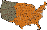
 LANDFIRE National