|
Schedule ››
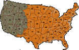
 Through the Rapid Refresh, mapping zones associated with eleven western states will be updated by June 2008. The data, like that of LANDFIRE National, will continue to be processed by mapping zone. Zones have been grouped by geographic areas (Southwest, Pacific Southwest, Pacific Northwest, Northern Rocky Mountains, Central Rocky Mountains, and the Great Basin,) to facilitate data gathering, processing, and review.
The subsequent Refresh phase will rely on interagency Fire Planning Units (FPU), which will serve to collect and coordinate data. Data will then be submitted for processing by geographic areas. Details on the Refresh schedule will be forthcoming.
For additional details on LANDFIRE’s Updating Products Operations and Maintenance Strategy, click here.
|
|