 |  |
| |
|
|
||||||||||||||||||||
|
About LANDFIRE
 Data Products
Schedule
How to Participate
Documents
Training & Technology Transfer

 National Schedule  |
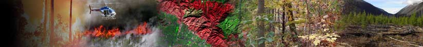
How to Participate ›› Updating Products ›› Providing Other Data Digital photos of vegetation and/or fuel conditions at geo-referenced points within forests or rangelands across the US will be useful in LANDFIRE Refresh. Photos should clearly show vegetation and/or fuel characteristics within 15 meters (ideally) of the geo-referenced point. Photos to be contributed to LANDFIRE must be accompanied by the following information for each: photo filename, coordinates of photo point, and coordinate system used. Additional information regarding the vegetation or fuel conditions depicted in each photo is valuable and requested as available, but not required. Vegetation or fuel plot data are likewise useful for LANDFIRE Refresh. Click here for more information about our needs for field-sampled vegetation and fuel data. Finally, any detailed information regarding specific natural disturbances or land-management activities that have taken place from 1999 to present within clearly delineated areas should also be useful for LANDFIRE Refresh and are likewise requested. Such resources would include documents describing the efficacy of certain fuel-reduction treatments or summarizing changes in vegetation or fuel resulting from natural or anthropogenic disturbances within clearly defined land-management units. Information along these lines in, for example, the form of a final project report is welcomed by itself or as a supplement to any spatial polygon event data, vegetation or fuel plot data, and/or digital photos contributed for Refresh. If you have recent digital photos, vegetation or fuel plot data, or any additional project information to contribute for LANDFIRE Refresh, please contact Karen Short, the LANDFIRE Reference Data Administrator, at 406-549-7478 or kshort@landfire.org.
|
|||||||||||||||||||
|
||||||||||||||||||||


 Thank you for your interest in providing digital photos, vegetation or fuel plot data, or other information to support LANDFIRE Refresh. Please note that, for the data to be useful for LANDFIRE Refresh, they must represent events or conditions from 1999 or later.