|
|
|
 |
| About Our Maps |
|
The Adobe PDF File Format:
| Most of the maps on this page are in the Adobe PDF file format. To view and print our PDF files we recommend the Adobe Reader® browser plug-in. This plug-in allows you to view our maps directly in your Internet Explorer, Netscape, or AOL browser. |
File Sizes
| Our downloadable map files range from 100kb to over 5 Mb in size. We have noted the file size next to each file link for your convenience. For reference, a 28.8k modem downloads approximately 200k per minute depending on network loads. |
Maps in Microstation Design File Format:
| Many of the CAD files used to create our PDF maps are also available. See our Microstation Design Files page for more information about what we provide in this CAD file format. |
Data in Other Formats
| Please see our Links page for more data resources. |
Printed Paper Copies of Maps
Standard Map Projection:
Our maps use the Oregon Geographic Information Council´s (OGIC) Lambert Projection.
More information can be found on our ODOT Standard Coordinate System page.
|
|
|
|
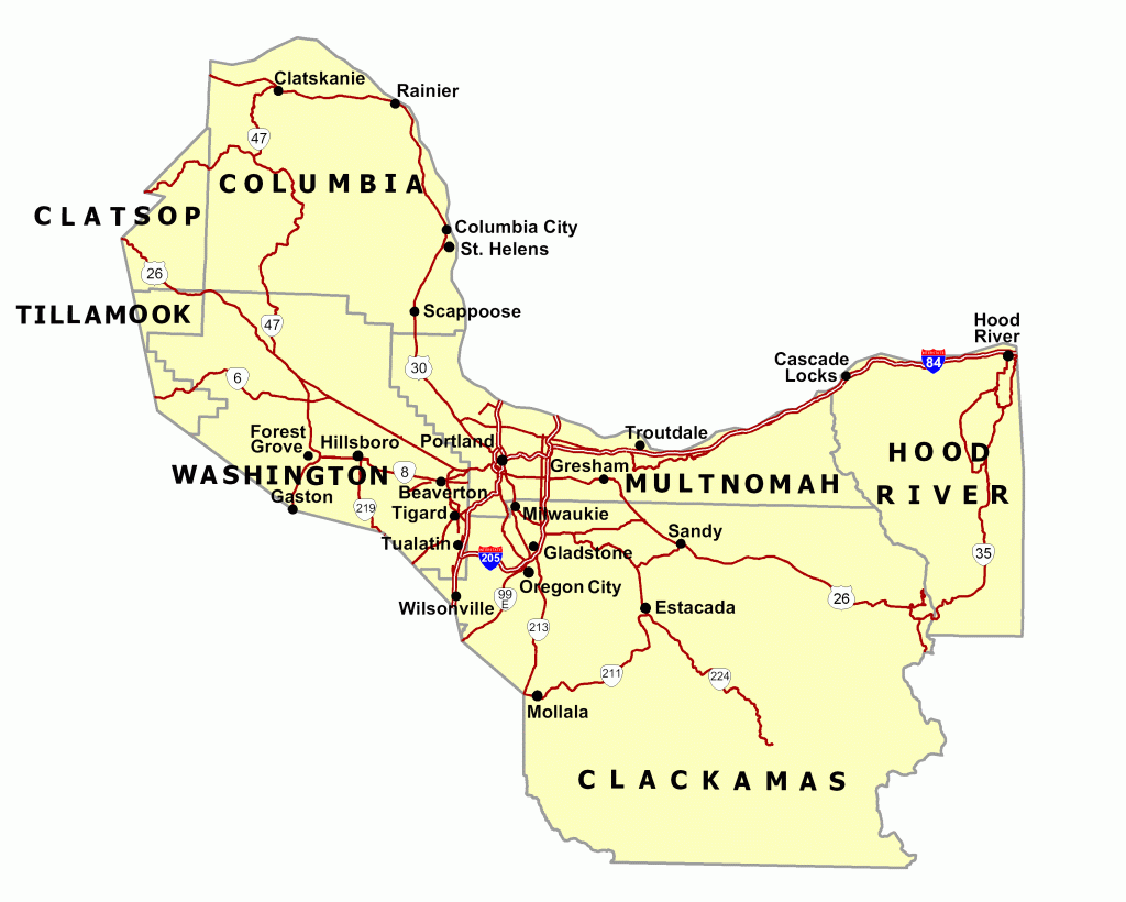
| City Maps |
|
Download ODOT City Maps in PDF format:
| Go to our City Maps page to download these files. |
| The ODOT GIS Unit also provides some additional city-scale maps, the areas and names of which correspond to various USGS quadrangle maps. For the cities of Portland and Salem these maps are offered in place of actual city maps. For the cities of Eugene and Springfield these maps are offered in addition to city maps. These quadrangle maps tile over large areas extending well beyond city boundaries. |
Features included on ODOT City Maps:
- Streets, roads and highways
- Railroads
- Schools
- Public buildings
- Political boundaries
- Land and water features
- Public Land Survey System (PLSS) Section corners
|
File size issues:
| If maps load slowly on your machine, PDF´s over 1.0mb are available in sections, typically four per city map. This reduces file size and shortens download time. If you would like to request a city map that has been divided into sections, please contact the GIS Unit. |
|
|
|
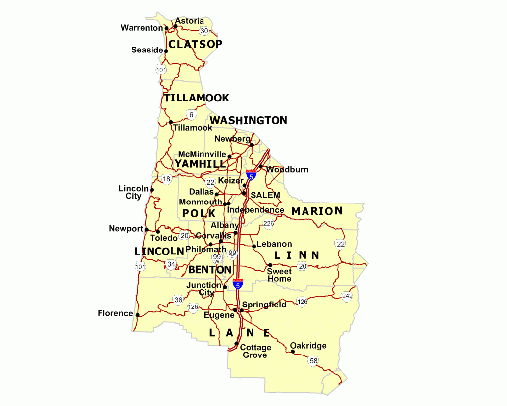
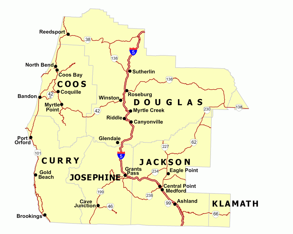
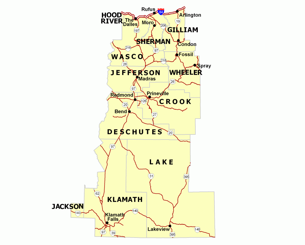
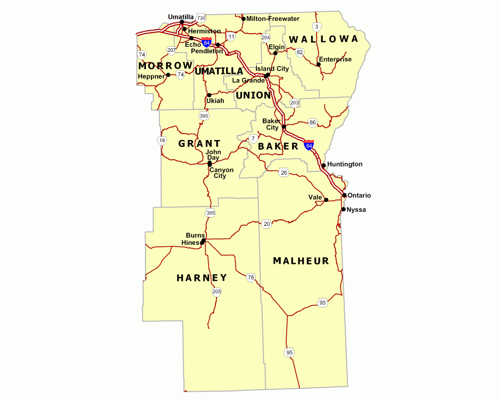
| County Maps |
|
Download ODOT County Maps in PDF format:
County Sheets:
| Most counties are large enough to require more than one map to cover the entire county area. County areas may be broken down into multiple "sheets." File naming convention for the county map series is based on the county name and the sheet number. The first four letters of the county name is used, followed by the sheet number. The sheet number may be 1 through the total number of sheets created for a given county. For example, the PDF file name for sheet 2 of Crook County would be croo2.pdf. |
Features Included on ODOT County Maps:
- Highways and roads
- Road names (outside enlargement areas)
- Functional classification of roads
- Railroads and railroad ownership
- Communities, incorporated cities and city limits
- Township, Range and Section
- State parks
- Forest boundaries
- Airports
- Land and water features
- Latitude and Longitude
|
|
|
|
| Statewide Maps |
|
Oregon Official State Highway Map:
The Oregon Official State Highway Map includes highways and roads, posted routes, mileage, interstate exit numbers, rest areas, cities, towns, counties, State and Federal lands, water features, parks, campgrounds, airports, lighthouses, fish hatcheries, winter recreation areas, and historic / national trails. (Last Updated 2007)
You may also order this free map by mail, phone, or e-mail:
-
Mail:
-
ODOT Transportation Development Division
-
Geographic Information Services Unit
-
555 13th St. N.E., Suite 2
-
Salem, OR 97301-4178
-
Phone:
-
E-mail:
|
ODOT Statewide Maps in PDF format:
- Highway Numbers and Routes - includes cities, counties, highways, highway numbers, and posted route numbers. (Last updated December 2007 - 760kb)
- ODOT Maintenance District Map - includes section foreman, cities, counties, regions, districts, highways, highway numbers, and posted route numbers. (Last updated 2007 - 1.2Mb)
- ODOT Region Map - includes regions, cities, counties, highways, posted route numbers (Last updated 2008 - 822kb)
- ODOT Region Map (small) - this is a smaller ODOT Region map with less detail and includes regions and counties only (Last updated 2004 - 139kb)
- Pavement Conditions - includes pavement conditions, cities, counties, regions, districts, highways, highway number, posted route number, and milepoints. (Last updated 2006)
- State of Oregon - includes counties, highways, posted highway numbers, posted route numbers, and hydrography. (Last updated 2002 - 1.4Mb)
- State Highway System - includes counties, state highways, posted route numbers and city limits. (Last updated 2008 - 2.2Mb)
- State Highway System with 5 Mile Markers - includes counties, state highways, five mile markers, posted route numbers and city limits. (Last updated 2008 - 4.6Mb)
- Portland Metro Area - State Highway System with 5 Mile Markers - 11x17 includes counties, state highways, five mile markers, posted route numbers and city limits. (Last updated 2008 - 500K)
- ODOT Corridors - includes ODOT Corridors, cities, regions, districts, and highways. (Last updated 1998 - 1.9Mb)
- Oregon Safety Corridors - Active and decommissioned safety corridors. (Last updated 2005 - 2.1Mb)
- Oregon Scenic Byways - includes All American Roads, National Scenic Byways, Oregon State Byways, cities, posted route numbers, Wilderness area, National forest, and Indian reservations. (Last updated 2002 - 1.6Mb)
- State Highway Freight System - includes freight system routes, cities, highways, and posted route numbers. (Last updated 2006 - 641kb)
- Oregon Railroads - includes railroad ownership, cities, and counties. (Last updated 2004 - 439kb)
|
Other Statewide Maps:
- Over-Dimension Truck Route Maps - Please note: The Oregon route maps accessible here are for reference only. Truckers who need safe routing instructions for over-dimension movements must contact the Motor Carrier Transportation Division in Salem at 503-378-5849.
- Right of Way Maps - Contact the Maps and Plans Center at (503) 986-3792
|
|
|
|
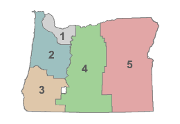
| ODOT Region Maps |
|
Statewide ODOT Region Maps in PDF format:
ODOT Region Maps in GIF image format:
Features included on ODOT Region Maps: cities, counties, highways, and posted route numbers.
(Last updated 2004)
|
|
|
|
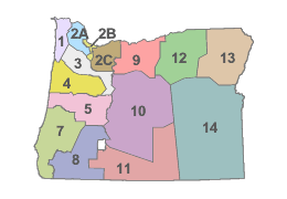
| ODOT District Maps |
|
Statewide ODOT District Maps in PDF format:
- ODOT Maintenance District Map - includes section foreman, cities, counties, regions, districts, highways, highway numbers, and posted route numbers. (Last updated 2007 - 1.2Mb)
|
ODOT District Maintenance Maps in PDF format:
| Features include on ODOT District Maps: cities, districts, counties, odot maintenance sections, highways, highway numbers, and posted route numbers with milepoints every five miles. (Last updated 2006) |
|
|
|
| Pavement Condition Maps |
|
Statewide Pavement Condition Maps in PDF format:
- Pavement Conditions - includes pavement conditions, cities, counties, regions, districts, highways, highway number, posted route number, and milepoints. (Last updated 2006)
|
|
|
|
| Seismic Lifeline Maps |
|
Lifeline Routes are predefined emergency routes categorized by the following lifeline priorities:
| Priority 1: |
Routes essential for emergency responses in first 72 hours after incidence. |
| Priority 2: |
Routes desirable for emergency responses in first 72 hours or routes essential for economic recovery. |
| Priority 3: |
Other emergency response routes or routes which serve relatively few people but are still important because they are the only access. |
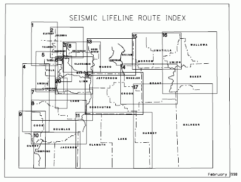
- Clatsop and Tillamook County
- Columbia, Washington, and Multnomah County (West)
- Multnomah, Hood River, and Clackamas County
- Lincoln, Lane, and Douglas County (Coastal)
- Yamhill, Polk, and Benton County
- Linn and Marion County
- Lane County
- Douglas County
- Coos and Curry County
- Josephine and Jackson County
- Klamath and Lake County
- Deschutes, Crook, and Jefferson County
- Wasco, Sherman, Gilliam, and Hood River County
- Wheeler and Grant County
- Morrow and Umatilla County
- Union, Wallowa, and Baker County
- Harney and Malheur County
- Portland Area (I-205, I-217, Columbia River)
- Mid-Willamette Valley (Albany to Wilsonville)
- South Willamette Valley (Cottage Grove to Albany)
|
|
|
| SPIS/SIP Maps |
|
Statewide Top 5% SPIS Sites
Statewide SPIS/SIP Maps
| Features include: SPIS sites and number of crashes on five mile segments, cities, regions, districts, counties, highway numbers, and posted route numbers. |
SPIS/SIP Region Maps
| Features include: SPIS sites and number of crashes (2004 - 2006) on five mile segments, cities, regions, districts, counties, highway numbers, and posted route numbers. (Last updated 2007) |
SPIS/SIP District Maps
| Features include: SPIS sites and number of crashes (2004 - 2006), cities, counties, highway numbers, and posted route numbers. (Last updated 2007) |
SPIS/SIP City Maps
| Features include: SPIS sites and number of crashes (2004 - 2006) on five mile segments, cities, regions, districts, counties, highway numbers, and posted route numbers. (Last updated 2007) |
What is SIP?
| Oregon has made a major effort to emphasize safety in all projects. The Safety Investment Program (SIP) of the Statewide Transportation Improvement Program (STIP) provides separate funding to address safety issues on preservation projects. In addition, safety considerations are identified in all projects involving the governor and the legislature. |
What is SPIS?
| The SPIS/SIP maps found on this page refer to the Safety Priortiy Index System (SPIS). SPIS is a method developed by ODOT for identifying potential safety problems on state highways. SPIS is a tool used to identify accident history in 0.10 mile or variable length segments on state highways. SPIS scores are developed based upon crash frequency, severity, and rate. A prioritized list is created for each region (the top 10 percent of statewide SPIS sites) and is provided to regions annually for analysis and possible corrective action. |
|
|
|
| Microstation Map Files |
|
|
|
|
| Hardcopy Printed Maps |
|
|
|
|
| Help |
|
If you are having trouble downloading or viewing any of our files please take a look at our help page .
|
|
|
|
| Disclaimer |
|
| Our products are for informational purposes only and may not have been prepared for legal, engineering or surveying purposes. Users of this information should review or consult the primary data and information sources to ascertain the usability of the information. |
|
|
| |
|
|

