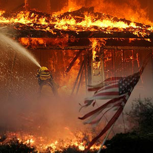
Natural Hazards
The USGS continues to mobilize equipment and personnel to gather the scientific data and information to assess the potential risk for debris-flow, increased flood risk, water quality degradation, and damages to ecosystems. Learn more (PDF).
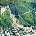
Landslide and Debris-Flow Impacts
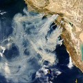
Satellite Imagery and other Geospatial Data
|
 |
News Releases
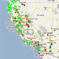
Monitor Streamflow Conditions Post-Fire
 |
|
Publications
 |
Additional USGS Information
 |
NOTE: The videos below are offered in Quicktime format. You can also download the videos, instead of playing them directly in your browser, by right-clicking the "Direct download" link choosing "Save Link As" or "Save Target As" option.
|
Federal Resources
 |
|

![]() U.S. Department of the Interior |
U.S. Geological Survey
U.S. Department of the Interior |
U.S. Geological Survey
URL: http://www.usgs.gov/hazards/wildfires/ca/default.asp
Page Contact Information: Ask USGS
Page Last Modified: Wednesday, December 17, 2008