Kansas Water Science Center
Surface Water
USGS Water Science Centers are located in each state.
2000 - 2006 Flows at some USGS streamgages lower than 1930's or 1950's droughts
USGS Home Water Resources Biology Geography Geology Geospatial


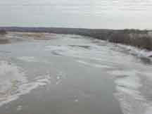 Kansas River at DeSoto, January 21, 2003, discharge 317 cubic feet per second. Photograph by J. Barnard, USGS
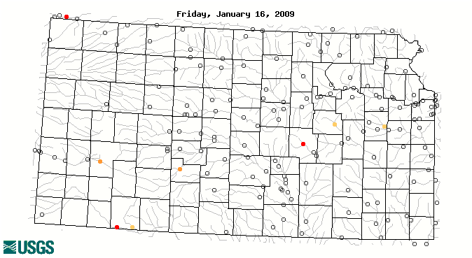
![[color-codes for map]](https://webarchive.library.unt.edu/eot2008/20090116033458im_/http://water.usgs.gov/waterwatch/images/map_legends/dry_dot_wnd.gif)