| Projects & Studies
|
| »
|
Benton County near St. Cloud, Minnesota
|
| »
|
Canisteo Mine Pit Flood Control Project, Itasca County, Minn.
|
| »
|
Chippewa River at Big Bend , Minnesota - Stream Bank Protection
|
| »
|
Crow River at Delano, Minnesota
|
| »
|
Devils Lake Basin, North Dakota
|
| »
|
Devils Lake Flood Risk Management Project
|
| »
|
Devils Lake Levee, North Dakota
|
| »
|
Devils Lake: Minnewaukan Flood Control Project, North Dakota
|
| »
|
Drayton Initial Assessment - Drayton, North Dakota
|
| »
|
Emergency Streambank Protection, Section 14, Brooklyn Center, Minn.
|
| »
|
Erosion along Highway 2, Red Lake River, Crookston, MN
|
| »
|
Fargo-Moorhead and Upstream Feasibility Study
|
| »
|
Flood Control: Downtown St. Paul Airport, St. Paul, Minnesota
|
| »
|
Flood Risk Management Continuing Authority, Red River of the North: Wahpeton, N.D.
|
| »
|
Flood Risk Management: Fargo-Moorhead Metro, North Dakota and Minnesota
|
| »
|
Flood Risk Management: Red Lake River, Crookston, Minnesota
|
| »
|
Flood Risk Management: Roseau River, Roseau, Minnesota
|
| »
|
Flood Risk Management: Twin Valley, Wild Rice River, Minnesota
|
| »
|
Hay Creek Aquatic Ecosystem Restoration - Roseau County, Minnesota
|
| »
|
Homme Dam and Reservoir Dam Safety, North Dakota
|
| »
|
Integrated Watershed Study: Minnesota River Basin in Minnesota, South Dakota, North Dakota and Iowa
|
| »
|
Kickapoo River Flood Damage Reduction, La Farge, Wisconsin
|
| »
|
Lac Qui Parle River, Dawson, Minnesota
|
| »
|
Marsh Creek near Mahnomen, Minnesota
|
| »
|
Minnesota River Flood Control Project : Montevideo, Minnesota
|
| »
|
Minnesota River Flood Control Project, at Granite Falls, Minnesota
|
| »
|
Mississippi Headwaters Reservoirs Project Sites
|
| »
|
Newport, Minnesota Flood Risk Management Project, Section 205
|
| »
|
Painter Creek Habitat Restoration, Minnehaha Creek, Minnesota
|
| »
|
Park River Flood Protection Project at Grafton, North Dakota
|
| »
|
Pembina River Flood Control Project: Neche, North Dakota
|
| »
|
Reconnaissance Study: Minnesota River Basin in MN, SD, IA and ND
|
| »
|
Red River of the North Basin: Basin-Wide Watershed Management Planning
|
| »
|
Red River of the North Basin: Minnesota, North Dakota, South Dakota and Manitoba, Reconnaissance Study
|
| »
|
Red River of the North Flood Control: Breckenridge, Minnesota
|
| »
|
Red River of the North at Grand Forks, North Dakota/East Grand Forks, Minnesota Flood Risk Management
|
| »
|
Ridgewood Addition, Fargo, North Dakota
|
| »
|
River Resource Values and Expectation
|
| »
|
Roads Serving As Water Barriers, Devils Lake Basin, North Dakota
|
| »
|
Sand Creek Flood Risk Management Project, Jordan, Minnesota
|
| »
|
Section 205 Flood Control Project, Borup, Minnesota
|
| »
|
Section 205 Flood Control Study: Mississippi River, Aitkin, Minnesota
|
| »
|
Sheyenne River Flood Control, West Fargo, North Dakota
|
| »
|
Sheyenne River, Baldhill Pool Raise, North Dakota
|
| »
|
South Fork Zumbro River Flood Control: Rochester, Minnesota
|
| »
|
South Washington Watershed District
|
| »
|
Stillwater Flood and Retaining Wall Project, St. Croix River, Stillwater, Minnesota
|
| »
|
Stream Bank Protection: Section 14, Pug Hole Lake, Minnesota
|
| »
|
Western Flood Control Sites - Minnesota: Lake Traverse, Orwell Lake, Hwy 75 - Bigstone, Lac qui Parle
|
| »
|
Western Flood Control Sites – North Dakota: Lake Ashtabula, Homme Lake Souris River
|
| »
|
White Rock Dam Safety, Wheaton, Minnesota
|
| »
|
Wild Rice River (MN) Feasibility Study
|
| »
|
Wild Rice and Marsh Rivers, Ada, Minnesota
|
|
|
|
Traverse Lake
|
Overview
|
Lake Traverse is open throughout the year. The shallow lakes are good fishing places for walleyes, northern pikes, bullheads and crappies, especially in the spring. In the summer, there is fishing, boating, waterskiing, picnicking and nature watching. There are many aquatic birds such as herons, egrets, grebes, pelicans and cormorants who visit the site. Additionally, the cold, winter days are perfect for ice-fishing, cross-country skiing and snowmobiling.
Hunting is open to the public on the 1,512 acres of wildlife management Areas, regulated by the Corps of Engineers and the Minnesota Department of Natural Resources. Check with the DNR prior to hunting for more information on current hunting regulations.
|
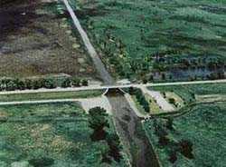
White Rock Dam, which forms Mud Lake, is located at the extreme north end of the site and controls water flowing north on the Bois de Sioux River. Reservation Dam controls the pool level at Lake Traverse and the water flow north into Mud Lake; it also serves as a levee that separates the two lakes.
Recreation facilities White Rock Dam, Reservation Control Dam and Browns Valley Dike include picnic areas, shoreline fishing areas and privies. The three recreation areas are all close to at least one of the eight boat ramps.
Camping sites are available at Traverse County Park and other recreation areas.
|
|
Location
|
The Lake Traverse Project is in Wheaton, Minn. It is located along the boundaries of western Minnesota, northeastern South Dakota and southeastern North Dakota. It is composed of two dams, two lakes and the Browns Valley dike at the lower end of the area.
|
|
History
|
Construction on the Lake Traverse Flood Control project began in 1936 and was completed in 1941. The primary purposes were for flood control benefits along the Bois de Sioux River and lower Red River valley, as well as water conservation for frequent periods of draught.
|
|
Specifications
|

Reservation Dam
Length -- 9,100 feet
Height -- 14.5 feet
Automated System -- Gate 1 @ 19.7 feet
Gate 2 @ 88.6 feet
|
White Rock Dam
Length -- 14,400 feet
Height -- 16 feet
Tainter Gates -- 3 @ 16'h X 13'w
|
 Browns Valley Dike
Length -- 10000 feet
Height -- 16 feet
|
Reservoirs
Lake Traverse -- 11,200 surface acres
Mud Lake -- 3850 surface acres
|
|
Current year hydrologic data
|
St. Paul District Water Control Center
Information about daily inflow, outflow and pool elevation.
|
|
Recreation Information
|

|
|
Additional
|
The Mud Lake Management Group has been formed to improve the waterfowl habitat of Mudlake, which has been in decline since 1988. more >>
|
|
|
[Printable Copy]
|