Division of Geology and Land Survey
Historic Photos

Photo circa 1970s. Ha Ha Tonka State Park
Welcome
Maps
Earthquake Maps
Geologic Maps
Topographic Maps
Resources
Corner Master Index
Educational Outreach
Geographic Reference System
Land Survey Index
Missouri Geology Bibliography
Museum of Missouri Geology
Wellhead Online Services
Celebrating 160 years of service to Missourians
 One hundred sixty years is not a very long time when speaking in geologic terms. However, the Missouri Department of Natural Resources' Geological Survey is observing this noteworthy milestone this year. Since 1853, the Missouri Geological Survey has provided reliable scientific information to describe and understand Missouri's wealth of natural resources.
Mark your calendars and plan to attend our week-long Open House, April 22-26, 2013 where you will find special exhibits, visit with staff, tour the Edward L. Clark Museum of Missouri Geology and attend daily presentations about the contributions staff members have made to both the environmental and economic vitality of Missouri. Read more.
Sinkhole Collapse
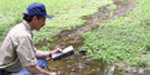
 Sinkholes are depressed or collapsed areas formed by dissolution of carbonate bedrock or collapse of underlying caves. They range in size from several square yards to hundreds of acres and may be very shallow or hundreds of feet deep. Sinkholes are part of what is called “karst” topography, which also includes caves, spring and losing streams. While many sinkholes occur as circular, bowl shaped depressions, others are not readily visible on the surface because voids are plugged or capped with soil or think layers of rock. The department’s Division of Geology and Land Survey provides technical assistance to the citizens of Missouri by evaluating the causes and repercussions of landslide development and sinkhole and mine collapse. Staff perform visual reconnaissance to determine if collapse or landslide is attributed to a natural karst feature or is associated with the failure of a man-made feature. Read more in the Geologic Hazards brochure. Create a map showing sinkholes that have been reported to the department or are on U.S. Geological Survey topographic maps. Other sinkholes may exist that have not been reported to the department.
- Search for Well or Pump Installation Contractors

- Our geologic maps and USGS topographic maps look great framed and they make great gifts
- Learn about careers in geology – watch this short, informative video
- USGS Director Marcia McNutt recognizes importance of State Geological Surveys
Geothermal Investigations![]() Oil and Gas Resources
Oil and Gas Resources![]() Protecting Drinking Water
Protecting Drinking Water

![]()

![]()

Mineral Resources![]() McCracken Core Library
McCracken Core Library![]() Earthquakes
Earthquakes


Missouri Cave and Springs![]() Environmental Geology
Environmental Geology![]() Missouri Fossils
Missouri Fossils

![]()
![]()

Geological Survey![]() Land Survey
Land Survey![]() Missouri Geology Store
Missouri Geology Store![]() Ask a Geologist
Ask a Geologist

![]()

![]()

![]()

Fact Sheets and Special Publications
Geologic Column of Missouri | General Interest Publications | News Archive | U.S. Public Land Survey System

