Promoting Safety, Protecting the Environment and Conserving Offshore Resources
The geographic data are built from the Technical Information Management System (TIMS). TIMS consists of two separate databases: an attribute database and a spatial database. The attribute information for offshore activities is stored in the TIMS database. The spatial database is a combination of the ARC/INFO and FINDER databases and contains all the coordinates and topology information for geographic features. The attribute and spatial databases are interconnected through the use of common data elements in both databases, thereby creating the spatial datasets.
The data in the mapping files are made up of straight-line segments. If an arc existed in the original data, it has been replaced with a series of straight lines that approximate the arc. The Gulf of Mexico OCS Region stores all its mapping data in longitude and latitude format. All coordinates are in NAD 27.
Data can be obtained in three types of digital formats:
Please read our disclaimer prior to downloading files.
| File Name | ASCII Files | E00 Files | DXF | SHP | Description |
|---|---|---|---|---|---|
| 5 & 10 Lease Lines Updated 11/20/14 |
8316 | 8205 | 8425 | shapefile | Consists of lease term lines that depict the 5, 8, and 10 year lease term areas. Browse-Graphic |
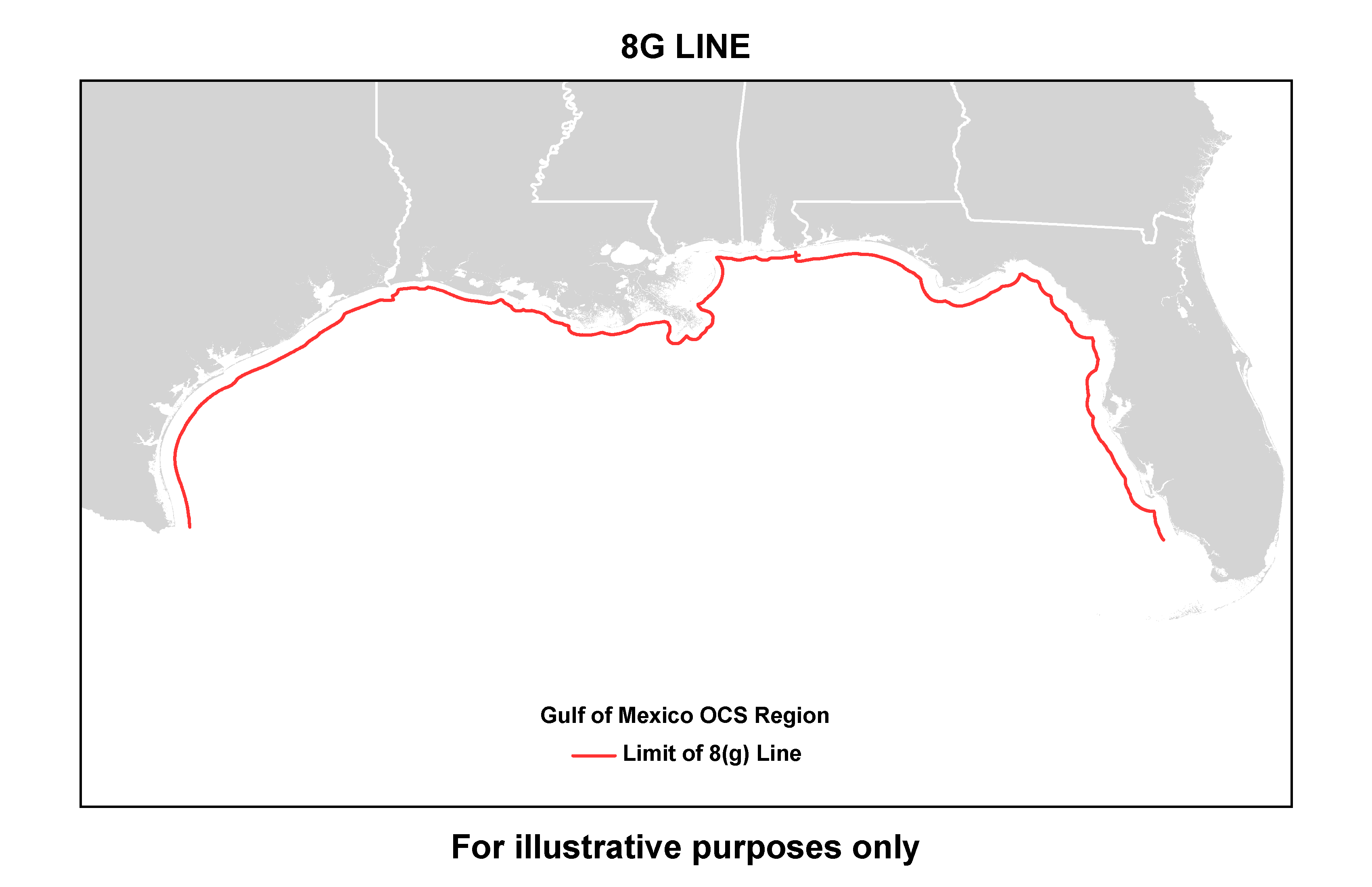
| 8g Line Updated 07/01/15 |
8317 | 8206 | 8426 | shapefile | Contains the information that delineates the Limit of the 8(g) Zone. Browse-Graphic |
|
Active Lease Polygons Updated 12/05/16 |
8300 | 8200 | 8400 | shapefile |
Contains all active lease polygons including whole block leases. Browse-Graphic |
| Blocks Updated 07/01/15 |
8311 | 8201 | 8421 | shapefile | Contains information that defines the Federal lease blocks for the GOM OCS Region. Browse-Graphic |
| Block Polygons - Clipped Updated 07/01/15 |
8310 | 8210 | 8410 | shapefile | Contains information that defines the Federal lease blocks and defines the Federal lease blocks clipped along the Fed/State boundary for the GOM OCS Region. Blocks or portion of blocks of the state side of the Fed/State boundary are not included. Browse-Graphic |
| BOEM 2012 - 2017 Final Program Areas Updated 6/25/12 |
n/a | n/a | n/a |
shapefile metadata |
BOEM has prepared a Five Year Program for 2012-2017. This data is from the Proposed Final Program (PFP), the third in a series of mandated leasing proposals developed for public review before the Secretary of the Interior approves the new Five Year Program for 2012-2017. These areas have since been approved by the Secretary. The areas shown in this layer represent the largest areas that may be considered for leasing within the 5 year period within the Gulf of Mexico.The zipped file contains four separate GIS shape files. One for each of the Gulf of Mexico Planning Areas, and an area showing the current congressional moratorium in the Eastern Gulf. Browse-Graphic |
| Continental Shelf Boundary (CSB) Updated 03/15/13 |
8323 | 8220 | 8432 | shapefile | The limit of U.S. jurisdiction for offshore mineral development. Browse-Graphic |
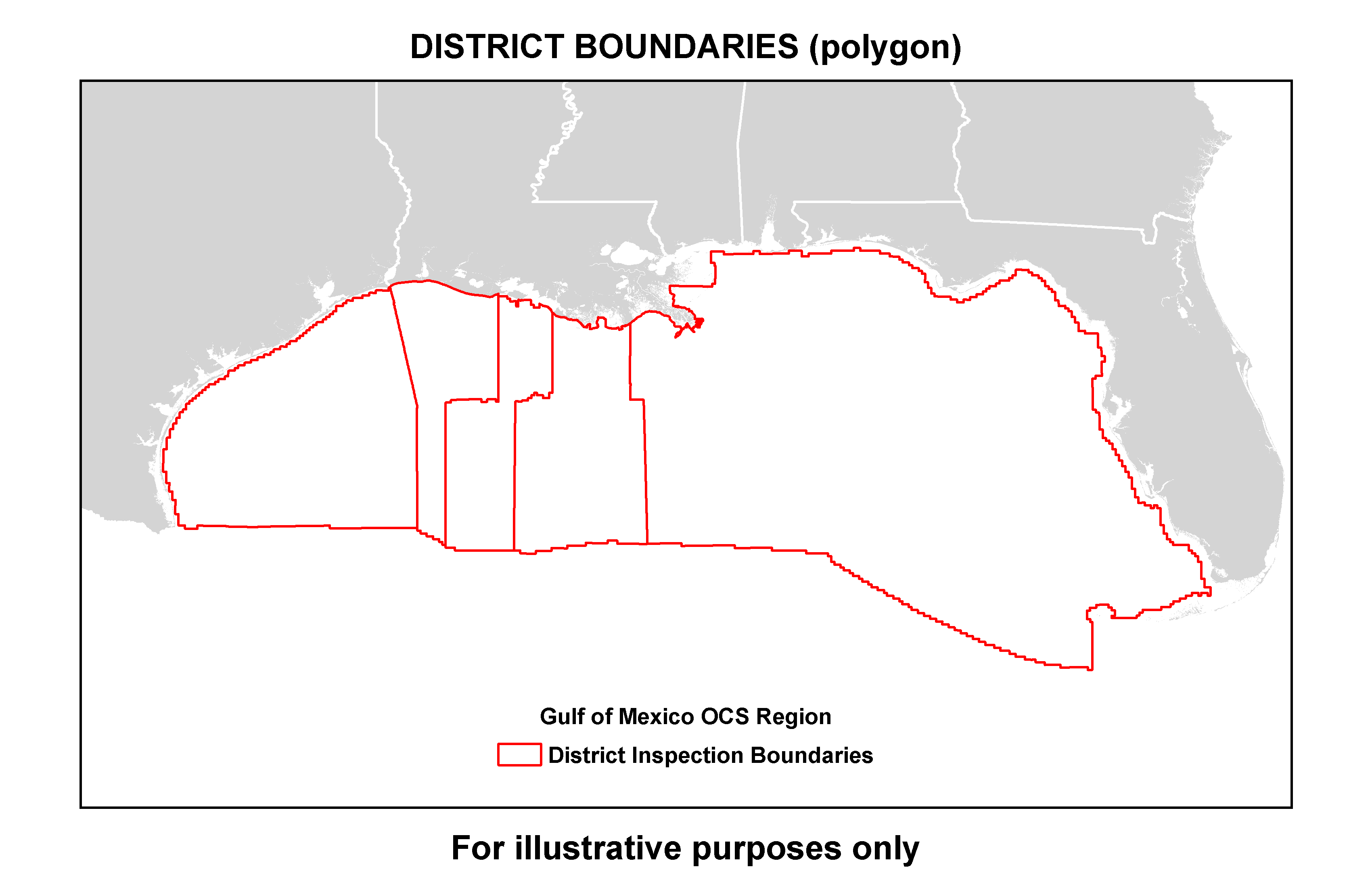
| District Boundaries Updated 03/15/13 |
8314 | 8203 | 8423 | shapefile | Contains the outlines of the districts for the GOM Region. Browse-Graphic |
| Fairways Updated 03/15/13 |
8313 | 8202 | 8422 | shapefile | Contains the major shipping fairways for the GOM Region. Browse-Graphic |
| Fed/State Boundary Updated 07/01/15 |
8315 | 8204 | 8424 | shapefile | Contains the information that delineates the State Seaward Boundary. Browse-Graphic |
| Pipelines
Updated 12/05/16 |
8321 | 8219 | 8430 | shapefile | Contains the points and arcs of the pipeline in the GOM. All pipelines existing in the databases are included. Browse-Graphic |
| Planning Area Boundary
Updated 03/15/13 |
n/a
|
n/a
|
n/a
|
shapefile | Contains the outlines of the GOM OCS Region Planning Area Boundary. Browse-Graphic |
| Platforms Updated 12/05/16 |
n/a | 8211 | 8431 | shapefile | Identifies the location of platforms in GOM. All platforms existing in the database are included. Browse-Graphic |
| Protraction Polygons Updated 07/01/15 |
8318 | 8207 | 8427 | shapefile | Contains information that defines a composite polygon of the areas for the GOM Region. This file is based on the OCS Marine Survey Group Official Protraction Diagram (OPD). Each offshore area is defined by an API Number corresponding to those in the API Bulletin Number D12A. Browse-Graphic |
| Protraction Polygons -
Clipped Updated 07/01/15 |
8319 | 8208 | 8428 | shapefile | Contains information as above and defines the Federal protractions clipped along the Fed/State boundary for the Gulf of Mexico OCS Region. No information in the state side of the Fed/State boundary is included. Browse-Graphic |
Return to Public Information Catalog