Click on a column heading to sort the list.
Click on an image for detailed information.
My
List |
Addition Date
|
Target
|
Mission
|
Instrument
|
Size
|

|
2009-08-03 |
Moon
|
Chandrayaan-1
|
Moon Mineralogy Mapper
|
1709x669x3 |

|
-
PIA12158:
-
Moon Mapper Looks Homeward
Full Resolution:
TIFF
(3.436 MB)
JPEG
(43.77 kB)
|
|
|
2009-07-17 |
Earth
|
Gravity Recovery and Climate Experiment (GRACE)
|
K-Band Ranging System
|
455x455x3 |

|
-
PIA12146:
-
GRACE Global Gravity Animation

Full Resolution:
TIFF
(209 kB)
JPEG
(35.98 kB)
|
|
|
2009-07-15 |
Earth
|
Gravity Recovery and Climate Experiment (GRACE)
|
K-Band Ranging System
|
1200x1200x3 |

|
-
PIA12133:
-
Global Gravity: Asia and Australia
Full Resolution:
TIFF
(4.325 MB)
JPEG
(118.3 kB)
|
|
|
2009-07-15 |
Earth
|
Gravity Recovery and Climate Experiment (GRACE)
|
K-Band Ranging System
|
1200x1200x3 |

|
-
PIA12132:
-
Global Gravity: North and South America
Full Resolution:
TIFF
(4.325 MB)
JPEG
(105.9 kB)
|
|
|
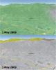
2009-06-30 |
Earth
|
Earth Observing System (EOS)
|
Atmospheric Infrared Sounder (AIRS)
|
1600x1025x3 |

|
-
PIA12098:
-
Global Daytime Air Temperature for May 2009
Full Resolution:
TIFF
(4.928 MB)
JPEG
(198.8 kB)
|
|
|
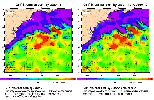
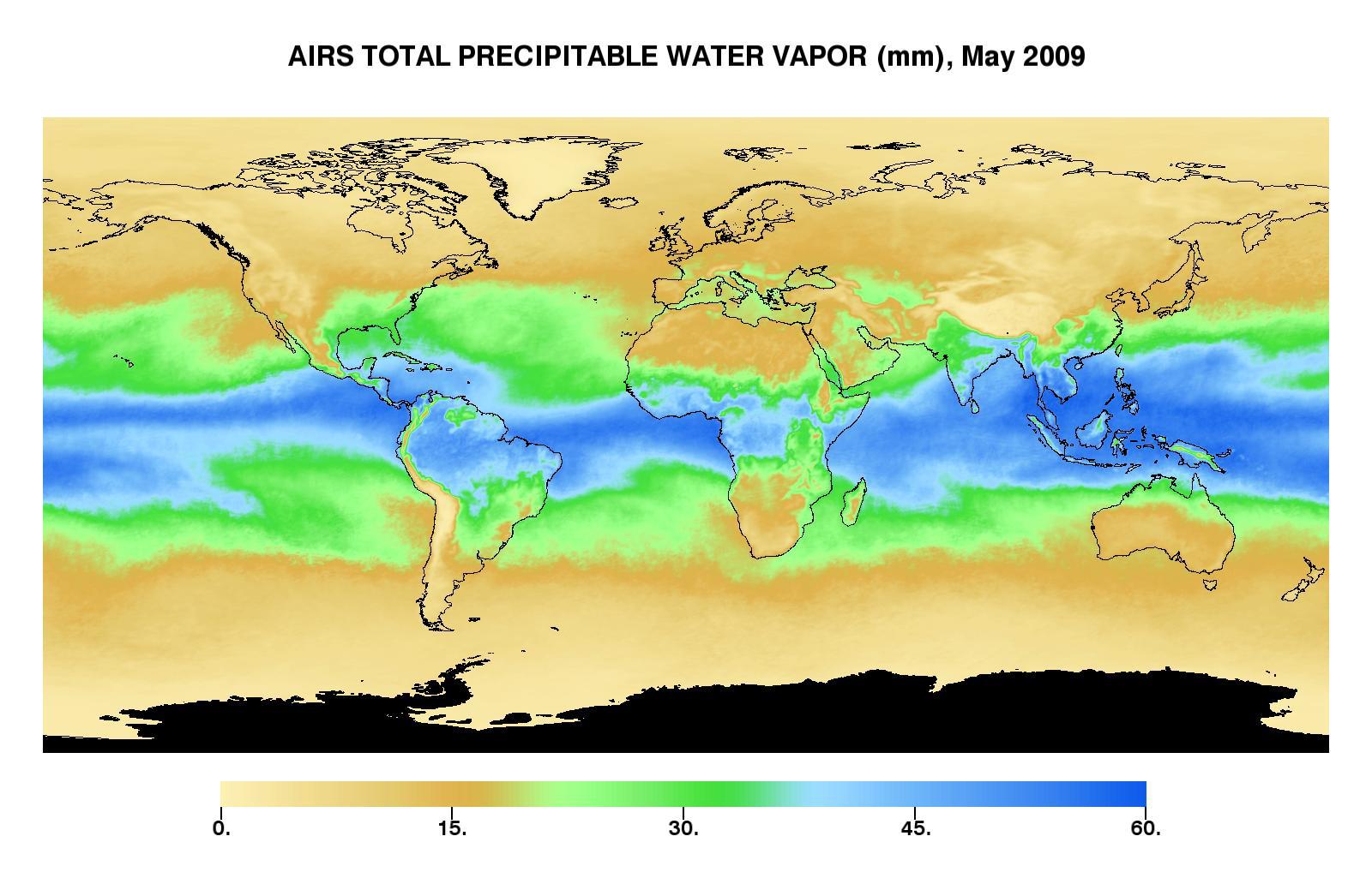
2009-06-30 |
Earth
|
Earth Observing System (EOS)
|
Atmospheric Infrared Sounder (AIRS)
|
1600x1025x3 |

|
-
PIA12097:
-
Global Total Precipitable Water Wapor for May 2009
Full Resolution:
TIFF
(4.928 MB)
JPEG
(187.7 kB)
|
|
|
2009-06-30 |
Earth
|
Earth Observing System (EOS)
|
Atmospheric Infrared Sounder (AIRS)
|
1600x1025x3 |

|
-
PIA12096:
-
Global Total Precipitable Water Wapor for May 2009
Full Resolution:
TIFF
(4.928 MB)
JPEG
(173.4 kB)
|
|
|
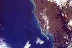
2009-06-29 |
Earth
|
Earth Observing System (EOS)
|
ASTER
|
1280x720x3 |

|
-
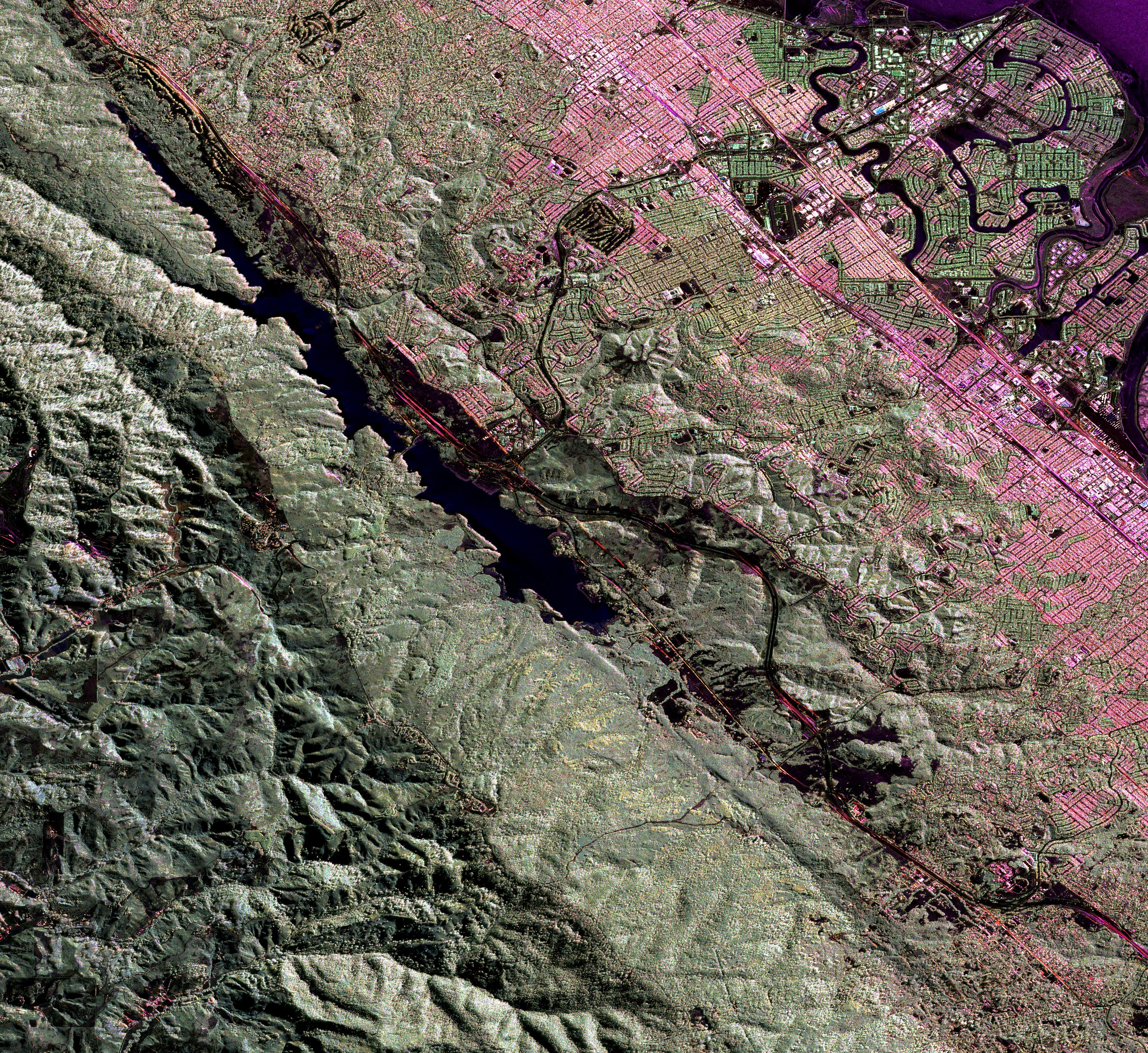
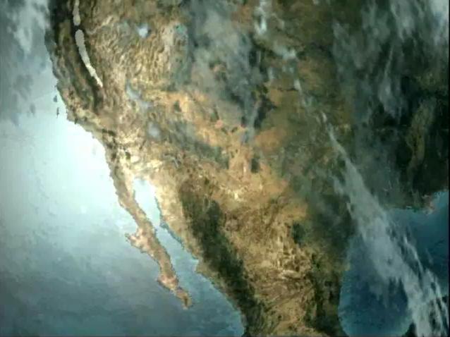
PIA12095:
-
Cruising Over Los Angeles
Full Resolution:
TIFF
(2.768 MB)
JPEG
(86.7 kB)
|
|
|
2009-06-29 |
Earth
|
Earth Observing System (EOS)
|
ASTER
|
1281x718x3 |

|
-
PIA12094:
-
Cruising Over California
Full Resolution:
TIFF
(2.762 MB)
JPEG
(37.04 kB)
|
|
|
2009-06-29 |
Earth
|
Earth Observing System (EOS)
|
ASTER
|
1280x720x3 |

|
-
PIA12093:
-
Los Angeles Basin
Full Resolution:
TIFF
(2.768 MB)
JPEG
(316.6 kB)
|
|
|
2009-06-29 |
Earth
|
Earth Observing System (EOS)
|
ASTER
|
1556x1370x3 |

|
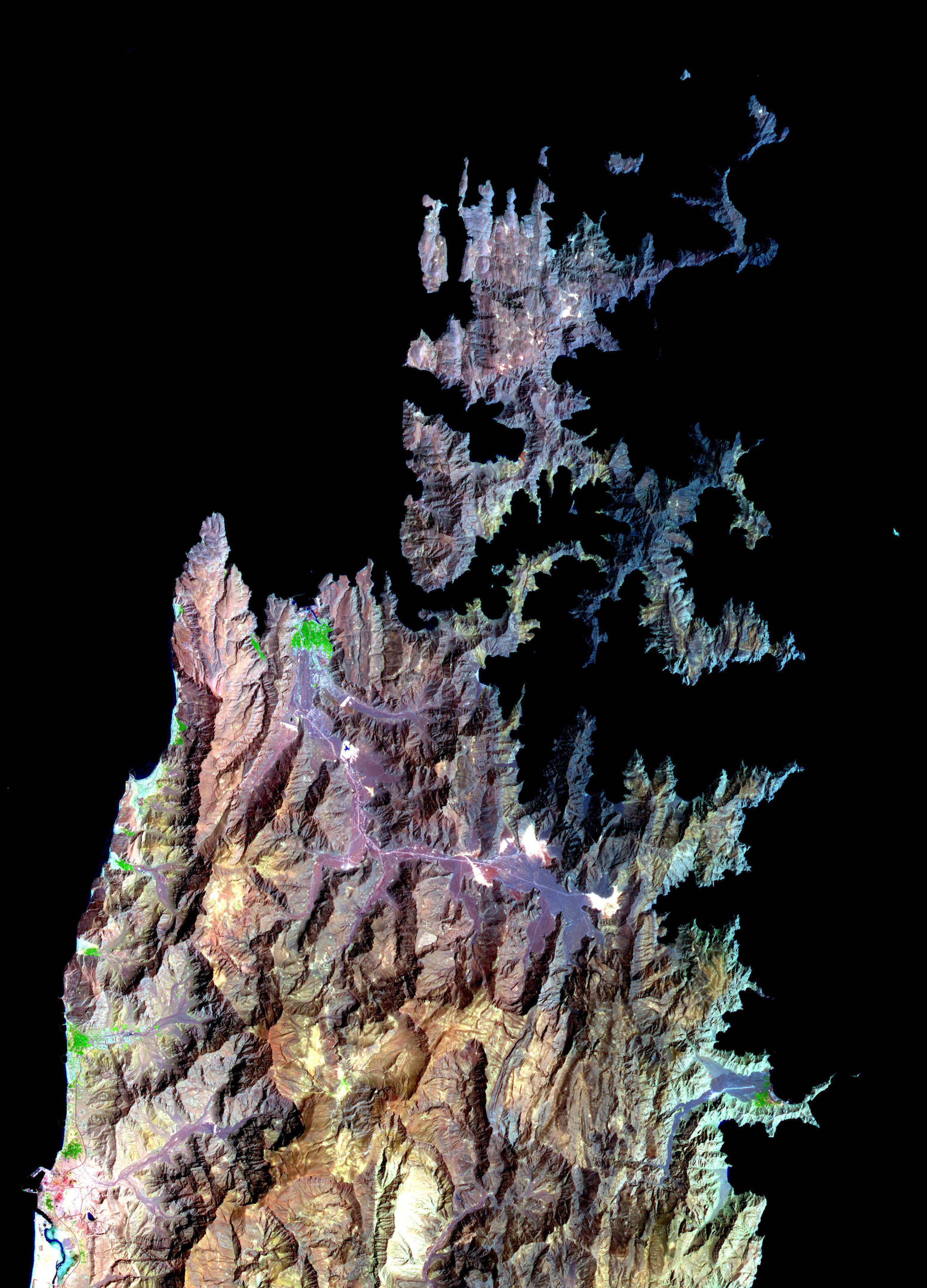
-
PIA12092:
-
Himalayan Glaciers in Bhutan
Full Resolution:
TIFF
(6.406 MB)
JPEG
(432.9 kB)
|
|
|
2009-06-29 |
Earth
|
Earth Observing System (EOS)
|
ASTER
|
1488x1493x3 |

|
-
PIA12091:
-
Death Valley, California
Full Resolution:
TIFF
(6.677 MB)
JPEG
(506.6 kB)
|
|
|
2009-06-29 |
Earth
|
Earth Observing System (EOS)
|
ASTER
|
4320x2160x3 |

|
-
PIA12090:
-
ASTER's Global Digital Elevation Model (GDEM)
Full Resolution:
TIFF
(27.99 MB)
JPEG
(1.153 MB)
|
|
|
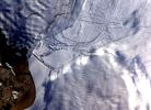
2009-06-18 |
Moon
|
Deep Space Network (DSN)
|
Goldstone Solar System Radar
|
4000x3796x3 |

|
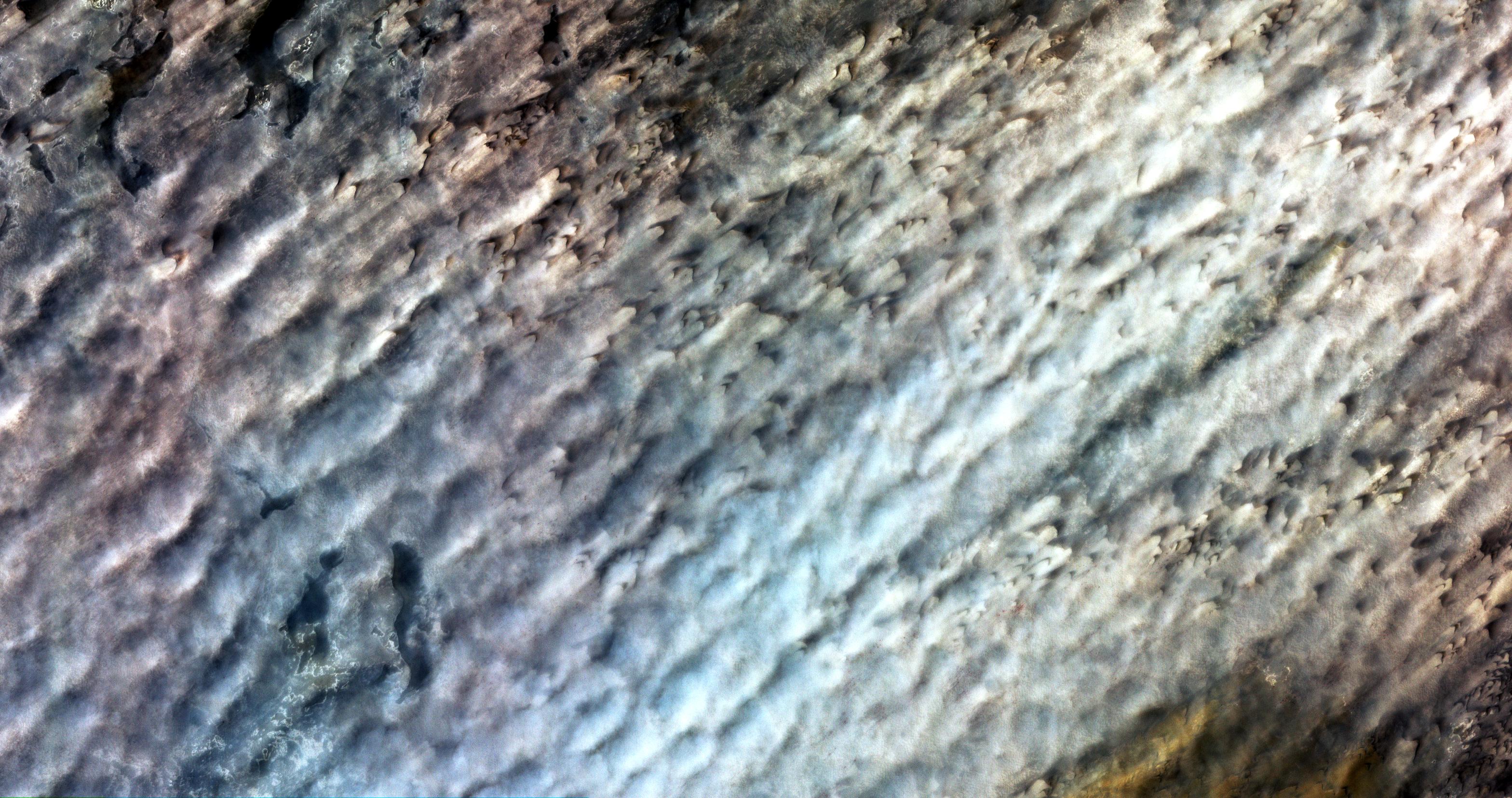
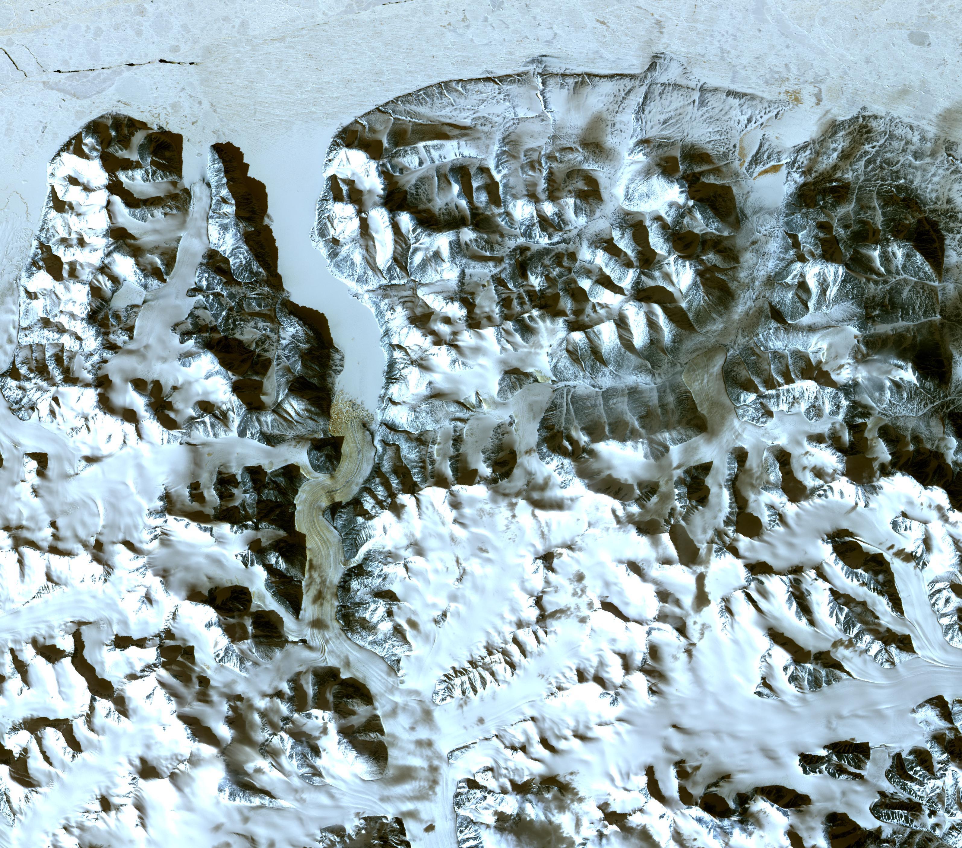
-
PIA12077:
-
Moon's Rugged South Polar Region Composite
Full Resolution:
TIFF
(45.55 MB)
JPEG
(1.896 MB)
|
|
|
2009-06-18 |
Earth
|
UAVSAR
|
L-Band UAVSAR
|
2984x2737x3 |

|
-
PIA12075:
-
Scientists Search for a Pulse in Skies Above Earthquake Country
Full Resolution:
TIFF
(24.5 MB)
JPEG
(3.571 MB)
|
|
|
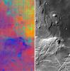
2009-06-02 |
Earth
|
Earth Observing System (EOS)
|
ASTER
|
2282x1772x3 |

|
-
PIA12064:
-
Jack Hills, Australia
Full Resolution:
TIFF
(12.15 MB)
JPEG
(877.8 kB)
|
|
|
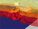
2009-05-18 |
Moon
|
Gravity Recovery and Interior Laboratory (GRAIL)
|
|
8000x7500x3 |

|
-
PIA12010:
-
GRAIL's Twin Spacecraft -- Crust to Core (Artist's Concept)
Full Resolution:
TIFF
(180 MB)
JPEG
(2.615 MB)
|
|
|
2009-05-18 |
Moon
|
Gravity Recovery and Interior Laboratory (GRAIL)
|
|
6000x4000x3 |

|
-
PIA12009:
-
GRAIL's Twin Spacecraft fly in Tandem Around the Moon (Artist's Concept)
Full Resolution:
TIFF
(72 MB)
JPEG
(1.186 MB)
|
|
|
2009-05-15 |
Earth
|
Earth Observing System (EOS)
|
ASTER
|
3456x2736x3 |

|
-
PIA12063:
-
Volcano Chaiten, Chile
Full Resolution:
TIFF
(28.37 MB)
JPEG
(1.285 MB)
|
|
|
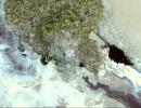
2009-05-08 |
Earth
|
QuikScat
|
SeaWinds Scatterometer
|
2367x2916x3 |
|
-
PIA12006:
-
Disaster Management: Rapid Dry-Up of Rainwater on Land Surface Leading to the Santa Barbara Wildfire
Full Resolution:
TIFF
(20.73 MB)
JPEG
(727.8 kB)
|
|
|
2009-05-01 |
Earth
|
Earth Observing System (EOS)
|
ASTER
|
1446x803x3 |

|
-
PIA12062:
-
Banks Peninsula, New Zealand
Full Resolution:
TIFF
(3.49 MB)
JPEG
(214.8 kB)
|
|
|
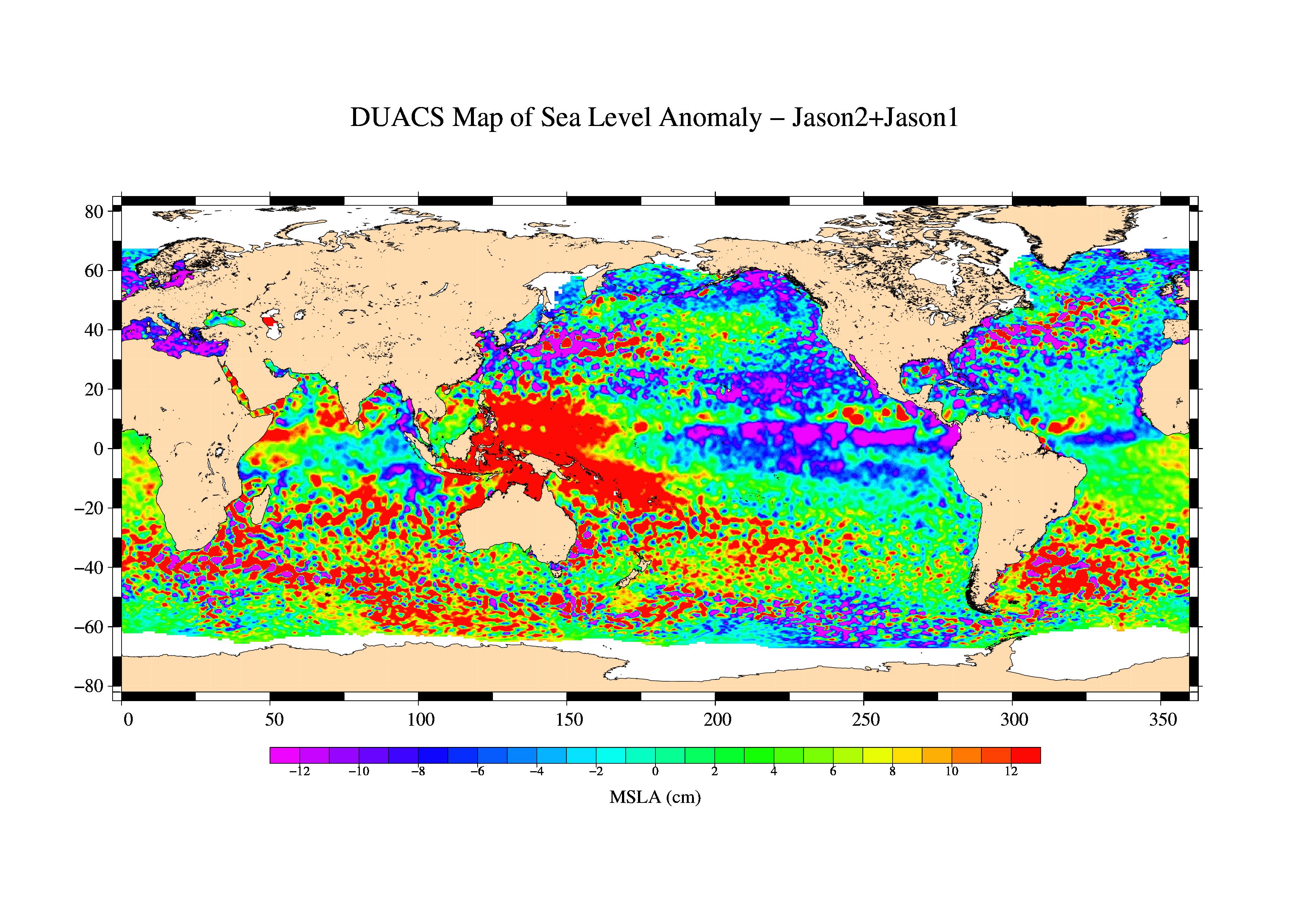
2009-04-27 |
Earth
|
Jason-1 (TOPEX/Poseidon)
OSTM/Jason-2
|
Altimeter
|
1010x654x3 |
|
-
PIA11997:
-
OSTM/Jason-2 and Jason-1 Tandem Mission View of the Gulf Stream
Full Resolution:
TIFF
(663 kB)
JPEG
(187.6 kB)
|
|
|
2009-04-20 |
Earth
|
Earth Observing System (EOS)
|
ASTER
|
3235x2351x3 |
|
-
PIA11991:
-
Wilkins Ice Shelf
Full Resolution:
TIFF
(22.82 MB)
JPEG
(984.9 kB)
|
|
|
2009-04-20 |
Earth
|
Earth Observing System (EOS)
|
ASTER
|
3708x2920x3 |

|
-
PIA12061:
-
Komodo National Park, Indonesia
Full Resolution:
TIFF
(32.48 MB)
JPEG
(1.387 MB)
|
|
|
2009-04-19 |
Earth
|
Earth Observing System (EOS)
|
ASTER
|
2508x5460x3 |

|
-
PIA11989:
-
North Dakota Floods
Full Resolution:
TIFF
(41.12 MB)
JPEG
(3.296 MB)
|
|
|
2009-04-03 |
Earth
|
Earth Observing System (EOS)
|
ASTER
|
3108x4319x3 |

|
-
PIA12060:
-
Musandam Penisnula, Oman
Full Resolution:
TIFF
(40.27 MB)
JPEG
(1.593 MB)
|
|
|
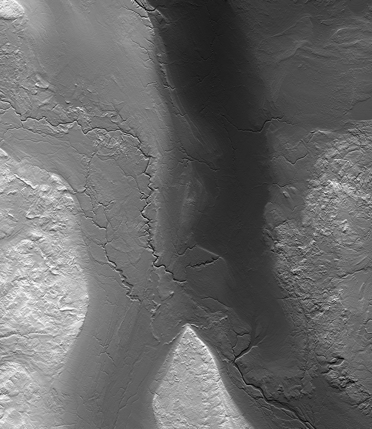
2009-04-01 |
Earth
|
Shuttle Radar Topography Mission (SRTM)
|
C-Band Radar
|
1250x1440x1 |

|
-
PIA11964:
-
Fargo, North Dakota, USA
Full Resolution:
TIFF
(1.802 MB)
JPEG
(353.4 kB)
|
|
|
2009-03-26 |
Earth
|
Jason-1 (TOPEX/Poseidon)
OSTM/Jason-2
|
Altimeter
|
3508x2479x3 |

|
-
PIA11859:
-
First Jason-1 and OSTM/Jason-2 Tandem Global View
Full Resolution:
TIFF
(26.09 MB)
JPEG
(1.128 MB)
|
|
|
2009-03-26 |
Earth
|
Earth Observing System (EOS)
|
ASTER
|
1949x2646x3 |

|
-
PIA12059:
-
Grand Turk Island
Full Resolution:
TIFF
(15.49 MB)
JPEG
(591.2 kB)
|
|
|
2009-03-16 |
Earth
|
Earth Observing System (EOS)
|
ASTER
|
2676x1918x3 |

|
-
PIA12058:
-
Karymsky Volcano, Kamchatka
Full Resolution:
TIFF
(15.41 MB)
JPEG
(726.5 kB)
|
|
|
2009-03-02 |
Earth
|
Earth Observing System (EOS)
|
ASTER
|
2368x3020x3 |

|
-
PIA12057:
-
Palm Islands, Dubai, UAE
Full Resolution:
TIFF
(21.48 MB)
JPEG
(700.7 kB)
|
|
|
2009-02-20 |
Earth
|
Earth Observing System (EOS)
|
ASTER
|
3900x3764x3 |

|
-
PIA12056:
-
Hokkaido, Japan
Full Resolution:
TIFF
(44.04 MB)
JPEG
(1.775 MB)
|
|
|
2009-02-19 |
Earth
|
Earth Observing System (EOS)
|
Atmospheric Infrared Sounder (AIRS)
|
764x522x3 |

|
-
PIA11807:
-
Carbon Monoxide from the Australian Fires of Feb 2009 as seen by AIRS
Full Resolution:
TIFF
(1.198 MB)
JPEG
(92.37 kB)
|
|
|
2009-02-18 |
Earth
|
Earth Observing System (EOS)
|
ASTER
|
3315x3324x3 |

|
-
PIA11806:
-
Australia Wildfires Extract a Heavy Toll in Lives, Land
Full Resolution:
TIFF
(33.06 MB)
JPEG
(1.678 MB)
|
|
|
2009-02-09 |
Earth
|
Earth Observing System (EOS)
|
ASTER
|
2468x1992x3 |

|
-
PIA12055:
-
Jamestown, VA
Full Resolution:
TIFF
(14.76 MB)
JPEG
(918.7 kB)
|
|
|
2009-02-06 |
Earth
|
Jason-1 (TOPEX/Poseidon)
OSTM/Jason-2
|
Altimeter
|
1074x1074x3 |

|
-
PIA11794:
-
Altimeter Family Portrait: Topex/Poseidon, Jason-1 and OSTM/Jason-2
Full Resolution:
TIFF
(3.465 MB)
JPEG
(131 kB)
|
|
|
2009-01-09 |
Earth
|
Earth Observing System (EOS)
|
ASTER
|
3136x1656x3 |

|
-
PIA11752:
-
Bodele Sand Dunes, Chad
Full Resolution:
TIFF
(15.58 MB)
JPEG
(879.5 kB)
|
|
|
2008-12-17 |
Moon
|
Chandrayaan-1
|
Moon Mineralogy Mapper
|
631x635x3 |
|
-
PIA11727:
-
NASA's Moon Mineralogy Mapper
Full Resolution:
TIFF
(1.204 MB)
JPEG
(65.59 kB)
|
|
|
2008-12-13 |
Earth
|
Jason-1 (TOPEX/Poseidon)
|
Altimeter
|
900x900x3 |

|
-
PIA11710:
-
Oscillation Rules as the Pacific Cools
Full Resolution:
TIFF
(2.433 MB)
JPEG
(102.9 kB)
|
|
|
2008-11-18 |
Earth
|
Earth Observing System (EOS)
|
Atmospheric Infrared Sounder (AIRS)
|
1024x576x3 |

|
-
PIA11424:
-
Water Vapor Transport, June through November 2005 (Movie)
Full Resolution:
TIFF
(1.772 MB)
JPEG
(54.12 kB)
|
|
|
2008-11-17 |
Earth
|
Earth Observing System (EOS)
|
ASTER
|
4070x8024x3 |

|
-
PIA11419:
-
Byrd Glacier, Antarctica
Full Resolution:
TIFF
(97.97 MB)
JPEG
(7.07 MB)
|
|
|
2008-11-03 |
Earth
|
Earth Observing System (EOS)
|
Atmospheric Infrared Sounder (AIRS)
|
3840x2160x3 |

|
-
PIA11395:
-
AIRS Carbon Dioxide with Mauna Loa Carbon Dioxide Overlaid
Full Resolution:
TIFF
(24.88 MB)
JPEG
(534 kB)
|
|
|
2008-11-03 |
Earth
|
Earth Observing System (EOS)
|
ASTER
|
6630x5000x3 |

|
-
PIA11394:
-
Aftermath of Hurricane Ike along Texas Coast
Full Resolution:
TIFF
(99.45 MB)
JPEG
(4.42 MB)
|
|
|
2008-10-16 |
Earth
|
Earth Observing System (EOS)
|
ASTER
|
1922x2982x3 |
|
-
PIA11420:
-
Mato Grosso, Brazil
Full Resolution:
TIFF
(17.22 MB)
JPEG
(1.446 MB)
|
|
|
2008-09-30 |
Earth
|
Phoenix
|
|
1228x910x1 |
|
-
PIA11207:
-
Terrestrial Clay under Microscope
Full Resolution:
TIFF
(1.119 MB)
JPEG
(140.7 kB)
|
|
|
2008-09-24 |
Earth
|
OSTM/Jason-2
|
Altimeter
|
1225x710x3 |

|
-
PIA11197:
-
Newest Ocean-Observing Satellite Records Recent Sea Level Changes
Full Resolution:
TIFF
(872.5 kB)
JPEG
(211.1 kB)
|
|
|
2008-09-24 |
Earth
|
Earth Observing System (EOS)
|
Atmospheric Infrared Sounder (AIRS)
|
5000x3750x3 |

|
-
PIA11194:
-
Global Carbon Dioxide Transport from AIRS Data, July 2008
Full Resolution:
TIFF
(56.25 MB)
JPEG
(715.3 kB)
|
|
|
2008-09-22 |
Earth
|
Earth Observing System (EOS)
|
Atmospheric Infrared Sounder (AIRS)
|
1777x948x3 |

|
-
PIA11186:
-
AIRS Global Distribution of Mid-Tropospheric Carbon Dioxide at 18-13 km
Altitudes
Full Resolution:
TIFF
(5.062 MB)
JPEG
(146.6 kB)
|
|
|
2008-09-17 |
Earth
|
Earth Observing System (EOS)
|
Atmospheric Infrared Sounder (AIRS)
|
638x478x3 |

|
-
PIA11171:
-
AIRS Collects Data and Creates a Temperature Profile
Full Resolution:
TIFF
(916.1 kB)
JPEG
(39.04 kB)
|
|
|
2008-09-16 |
Earth
|
Earth Observing System (EOS)
|
ASTER
|
3190x2810x3 |

|
-
PIA11169:
-
Northern Greenland
Full Resolution:
TIFF
(26.89 MB)
JPEG
(1.555 MB)
|
|
|
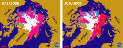
2008-09-11 |
Earth
|
QuikScat
|
SeaWinds Scatterometer
|
2344x926x3 |
|
-
PIA11086:
-
Recent State of Arctic Sea Ice
Full Resolution:
TIFF
(6.519 MB)
JPEG
(290.8 kB)
|
|
|
2008-09-05 |
Earth
|
ISS EarthKam
|
Electronic Still Camera
|
3060x2036x3 |

|
-
PIA11070:
-
Ganges River Delta
Full Resolution:
TIFF
(18.69 MB)
JPEG
(852 kB)
|
|
|
2008-09-05 |
Earth
|
ISS EarthKam
|
Electronic Still Camera
|
3060x2036x3 |
|
-
PIA11069:
-
Sand Dunes and Center-Pivot Irrigation in Saudi Arabia
Full Resolution:
TIFF
(18.69 MB)
JPEG
(886.2 kB)
|
|
|
2008-09-05 |
Earth
|
ISS EarthKam
|
Electronic Still Camera
|
3060x2036x3 |

|
-
PIA11068:
-
Atlantic (maybe Caribbean Sea) Ocean and Islands
Full Resolution:
TIFF
(18.69 MB)
JPEG
(475.3 kB)
|
|
|
2008-09-05 |
Earth
|
ISS EarthKam
|
Electronic Still Camera
|
3060x2036x3 |
|
-
PIA11067:
-
Alluvial fan in China
Full Resolution:
TIFF
(18.69 MB)
JPEG
(854 kB)
|
|
|
2008-09-05 |
Earth
|
ISS EarthKam
|
Electronic Still Camera
|
3060x2036x3 |

|
-
PIA11066:
-
Oblique shot of Earth
Full Resolution:
TIFF
(18.69 MB)
JPEG
(460.9 kB)
|
|
|
2008-09-05 |
Earth
|
ISS EarthKam
|
Electronic Still Camera
|
3060x2036x3 |

|
-
PIA11065:
-
Delta of the Gurupi, Maracacume, and Tiriacu Rivers, Brazil
Full Resolution:
TIFF
(18.69 MB)
JPEG
(731 kB)
|
|
|
2008-09-05 |
Earth
|
ISS EarthKam
|
Electronic Still Camera
|
3060x2036x3 |

|
-
PIA11064:
-
Cape Cod, Massachusetts
Full Resolution:
TIFF
(18.69 MB)
JPEG
(1.008 MB)
|
|
|
2008-09-05 |
Earth
|
ISS EarthKam
|
Electronic Still Camera
|
3060x2036x3 |
|
-
PIA11063:
-
Southern tip of Baja California, Mexico
Full Resolution:
TIFF
(18.69 MB)
JPEG
(1.229 MB)
|
|
|
2008-09-05 |
Earth
|
ISS EarthKam
|
Electronic Still Camera
|
3060x2036x3 |

|
-
PIA11062:
-
Contrails over Lisbon, Portugal
Full Resolution:
TIFF
(18.69 MB)
JPEG
(1.138 MB)
|
|
|
2008-09-05 |
Earth
|
ISS EarthKam
|
Electronic Still Camera
|
3060x2036x3 |
|
-
PIA11061:
-
Frozen Lake Quinghai Nanshan, Northern China
Full Resolution:
TIFF
(18.69 MB)
JPEG
(1.217 MB)
|
|
|
2008-09-04 |
Earth
|
ISS EarthKam
|
Electronic Still Camera
|
3060x2036x3 |

|
-
PIA11021:
-
The Persian Gulf and the Delta of the Tigris and Euphrates Rivers, Kuwait, Iraq, and Iran
Full Resolution:
TIFF
(18.69 MB)
JPEG
(1.299 MB)
|
|
|
2008-09-04 |
Earth
|
ISS EarthKam
|
Electronic Still Camera
|
3060x2036x3 |

|
-
PIA11020:
-
Isla Isabella, Galapagos Island
Full Resolution:
TIFF
(18.69 MB)
JPEG
(873.7 kB)
|
|
|
2008-09-04 |
Earth
|
ISS EarthKam
|
Electronic Still Camera
|
3060x2036x3 |
|
-
PIA11019:
-
Tongue of the Ocean and Grand Bahama Bank
Full Resolution:
TIFF
(18.69 MB)
JPEG
(1.05 MB)
|
|
|
2008-09-04 |
Earth
|
ISS EarthKam
|
Electronic Still Camera
|
3060x2036x3 |

|
-
PIA11018:
-
Sakhalin Island, Russia
Full Resolution:
TIFF
(18.69 MB)
JPEG
(1.377 MB)
|
|
|
2008-09-04 |
Earth
|
ISS EarthKam
|
Electronic Still Camera
|
3060x2036x3 |

|
-
PIA11017:
-
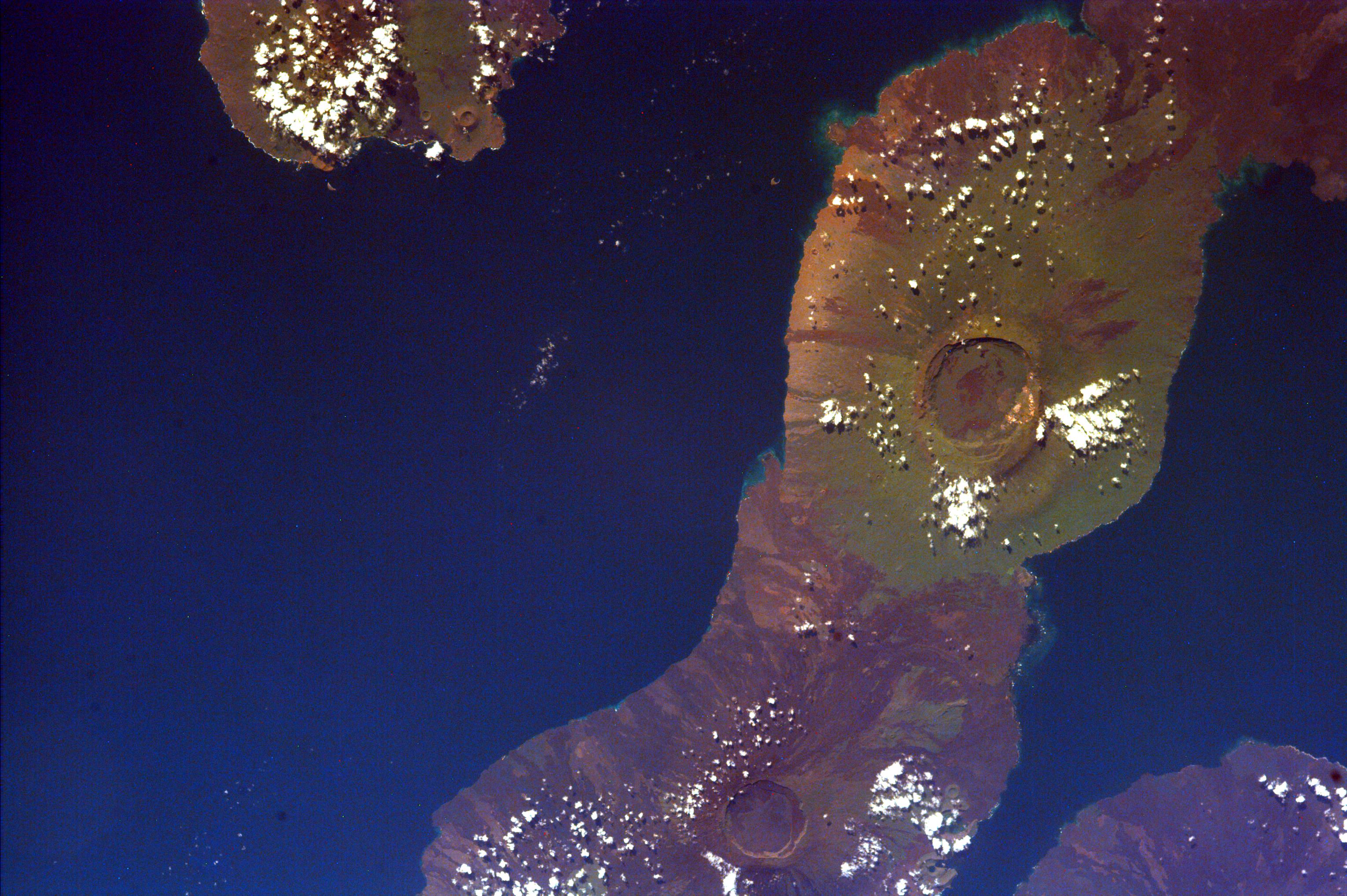
Aracar Volcano, Andes Mountains, Argentina near Chile Border
Full Resolution:
TIFF
(18.69 MB)
JPEG
(1.265 MB)
|
|
|
2008-09-04 |
Earth
|
ISS EarthKam
|
Electronic Still Camera
|
3060x2036x3 |

|
-
PIA11016:
-
South Australia, Australia
Full Resolution:
TIFF
(18.69 MB)
JPEG
(1.711 MB)
|
|
|
2008-09-04 |
Earth
|
ISS EarthKam
|
Electronic Still Camera
|
3060x2036x3 |

|
-
PIA11015:
-
Algeria
Full Resolution:
TIFF
(18.69 MB)
JPEG
(1.659 MB)
|
|
|
2008-09-04 |
Earth
|
ISS EarthKam
|
Electronic Still Camera
|
3060x2036x3 |
|
-
PIA11014:
-
North Island, New Zealand
Full Resolution:
TIFF
(18.69 MB)
JPEG
(1.303 MB)
|
|
|
2008-08-28 |
Earth
|
Earth Observing System (EOS)
|
ASTER
|
3832x2956x3 |
|
-
PIA11085:
-
Colorado River Delta
Full Resolution:
TIFF
(33.98 MB)
JPEG
(1.911 MB)
|
|
|
2008-08-14 |
Earth
|
Earth Observing System (EOS)
|
Atmospheric Infrared Sounder (AIRS)
|
640x480x3 |

|
-
PIA11034:
-
Transport of Carbon Monoxide Generated by Alaska Fires, July 2004
Full Resolution:
TIFF
(922.8 kB)
JPEG
(44.52 kB)
|
|
|
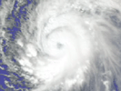
2008-08-13 |
Earth
|
Earth Observing System (EOS)
|
Atmospheric Infrared Sounder (AIRS)
|
319x240x3 |
|
-
PIA11033:
-
Supertyphoon Pongsona Isotherms
Full Resolution:
TIFF
(230.2 kB)
JPEG
(9.715 kB)
|
|
|
2008-08-13 |
Earth
|
Earth Observing System (EOS)
|
Atmospheric Infrared Sounder (AIRS)
|
321x239x3 |
|
-
PIA11032:
-
Hurricane Isabel Isotherms
Full Resolution:
TIFF
(230.6 kB)
JPEG
(8.968 kB)
|
|
|
2008-08-08 |
Earth
|
Earth Observing System (EOS)
|
ASTER
|
3656x4124x3 |

|
-
PIA11084:
-
Rub' al Khali, Arabia
Full Resolution:
TIFF
(45.23 MB)
JPEG
(3.202 MB)
|
|
|
2008-08-06 |
Earth
|
Earth Observing System (EOS)
|
Atmospheric Infrared Sounder (AIRS)
|
727x329x3 |

|
-
PIA11009:
-
Transport of Dust from China Dust Storm of April 2006
Full Resolution:
TIFF
(718.7 kB)
JPEG
(30.38 kB)
|
|
|
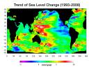
2008-07-31 |
Earth
|
Jason-1 (TOPEX/Poseidon)
|
Altimeter
|
919x699x3 |
|
-
PIA11002:
-
Portrait of a Warming Ocean and Rising Sea Levels:
Trend of Sea Level Change 1993-2008
Full Resolution:
TIFF
(644.9 kB)
JPEG
(104.2 kB)
|
|
|
2008-07-23 |
Earth
|
Earth Observing System (EOS)
|
ASTER
|
1503x2214x3 |

|
-
PIA10975:
-
Yolla Bolly Complex Wildland Fire
Full Resolution:
TIFF
(10 MB)
JPEG
(733.5 kB)
|
|
|
2008-07-22 |
Earth
|
Earth Observing System (EOS)
|
Atmospheric Infrared Sounder (AIRS)
|
1026x577x3 |

|
-
PIA10973:
-
Carbon Monoxide from California's Wildfires—
a Visualization Created Using Data from NASA's Atmospheric Infrared Sounder
Full Resolution:
TIFF
(1.779 MB)
JPEG
(61.13 kB)
|
|
|
2008-07-18 |
Earth
|
Earth Observing System (EOS)
|
ASTER
|
1639x1611x3 |

|
-
PIA11083:
-
L'Anse Aux Meadows, Newfoundland
Full Resolution:
TIFF
(7.934 MB)
JPEG
(468.6 kB)
|
|
|
2008-07-15 |
Earth
|
OSTM/Jason-2
|
Advanced Microwave Radiometer (AMR)
|
2400x2772x3 |

|
-
PIA10954:
-
Global Views of Atmospheric Water Vapor:
First Data from OSTM/Jason-2's Advanced Microwave Radiometer
Full Resolution:
TIFF
(19.98 MB)
JPEG
(537.4 kB)
|
|
|
2008-07-06 |
Earth
|
|
|
1148x1119x3 |

|
-
PIA10953:
-
70m antenna at Goldstone, California
Full Resolution:
TIFF
(3.859 MB)
JPEG
(120 kB)
|
|
|
2008-07-02 |
Earth
|
Earth Observing System (EOS)
|
Multi-angle Imaging SpectroRadiometer (MISR)
|
1267x1187x3 |

|
-
PIA10927:
-
Smoke Blankets Northern California
Full Resolution:
TIFF
(4.517 MB)
JPEG
(100.6 kB)
|
|
|
2008-06-30 |
Earth
|
Earth Observing System (EOS)
|
ASTER
|
3858x2484x3 |

|
-
PIA10925:
-
Fires Burning near Big Sur, California
Full Resolution:
TIFF
(28.75 MB)
JPEG
(1.261 MB)
|
|
|
2008-06-18 |
Earth
|
Earth Observing System (EOS)
|
ASTER
|
2706x2134x3 |

|
-
PIA11082:
-
East African Rift
Full Resolution:
TIFF
(17.34 MB)
JPEG
(1.272 MB)
|
|
|
2008-06-06 |
Earth
|
Earth Observing System (EOS)
|
ASTER
|
1761x1054x3 |
|
-
PIA10772:
-
Sichuan Earthquake in China
Full Resolution:
TIFF
(5.577 MB)
JPEG
(375.9 kB)
|
|
|
2008-05-30 |
Earth
|
Earth Observing System (EOS)
|
ASTER
|
800x295x3 |

|
-
PIA11081:
-
Chaiten Volcano, Chile
Full Resolution:
TIFF
(709 kB)
JPEG
(45.79 kB)
|
|
|
2008-05-23 |
Earth
|
Earth Observing System (EOS)
|
ASTER
|
1735x1511x3 |

|
-
PIA11080:
-
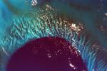
Nuuk, Greenland
Full Resolution:
TIFF
(7.877 MB)
JPEG
(433.8 kB)
|
|
|
2008-05-09 |
Earth
|
Earth Observing System (EOS)
|
ASTER
|
3732x2427x3 |

|
-
PIA11079:
-
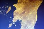
Al Jazirah, Sudan
Full Resolution:
TIFF
(27.17 MB)
JPEG
(2.287 MB)
|
|
|
2008-04-30 |
Earth
|
Earth Observing System (EOS)
|
ASTER
|
900x720x3 |

|
-
PIA10631:
-
Diomede Islands, Bering Straight
Full Resolution:
TIFF
(1.946 MB)
JPEG
(67.39 kB)
|
|
|
2008-04-22 |
Earth
|
Jason-1 (TOPEX/Poseidon)
|
Altimeter
|
900x900x3 |

|
-
PIA10377:
-
Larger Pacific Climate Event Helps Current La Niña Linger
Full Resolution:
TIFF
(2.433 MB)
JPEG
(103 kB)
|
|
|
2008-04-21 |
Earth
|
Earth Observing System (EOS)
|
ASTER
|
1832x3276x3 |

|
-
PIA10630:
-
Phosphate Mines, Jordan
Full Resolution:
TIFF
(18.03 MB)
JPEG
(949.6 kB)
|
|
|
2008-04-08 |
Earth
|
Earth Observing System (EOS)
|
ASTER
|
1250x1091x3 |

|
-
PIA10629:
-
Nardò Ring, Italy
Full Resolution:
TIFF
(4.096 MB)
JPEG
(336.8 kB)
|
|
|
2008-04-04 |
Earth
|
Earth Observing System (EOS)
|
ASTER
|
393x416x3 |

|
-
PIA10365:
-
Hawaii's Kilauea Volcano Belches a Toxic Brew
Full Resolution:
TIFF
(491.3 kB)
JPEG
(27.74 kB)
|
|
|
2008-04-01 |
Earth
|
Earth Observing System (EOS)
|
ASTER
|
2536x2104x3 |

|
-
PIA10628:
-
Western Slope of Andes, Peru
Full Resolution:
TIFF
(16.02 MB)
JPEG
(1.374 MB)
|
|
|
2008-03-21 |
Earth
|
Earth Observing System (EOS)
|
ASTER
|
2505x2463x3 |

|
-
PIA10627:
-
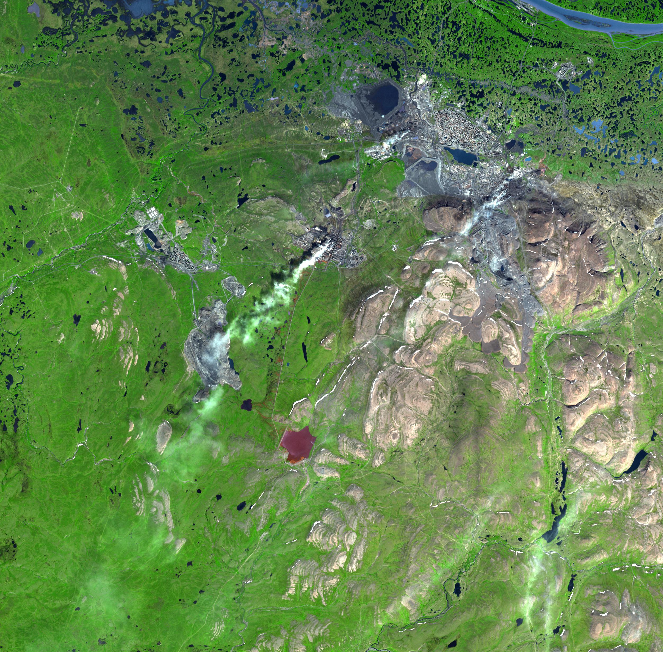
Norilsk, Siberia
Full Resolution:
TIFF
(18.53 MB)
JPEG
(1.2 MB)
|
|
|
2008-03-17 |
Earth
|
Earth Observing System (EOS)
|
Atmospheric Infrared Sounder (AIRS)
|
1428x1836x3 |

|
-
PIA10242:
-
Mean Clear Air Precipitable Water, 500mb to TOA from AIRS data
Full Resolution:
TIFF
(7.88 MB)
JPEG
(295.5 kB)
|
|
|
2008-03-12 |
Earth
|
Earth Observing System (EOS)
|
Atmospheric Infrared Sounder (AIRS)
|
4196x2747x3 |

|
-
PIA10241:
-
AIRS Mean Carbon Monoxide at 500 Millibar, September 22-29, 2002
Full Resolution:
TIFF
(34.58 MB)
JPEG
(798.8 kB)
|
|
|
2008-03-10 |
Earth
|
Earth Observing System (EOS)
|
ASTER
|
1596x1509x3 |

|
-
PIA10626:
-
Longyearbyen, Svalbard, Norway
Full Resolution:
TIFF
(7.237 MB)
JPEG
(503.1 kB)
|
|
|
2008-03-03 |
Earth
|
Mars Reconnaissance Orbiter (MRO)
|
HiRISE
|
800x800x3 |

|
-
PIA10244:
-
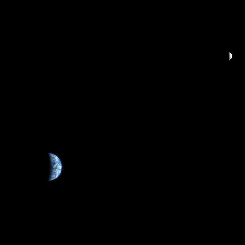
Earth and Moon as Seen from Mars
Full Resolution:
TIFF
(1.922 MB)
JPEG
(11.74 kB)
|
|
|
2008-02-29 |
Earth
|
Earth Observing System (EOS)
|
ASTER
|
1666x1772x3 |
|
-
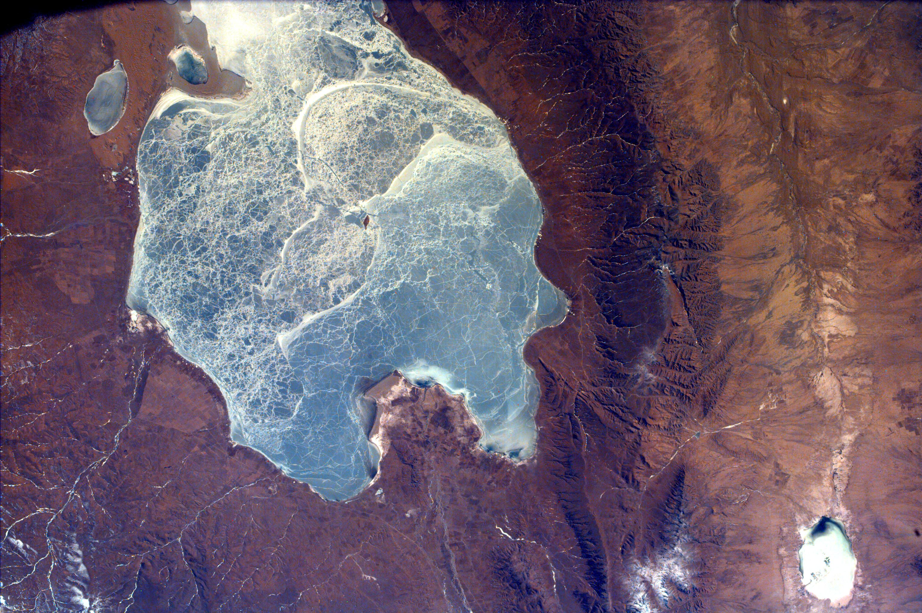
PIA10625:
-
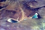
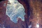
Lake Naivasha, Kenya
Full Resolution:
TIFF
(8.871 MB)
JPEG
(451.1 kB)
|


