North Dakota Water Science Center
|
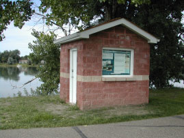
Webcam on Red River at Grand Forks, ND 
Information Center
Red River Basin
Devils Lake Basin
Missouri River Basin North Dakota Wetlands Annual Data Reports Lewis & Clark and the USGS Canoeing North Dakota's Rivers Education USGS IN YOUR STATEUSGS Water Science Centers are located in each state. 
|
The Missouri River Basin in North Dakota
Lake Sakakawea Month-End Elevation and Contents Data, 1960-2004Data from Other Federal Agencies
The Missouri River is the largest river in North Dakota and accounts for 80 percent of the total mean streamflow in the State. The Missouri River Basin is comprised of seven major subbasins and drains about 34,000 square miles or about 48 percent of the State's total area. Of the original 390 Missouri River miles in North Dakota, about 80 miles remain free-flowing. These free-flowing river miles are located in the reach just below Garrison Dam and upstream from Lake Oahe (formed by a Oahe Dam located in South Dakota). Garrison Dam, about 70 miles north of Bismarck, was built in 1953 as part of a system of dams and reservoirs located on the Missouri River in Montana, North Dakota, and South Dakota. The U.S. Army Corps of Engineers built the dams, in part, to control flooding on the Missouri River. Before the construction of Garrison Dam, the maximum peak streamflow measured at Bismarck was 500,000 cubic feet per second on April 6, 1952. For 1954-2000, the annual mean flow at Bismarck was 23,170 cubic feet per second. To Top of Page |

![]() U.S. Department of the Interior |
U.S. Geological Survey
U.S. Department of the Interior |
U.S. Geological Survey
URL: http://nd.water.usgs.gov/missouririver/index.html
Page Contact Information: Webmaster
Page Last Modified: Thursday, 12-Feb-2009 11:52:32 EST
Sioux Falls, SD [sdww50]