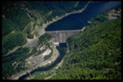
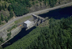
Detroit and Big Cliff Dams and Reservoirs
The Detroit and Big Cliff Dams are two of 13 multi-purpose dams operated by the Corps of Engineers in the Willamette Valley. Located in the rugged mountain forests below Mt. Jefferson, the two dams store waters of the North Santiam River, providing flood damage reduction, irrigation, power generation, recreation, navigation, and downstream water quality improvement. Detroit and Big Cliff dams were completed in 1953 at a cost of $62.7 million.
Detroit:
Detroit dam, the principal facility, rises 463 feet above its foundation in the narrow, steep, rocky slopes of North Santiam Canyon. The dam is a concrete gravity structure with a gated spillway. The powerhouse contains two generator units with the capacity to produce a total of 100,000 kilowatts. During the summer, Detroit Lake is a popular destination for water-related recreation activities. For more information about recreation opportunities, go the Detroit Lake Recreation page. To learn about water management as it relates to Detroit Lake, download the Water Management Update slide presentation.
Big Cliff:
Big Cliff, a reregulating dam and small reservoir, is located three miles downstream from Detroit dam. Big Cliff Lake is used to smooth out the power generation water releases from Detroit dam and to control downstream river level fluctuations. Big Cliff dam is a 191 foot-high concrete dam. The powerhouse has one 18,000 kilowatt capacity generating unit. Reregulation operations at Big Cliff dam may cause the lake level to fluctuate as much as 24 feet daily.
|
Dams |
|
|
Big Cliff |
| |
|
|
|
Measure |
Metric |
Measure |
Metric |
| Length | 1,523.5ft | 464.5m | 280ft | 85.3m | |
| Height | 463ft | 141.1m | 191ft | 58.2m | |
| Elevation (NGVD*) | 1,580ft | 481m | 1,212ft | 369m | |
| Total kilowatt capacity | 100,000kw | 18,000kw | |||
| Lakes | |||||
| Length | 9mi | 14.4km | 2.8mi | 4.5km | |
| Shoreline | 32mi | 51.4km | |||
| Area when full | 3,500ac | 1,432ha |
*National Geodetic Vertical Datum (Mean Sea Level)


