|
2007 Mined Land Reclamation Awards announced
December 2, 2008 - An extensive clean-up of a long neglected mine site and a Good Neighbor award in Linn County are the highlights of this year's Mined Land Reclamation Awards.
|
|
DOGAMI Publications Search
|
Statewide Landslide Information Database Released 
DOGAMI created the Statewide Landslide Information Database for Oregon to improve the understanding of the landslide hazard in Oregon and to create a statewide base level of landslide data. The landslide database is the first step in a comprehensive and systematic approach to cataloging the nature and scope of landslides in Oregon and should serve as useful tool for differentiating areas of higher and/or lower hazard. This information is basic to emergency and land use applications by helping identify vulnerable areas that may require planning considerations and in prioritizing mitigation measures that may need to be implemented to reduce future losses.
|
Oregon LIDAR Consortium 
In 2007 the Oregon 74th Legislative Assembly directed DOGAMI to extend LIDAR collection efforts throughout the state in order to provide high-quality LIDAR coverage for the entire state. To achieve this goal DOGAMI has formed the Oregon LIDAR Consortium (OLC), which will develop cooperative agreements for the collection of high-quality LIDAR that benefits the public at large, the business community, and agencies at all levels of government.
|
Happy Birthday, Oregon! 
Oregon will celebrate its 150th birthday in the year 2009. Planning for this big event has already begun. Check out the Oregon 150 Web site. You can share your thoughts and ideas with the planning team, sign up to receive e-mail updates, and learn how you can get involved.
|
|

|
|
Next DOGAMI Governing Board Meeting
December 12, 2008, 8:30 am - noon
Portland State Office Building
800 NE Oregon Street, Suite 965
Portland, Oregon 97232
|
New geologic map for two quadrangles in Linn County released 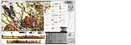
News Release: November 20, 2008
Open-File Report O-08-11, Preliminary Geologic Map of the Lebanon and Onehorse Slough 7.5' Quadrangles, Linn County, Oregon by Mark L. Ferns and Jason D. McClaughry, has been released.
The Lebanon and Onehorse Slough 7.5' quadrangles are located in the Willamette Valley of Oregon at the western edge of the Western Cascades physiographic province. The area was remapped as part of a regional effort to construct a geologic framework for the middle and southern Willamette Valley. New mapping conducted during the 2007 field season, augmented by numerous geochemical analyses and compiled radiometric age determinations, now ties poorly exposed, discontinuous bedrock outcrops to lithologic, geochemical, and fossil data extracted from engineering bore holes and oil and gas exploration wells.
The map was funded in part by the U.S. Geological Survey National Cooperative Geologic Mapping Program.
|
|
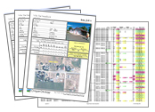
Report on Seismic Critical Energy Infrastructures Workshop released
News Release: October 14, 2008
Open-File Report O-08-10, Oregon Public Utilities Commission--Oregon Department of Geology and Mineral Industries Leadership Forum and Seismic Critical Energy Infrastructures Workshop, April 2, 2008, compiled by Yumei Wang and Jose R. Gonzalez has been released.
This report documents the Leadership Forum and Seismic Critical Energy Infrastructures Workshop, held in Salem, Oregon, which brought together executives and senior engineers from critical energy and telecommunication infrastructure organizations with the goal of sharing evidence that earthquake preparedness is needed for the State's energy and telecommunication infrastructure.
|
Hazard Maps Released for Six Counties in the Mid-Willamette Valley 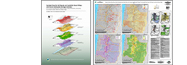
7-14-08 - IMS-24, Geologic Hazards, Earthquake and Landslide Hazard Maps, and Future Earthquake Damage Estimates for Six Counties in the Mid/Southern Willamette Valley Including Yamhill, Marion, Polk, Benton, Linn, and Lane Counties, and the City of Albany, Oregon, by William J. Burns, R. Jon Hofmeister, and Yumei Wang, 3-CD set $25.
|
Oregon Geology magazine 
Articles: Early Pliocene (Blancan) Always Welcome Inn local fauna, Baker City; Jurassic crocodile discovered in Crook County; Watershed assessment, river restoration, and the geoscience profession in Oregon; Preliminary assessment of the extent of the leaf fossil beds at Wheeler High School, Fossil ( news release)
|
|