 |
| Available Data: | GROUND-WATER
MONITORING, NORTHERN GUAM LENS, MAY 2004 – FEBRUARY 2005 |
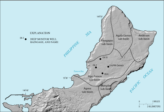
Introduction Rainfall, water-level, and specific-conductance data were collected from four locations in the Yigo-Tumon sub-basin of the Northern Guam Lens (NGL). The data was collected to investigate how the lens thickness and the specific-conductance distribution with depth responds to recharge events. The Northern Guam Lens provides nearly 40 million gallons per day (about 80 percent of the total) of drinking water to the island of Guam (Jocson and others, 2002). Within the NGL, the Yigo-Tumon sub-basin is the principal water-producing sub-basin, accounting for about 40 percent of the total production and probably as much of the remaining freshwater reserve. It is also the most heavily developed area, containing over half of the island's population, and nearly all of its civilian commercial and industrial activities. Saltwater intrusion has affected several wells in the Yigo-Tumon sub-basin owing to high pumping rates and well completion depths that are too deep relative to the freshwater-lens thickness, aquifer properties, and recharge. A better understanding of the response of the freshwater lens to pumping, as well as to short-term variations in recharge, is needed to provide a basis for appropriate well design and proper production management. Rainfall, water-level, and specific-conductance data were collected in cooperation with the Guam Environmental Protection Agency (GEPA) from May 17, 2004 to February 24, 2005. Personnel from the Water and Environmental Research Institute (WERI) of the University of Guam and the GEPA assisted with the collection and review of the data. A description of general hydrologic principles, the island’s ground-water systems, as well as Guam’s rainfall, surface water, and geology, is provided in USGS Water-Resources Investigation Report 03-4126 (Gingerich 2003).
|