
Mars MOC NA Hi-Resolution Topography
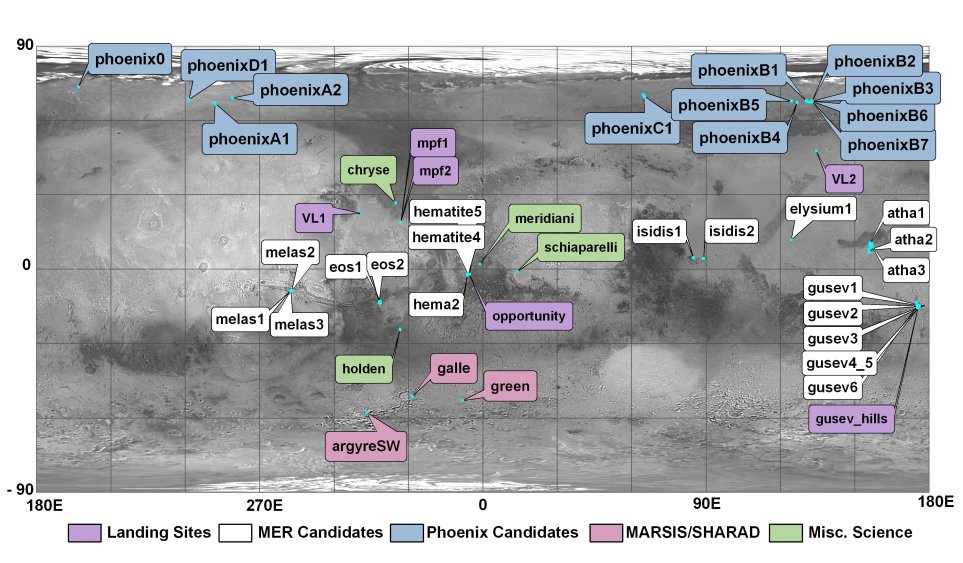
click on label above to continue to download page. View larger locator map - (jpeg)
Overview
- ReadMe (PDF)
Tables
- August 2005: Stereo Summary Worksheet (Excel)
Papers and Presentations
- MER Special Issue of JGR, June 2003: High-Resolution Topomapping Of Candidate Mer Landing Sites With Mars Orbiter Camera Narrow-Angle Images paper (pdf)
- MER Landing Site Workshop, Jan 2003: High-Resolution Slope Estimates of MER Landing Sites From MOC-Na Images presentation (pdf)
- Phoenix Landing Site Workshop, Nov 2005: Phoenix Landing Site Topography from MOC presentation (pdf)
- Phoenix Landing Site Workshop, Jan 2007: Phoenix Landing Site Topomapping Update presentation (pdf)
Related Sites
- Planetary Geomatics Group
- ISIS Photometry and Photoclinometry Software
- USGS Mars Science Laboratory site
Credits
Production of these DTMs was funded by the NASA Planetary Geology & Geophysics, Mars Fundamental Research, and Mars Critical Data Products programs.Alphabetical Listing:
- argyreSW
- atha1
- atha2
- atha3
- chryse
- elysium1
- eos1
- eos2
- galle
- green
- gusev1
- gusev2
- gusev3
- gusev4_5
- gusev6
- gusev_hills
- hema2
- hematite4
- hematite5
- holden
- isidis1
- isidis2
- melas1
- melas2
- melas3
- meridiani
- mpf1_bigcrater
- mpf2_bigcrater
- phoenix0
- opportunity
- phoenixA1
- phoenixA2
- phoenixB1
- phoenixB2
- phoenixB3
- phoenixB4
- phoenixB5
- phoenixB6
- phoenixB7
- phoenixC1
- phoenixD1
- schiaparelli
- VL1
- VL2