

|
Current Events Data & Products Purchase Climate Info. |
|
|
|
||||||||||||||
|
||||||||||||||
|
||||||||||||||
|
|
||||||||||||||
|
||||||||||||||
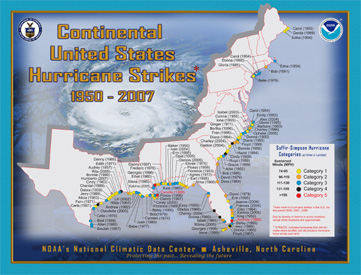
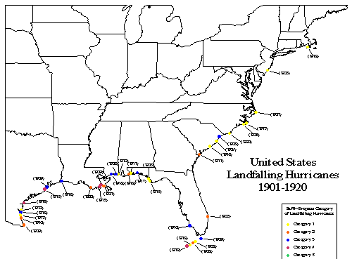
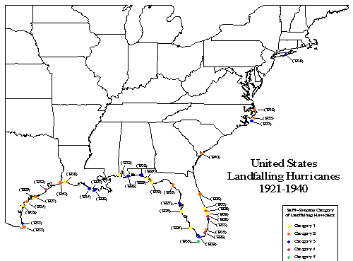
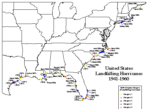
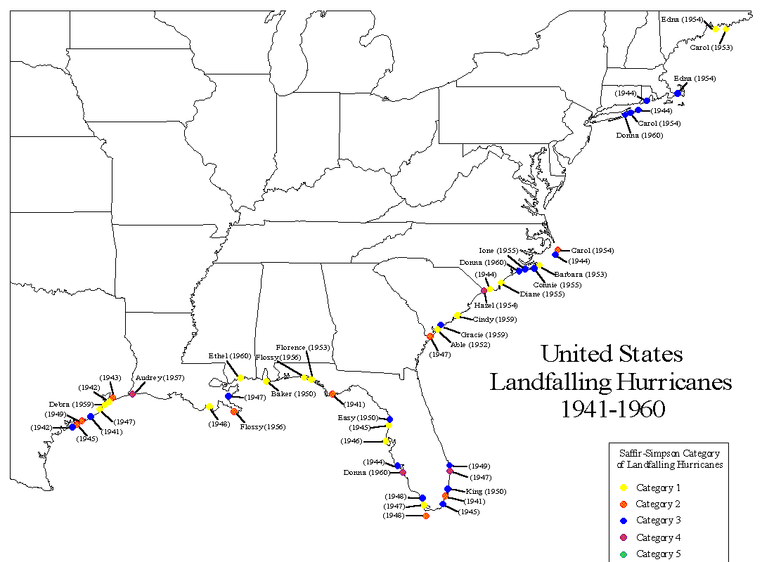
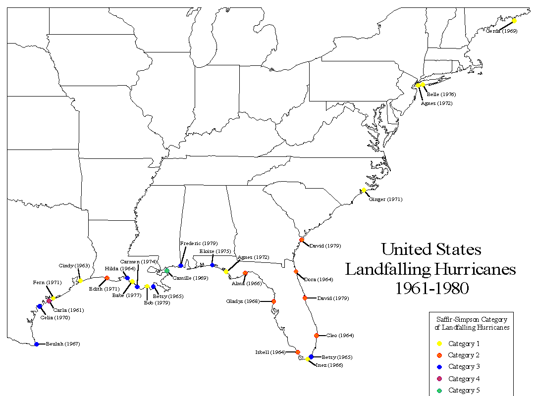
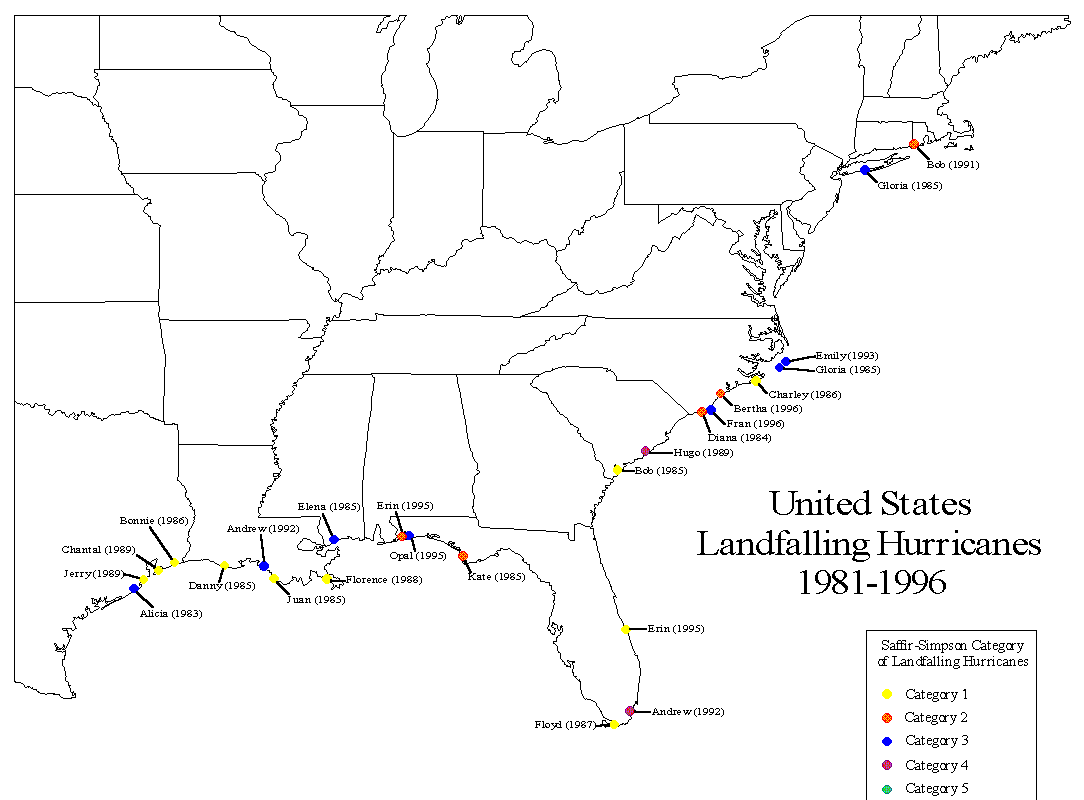
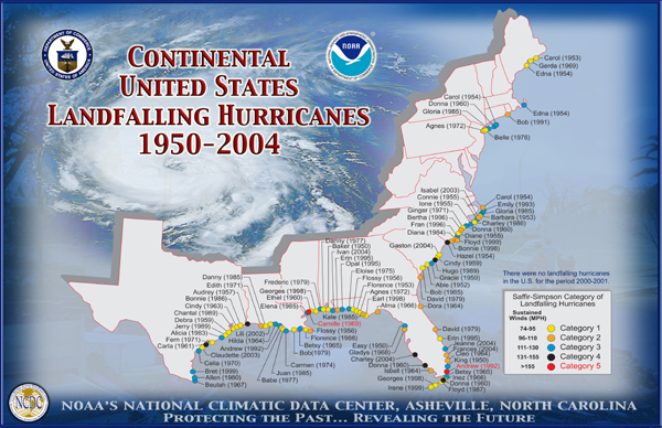
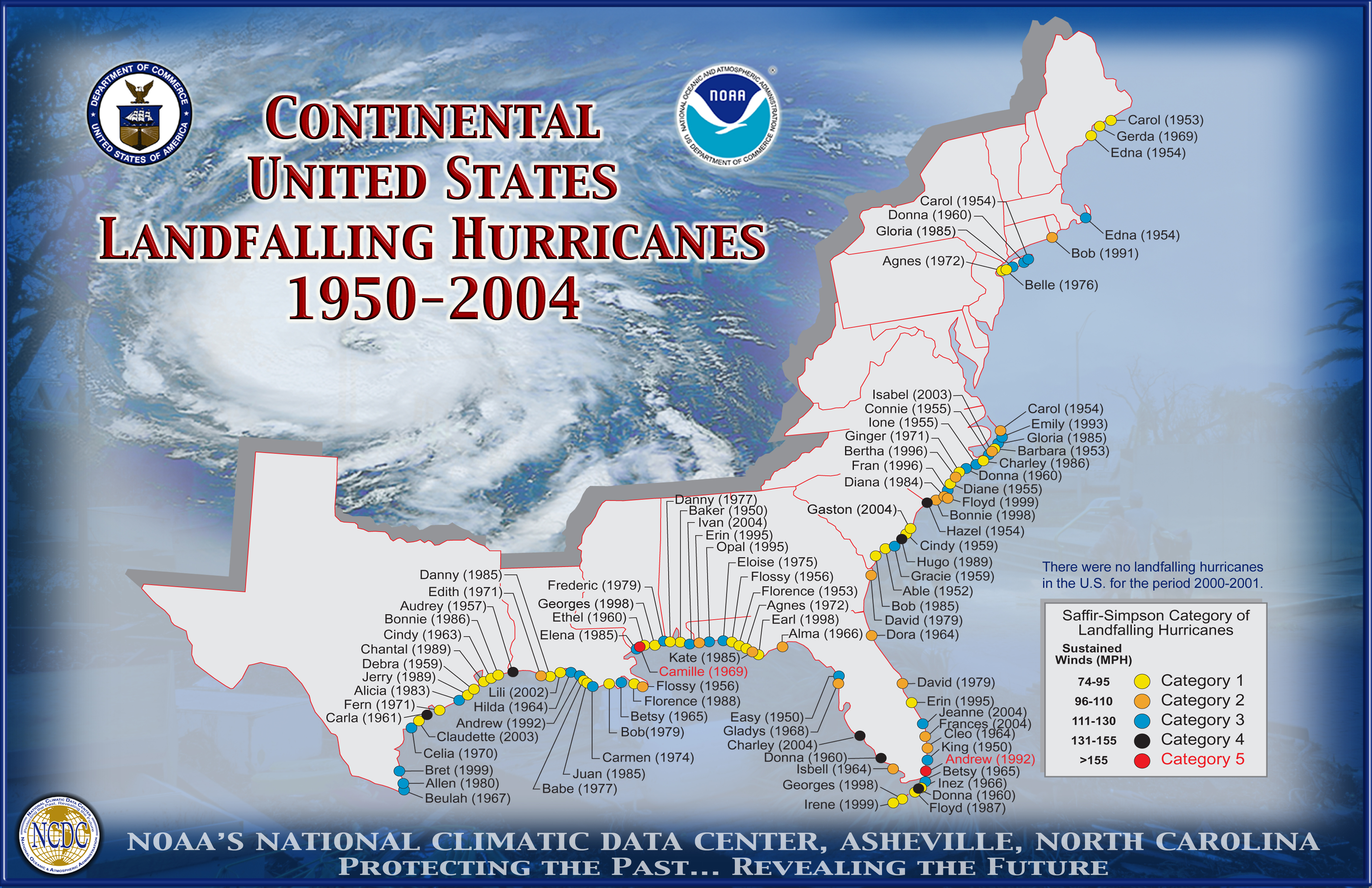
1901-2004 U.S. Landfalling Hurricanes (GIF & JPEG Maps): |
||||||||||||||
|
||||||||||||||
|
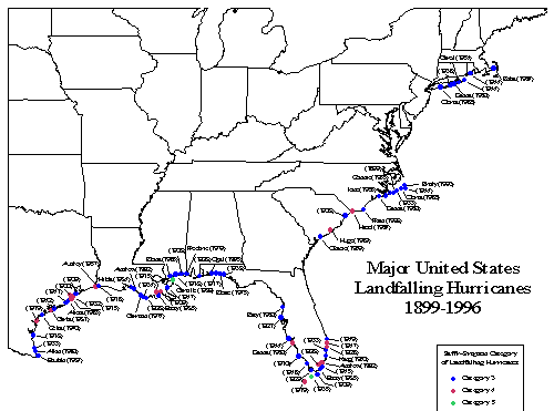
Small--for a quick view, Large--larger image for printing1899-1996 U.S. Landfalling Major Hurricanes--GIF Maps (small ) (large) | ||||||||||||||
| ||||||||||||||
| ||||||||||||||
|


