
California Water Science Center
Multimedia
Multimedia products allow us to distribute information to the public. The California Water Science Center has a variety of materials available, including webcasts, videos, and images.
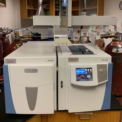
Trace 1310 GC with a TSQ 9000 triple quadrupole MS (Thermo Scientific)
Trace 1310 GC with a TSQ 9000 triple quadrupole MS (Thermo Scientific)

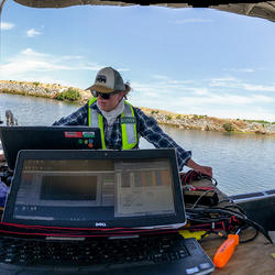
Scientists Collect Water Quality Data
Scientists Collect Water Quality Data Prior to Wastewater Treatment Plant Upgrades
USGS Scientists Map Nutrients on Sacramento Delta
USGS Scientists Map Nutrients on Sacramento Delta

One-Water Hydrologic Flow Model cross section
One-Water Hydrologic Flow Model: A MODFLOW Based Conjunctive-Use Simulation Software (Boyce and others, 2020).
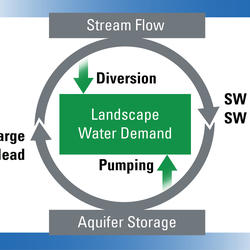
Groundwater / Surface Water Interconnectivity
Diagram showing that water flow and use is interconnected through physically-based processes and management processes. Note that precipitation is not included in figure, but is a source of water that could potentially reduce the landscape water demand and increase aquifer storage and stream flow (
...
MODFLOW-2005 Framework
Diagram the MODFLOW-2005 framework and its descendants (Boyce and others, 2020)

Land Use Change (1934 - 2005), Anza Valley, CA
Land use change in the Anza Valley, CA from 1934 to 2005.

Natural Recharge (1981 - 2010), Indian Wells Valley, CA
The USGS California Basin Characterization Model (BCM) was used to understand the rate and amounts of natural groundwater recharge in the Indian Wells Valley and to refine historical estimates of groundwater recharge in the valley. Results from this study provide validation of recharge estimates
...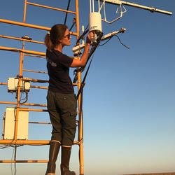
Scientist adjusts equipment mounted on tower at the Suisun Marsh
USGS Research Scientist Ellen Goodrich-Stuart adjusts a CH4 (Methane) analyzer mounted on the eddy covariance flux tower at the Rush Ranch site at Suisun Marsh.

Groundwater-level Response to the July 2019 Ridgecrest, CA Earthquakes
Locations of the July 2019 earthquake epicenters and six USGS groundwater-monitoring sites. The hydrographs show the response of groundwater levels to the earthquakes. Sites shown are California (1)
...
High-resolution Water Quality Mapping on California's Bay-Delta
Hydrologist Brian Bergamaschi is seen through the USGS California Water Science Center Biogeochemistry Group's underwater water quality mapping manifold. This maze of tygon tubing allows water to be pumped onto a boat while underway, splits the water into multiple flowpaths, and passes the water to various flow-through water quality instruments through a manifold that
...
Quratulain Ahmed preserving samples in fume hood
Quratulain Ahmed preserving samples in fume hood