Central Midwest Water Science Center
News
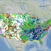
USGS Unveils Mobile Flood Tool for the Nation
The U.S. Geological Survey announced Friday the completion of a new mobile tool that provides real-time information on water levels, weather and flood forecasts all in one place on a computer, smartphone or other mobile device.
USGS Responds to Spring Flooding
U.S. Geological Survey field crews are measuring flooding across the country as spring weather is in full swing. Warming temperatures, increased precipitation and snowmelt have caused moderate to major flooding in the upper Midwest, East Coast, Central Plains and the Southeast portions of the country.
USGS Mobile Water Quality Sensor on Mississippi River Boat
U.S. Geological Survey expands its network of water-quality sensors to include the American Queen Steamboat as she travels the entire length of the Mississippi River collecting nutrient levels and water-quality data along the way. (Image Courtesy: Iowa Public Radio, Iowa City, Iowa, limited use USGS only)
Media Advisory: USGS Assesses Iowa Flood Levels for Emergency Preparedness
Reporters: Do you want to accompany a USGS field crew as they inspect high-water marks? Please contact Marisa Lubeck or Paul Rydlund.
USGS Flood Experts Respond to High Water in Central, Northeastern U.S.
Crews from the U.S. Geological Survey have been in the field for weeks measuring flooding in the Midwest and in the Mississippi River watershed, and more recently flooding and storm tides on the Northern Atlantic coast, as higher temperatures, heavy rain, snowmelt and nor’easters affected numerous states.
New Report on Channel Bed Erosion Helps Assess Bridge Stability in St. Louis
A new assessment of channel bed erosion near 13 highway bridges in the greater St. Louis, Missouri, area is now available in an online report from the U.S. Geological Survey, produced in cooperation with the Missouri Department of Transportation.
Red Dye Study Will Examine Water Flow through Auxiliary Lock 14 near the Quad Cities
U.S. Geological Survey scientists will inject a harmless, bright red fluorescent dye into the auxiliary lock at Locks and Dam 14 on the Mississippi River near Pleasant Valley, Iowa, Tuesday, June 13, 2017, weather permitting. If needed, a backup date is scheduled for June 27, 2017.
The Vital Nature of Streamgaging
Gary Moore spent the last three days of 2015 stacking hefty bags of sand in front of a fellow church member’s brick home. With only 1,000 feet between the house and the swelling Mississippi and Meramec Rivers, Moore and other volunteers worked quickly, in frigid temperatures, to assemble a 10-foot high, 1,000-foot-long sandbag wall to ward off floodwaters.
USGS Measures Record Flooding in Missouri
Reporters: Do you want to interview USGS scientists as they measure flooding? Please contact Jennifer LaVista.
Media Advisory: Helicopter to Fly Low Over Cedar Rapids for Groundwater Study
Starting on May 2 and lasting for about two days, a helicopter towing a large, cylindrical sensor will make low-level flights over parts of Cedar Rapids as part of a groundwater survey.
Asian Carp Would Have Adequate Food to Survive in Lake Michigan
If invasive bighead carp and silver carp spread into Lake Michigan, there would be enough food available for these particular species of Asian carp to survive, according to a new study by the U.S. Geological Survey.
Up in the Air to Look Deep Underground
Look, in the sky! It’s a bird! It’s a plane! It’s...underground mineral research?


