
Lower Mississippi-Gulf Water Science Center
Home
Hydrologic Data at LMG
We provide current and historical surface-water, groundwater, water quality, water use, and ecological data in various formats (map, graphical, tabular)
Water Data at LMGScience at LMG
The Lower Mississippi Water Science Center collects high-quality hydrologic data and conducts unbiased, scientifically sound research on Alabama, Arkansas, Louisiana, Mississippi, and Tennessee water resources.
Science at LMGQuick links - Water Conditions for the nation
See current and historical water data for the United States. Here you can find information from floods to droughts for the entire nation.
USGS WaterWatch - Current Streamflow
USGS WaterWatch - Past Flow/Runoff
NWISWebNews

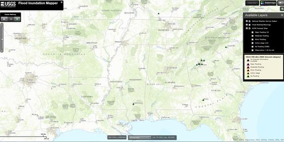
USGS Unveils Mobile Flood Tool for the Nation
The U.S. Geological Survey announced Friday the completion of a new mobile tool that provides real-time information on water levels, weather and flood forecasts all in one place on a computer, smartphone or other mobile device.

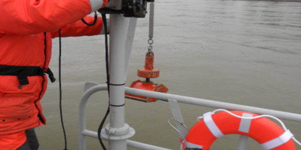
USGS Deploying Storm Tide Sensors Along Gulf Coast for Hurricane Delta
To learn more about USGS’s role in providing science to decision-makers before, during and after Hurricane Delta, visit the USGS Hurricane Delta page at www.usgs.gov/delta.

Coastal Change Happens! USGS Has Data and Tools to Help Coastal Communities Prepare
USGS Introduces a National Approach to Coastal Change Hazards (CCH) Science
Publications
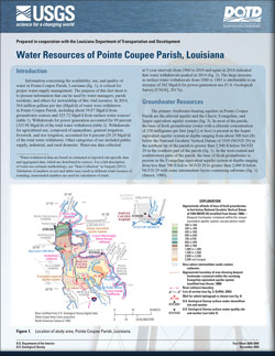
Water resources of Pointe Coupee Parish, Louisiana
Information concerning the availability, use, and quality of water in Pointe Coupee Parish, Louisiana, is critical for proper water-supply management. The purpose of this fact sheet is to present information that can be used by water managers, parish residents, and others for stewardship of this vital resource. In 2014, 364 million gallons per day...
White, Vincent E.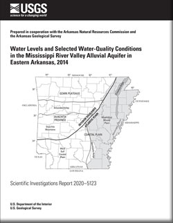
Water levels and selected water-quality conditions in the Mississippi River Valley alluvial aquifer in eastern Arkansas, 2014
In 2014, the U.S. Geological Survey, in cooperation with the Arkansas Geological Survey and the Arkansas Natural Resources Commission, determined water-level altitudes in 468 wells in eastern Arkansas and collected water-quality samples from 144 wells. Water-level altitudes were calculated based on the measured depth to water in each well and used...
Rodgers, Kirk D.; Whaling, Amanda R.
An analysis of streamflow trends in the southern and southeastern US from 1950-2015
In this article, the mean daily streamflow at 139 streamflow-gaging stations (sites) in the southern and southeastern United States are analyzed for spatial and temporal patterns. One hundred and thirty-nine individual time-series of mean daily streamflow were reduced to five aggregated time series of Z scores for clusters of sites with similar...
Rodgers, Kirk D.; Roland II, Victor L.; Hoos, Anne B.; Crowley-Ornelas, Elena; Knight, Rodney