Oklahoma-Texas Water Science Center
Home
Water information is fundamental to national and local economic well-being, protection of life and property, and effective management of water resources. The USGS works with partners in Texas to monitor, assess, conduct targeted research, and deliver information on a wide range of water resources including streamflow, groundwater, water quality, and water use and availability.
Texas Water Dashboard
View over 850 USGS real-time stream, lake, reservoir, precipitation, water quality and groundwater stations in context with current weather and hazard conditions!
Go to the DashboardWater On-The-Go
Map-based mobile web application that gives Texans easy access to current conditions in streams near them.
Find Data Near MeNews
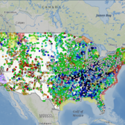
USGS Unveils Mobile Flood Tool for the Nation
The U.S. Geological Survey announced Friday the completion of a new mobile tool that provides real-time information on water levels, weather and flood forecasts all in one place on a computer, smartphone or other mobile device.
Hurricane Laura Temporarily Reverses Neches River
As Hurricane Laura came ashore near the Texas and Louisiana borders, its strong winds pushed so much water ahead of it that the Neches River even flowed backwards for a time, according to a USGS streamgage in Beaumont.
USGS: Laura to strongly affect Texas, Louisiana beaches and barrier islands
To learn more about USGS’s role in providing science to decision makers before, during and after Hurricane Laura, visit www.usgs.gov/laura
Publications
Regional regression equations for estimation of four hydraulic properties of streams at approximate bankfull conditions for different ecoregions in Texas
The U.S. Geological Survey, in cooperation with the U.S. Army Corps of Engineers, assessed statistical relations between hydraulic properties of streams at approximate bankfull conditions for different ecological regions (ecoregions) in Texas. Data from more than 103,000 records of measured discharge and ancillary hydraulic properties were...
Asquith, William H.; Gordon, John D.; Wallace, David S.Water resources in the Cheyenne and Arapaho Tribal jurisdictional area, west-central Oklahoma, with an analysis of data gaps through 2015
This report provides an overview of existing hydrologic information describing the quality, quantity, and extent of the major surface-water and groundwater resources in the Cheyenne and Arapaho Tribal jurisdictional area, west-central Oklahoma. Hydrologic information is provided for five major river systems (Cimarron River, North Canadian River,...
Becker, Carol J.; Varonka, Matthew S.Geologic framework and hydrostratigraphy of the Edwards and Trinity aquifers within northern Medina County, Texas
The karstic Edwards and Trinity aquifers are classified as major sources of water in south-central Texas by the Texas Water Development Board. During 2018–20 the U.S. Geological Survey, in cooperation with the Edwards Aquifer Authority, mapped and described the geologic framework and hydrostratigraphy of the rocks composing the Edwards and Trinity...
Clark, Allan K.; Morris, Robert E.; Pedraza, Diana E.


