
New Mexico Water Science Center
Home
New Mexico Water Science Center's priority is to continue the important work of the Department of the Interior and the USGS, while also maintaining the health and safety of our employees and community. Based on guidance from the White House, the CDC, and state and local authorities, we are shifting our operations to a virtual mode and have minimal staffing within our offices.
New Mexico Current Water Conditions Dashboard
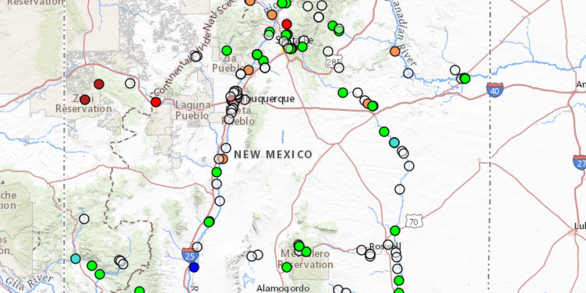
The maps utilize zoom and pan to allow you to focus in on the water-monitoring sites that interest you. The maps show current water conditions as compared to historical records.
Visit the SitesNew Mexico Water Science Center Featured Project:
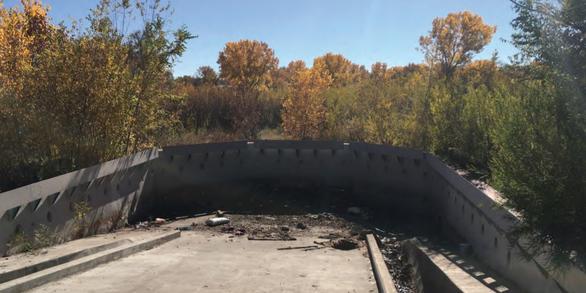
In cooperation with Bernalillo County, the U.S. Geological Survey characterized polychlorinated biphenyl (PCB) concentrations and made PCB load estimates from Albuquerque area stormwater channels.
Project PagePopular Links
New Mexico Water Science Center's most popular pages and external links:
The Water Quality Portal (WQP)
New Mexico ScienceNews

Pesticides and their degradation products common in groundwater but at low concentrations unlikely to be human-health concern
Thousands of pesticides are used on crops and landscaping, are they in our groundwater? According to a new USGS study, the answer is a qualified yes—some pesticides and the chemical compounds they degrade to are common in groundwater used for public drinking-water supply, but mostly at concentrations well below levels of concern for...

USGS Unveils Mobile Flood Tool for the Nation
The U.S. Geological Survey announced Friday the completion of a new mobile tool that provides real-time information on water levels, weather and flood forecasts all in one place on a computer, smartphone or other mobile device.
")
USGS News Release: Groundwater Levels are Rebounding in Albuquerque
Groundwater levels in the Albuquerque area are on the rise according to newly published research from the U.S. Geological Survey.
Publications

Optimization assessment of a groundwater-level observation network in the Middle Rio Grande Basin, New Mexico
The U.S. Geological Survey, in cooperation with the Albuquerque Bernalillo County Water Utility Authority (ABCWUA), measures groundwater levels continuously (hourly) and discretely (semiannually and annually) at a network of wells and piezometers (hereafter called the observation network) within the Middle Rio Grande Basin in central New Mexico....
Ritchie, Andre B.; Pepin, Jeff D.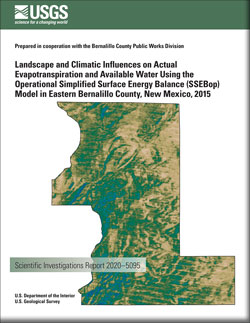
Landscape and climatic influences on actual evapotranspiration and available water using the Operational Simplified Surface Energy Balance (SSEBop) Model in eastern Bernalillo County, New Mexico, 2015
The U.S. Geological Survey, in cooperation with the Bernalillo County Public Works Division, conducted a 1-year study in 2015 to assess the spatial and temporal distribution of evapotranspiration (ET) and available water within the East Mountain area in Bernalillo County, New Mexico. ET and available water vary spatiotemporally because of complex...
Douglas-Mankin, Kyle R.; McCutcheon, Ryan J.; Mitchell, Aurelia C.; Senay, Gabriel B.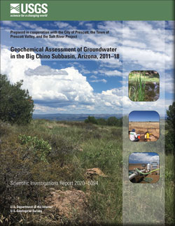
Geochemical assessment of groundwater in the Big Chino subbasin, Arizona, 2011–18
A geochemical characterization of groundwater in the Big Chino subbasin of Arizona was conducted by the U.S. Geological Survey, in cooperation with the City of Prescott, the Town of Prescott Valley, and the Salt River Project, to understand groundwater evolution through the study area and the source of water to springs along the gaining reach of...
Beisner, Kimberly R.; Jones, Casey J. R.