

Explore drought information by location through NIDIS Drought Early Warning Systems, individual states, or NOAA’s Regional Climate Center areas.
NIDIS Regional Drought Early Warning Systems (DEWS)
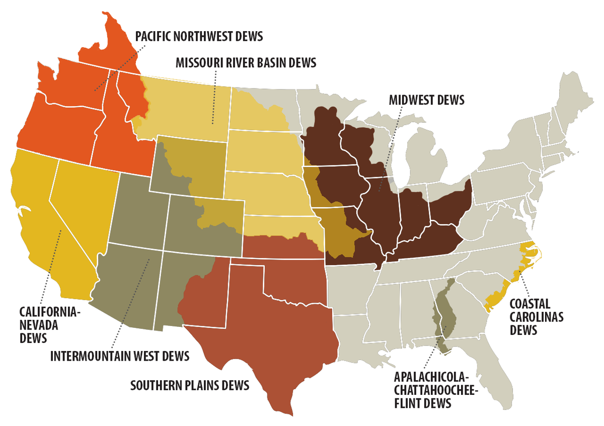
NIDIS Regional Drought Early Warning Systems (DEWS) are partnerships of federal, state, regional, local and private entities with the goal of helping stakeholders in the region cope with drought. The regional DEWS explore and demonstrate a variety of early warning and drought risk reduction strategies that incorporate drought monitoring and prediction information. Information on DEWS pages includes Drought Monitor graphics; other area maps and data; outlooks and reports; related meetings, events and webinars; links to related regions and states; stakeholder and partner lists and contact information.
State and Regional Climate Center Drought Information
Access drought information for individual states, or regions defined by NOAA’s Regional Climate Centers (RCCs) by clicking on the maps or text below. The six RCCs are a federal-state cooperative effort, producing and delivering climate data, information, and knowledge for decision makers and other users at the local, state, regional, and national levels. They provide monthly regional climate monitoring and engage in applied climate research.
Information on state and region pages includes Drought Monitor graphics; other area maps and data; drought outlooks and reports; links to related regions and states; and contact information.
