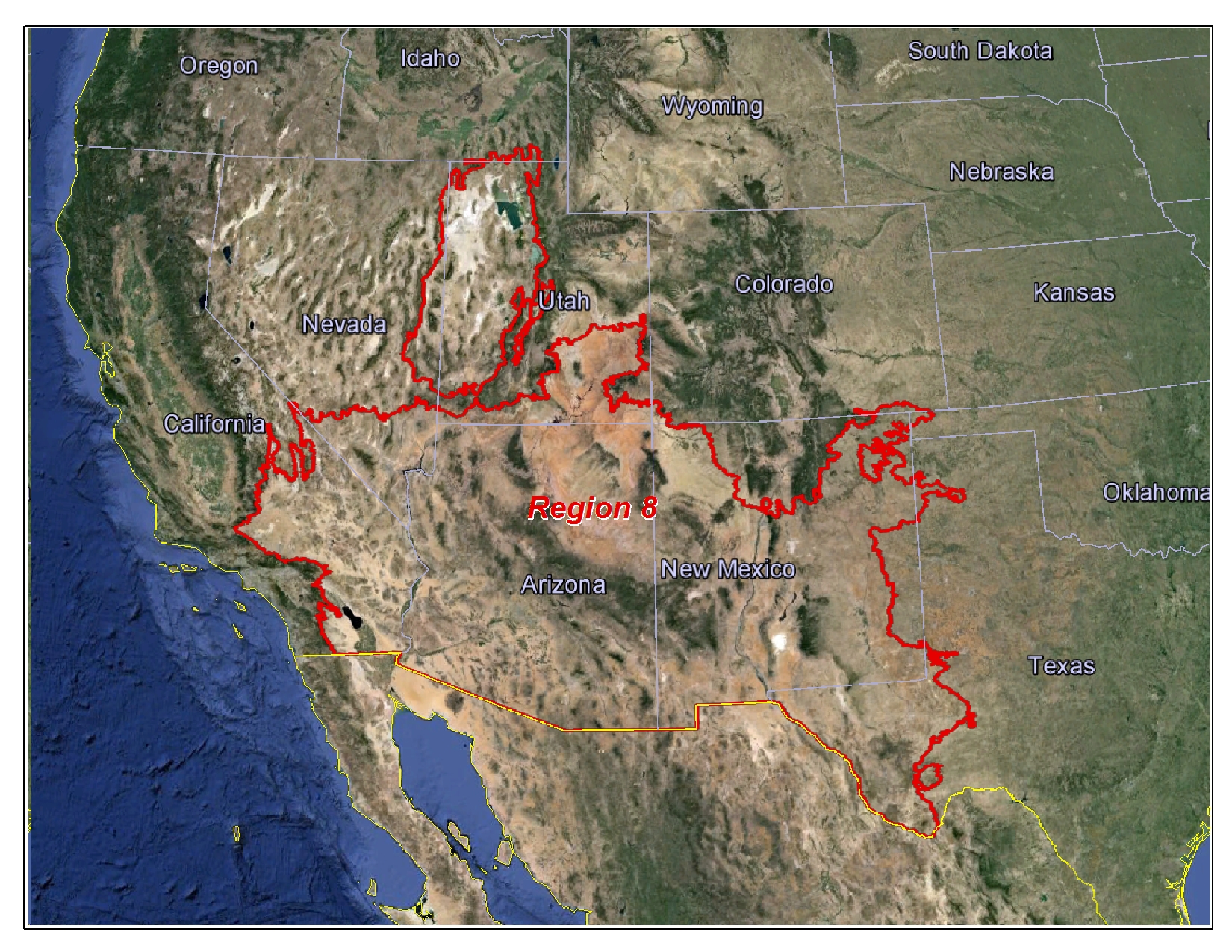
The Southwest Region 8 Office provides quality assurance of soil and ecological site information using National Cooperative Soil Survey (NCSS) standards. The SSR 8 area of responsibility is based on Major Land Resource Areas (MLRA). The Region 8 office in Phoenix, Arizona provides assistance to 10 MLRA soil survey offices and includes all of Arizona, and extends into parts of California, Colorado, Idaho, Nevada, New Mexico, Oklahoma, Texas, and Utah.
Southwest Region 8 Area of Responsibility:
|
SSR 8 Office Location:
230 N First Avenue, Suite 509
Phoenix, AZ 85003
Phone: 602-285-6347
Soil Survey Regional Director: Cathy McGuire
Assistant to Region 8 Director: Currently Vacant
|
Contact us:
Region 8 Office Directory - Phoenix, Arizona
Region 8 Major Land Resource Area (MLRA) Soil Survey Office Contacts
Status of Region 8 Soil Surveys:
This map shows the current status of all non-MLRA soil surveys for Region 8. All published surveys may be found in digital form (SSURGO) on the Web Soil Survey website.
Archived surveys from print versions in PDF format, as well as links to online surveys, may also be found at the NRCS Soil Surveys By State site. The status map is updated annually.
Click on the map, or link to the right, to view or download a higher resolution version.
The following document requires Adobe Acrobat.
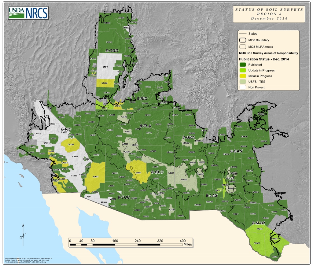
Status of Soil Survey - Region 8 (PDF; 5.6 MB)
Region 8 MLRA Soil Survey Office Areas of Responsibility:
This map shows the limits of responsibility for each of the ten MLRA Soil Survey Offices located within Region 8.
The ten soil offices include:
8-FLA (Flagstaff, AZ), 8-GLO (Globe, AZ), 8-GRA (Grants, NM), 8-LAS (Las Cruces, NM), 8-MAF (Marfa, TX),
8-OGD (Ogden, UT), 8-RIC (Richfield, UT), 8-SAN (Santa Fe, NM), 8-TUC (Tucson, AZ), 8-VIC (Victorville, CA)
Click on the map, or link to the right, to view or download a higher resolution version.
The following document requires Adobe Acrobat.

Region 8 MSSO Areas (PDF; 3.5 MB)
State Soils
A state soil is a soil that has special significance to a particular state. Each state in the United States has selected a state soil, twenty of which have been legislatively established. These “Official State Soils” share the same level of distinction as official state flowers and birds.
Click here to view state soil profiles from the NRCS State Soils page.
Other Soil Related Links:

Web Soil Survey - Explore seamless soils data. View, download, and print custom maps, reports, and interpretations based on your area of interest.
Soil Data Viewer - Free ArcMap AddInn Extension for exploring soil data and creating custom maps.
SoilWeb Smart Phone App - Smart Phone app for examining local soil data.
Ecological Site Descriptions (ESDs) - provide a consistent framework for classifying and describing rangeland and forestland soils and vegetation.
Soil Health - USDA/NRCS - Information for Healthy Soil for Life
Soils For Educators - Soils information and resources for teachers and students.
NCSS Soil Characterization Database - Application to generate, print and download reports containing soil characterization data from cooperator's laboratories stored and maintained by the NSSC Soil Survey Laboratory.


