restoration

Bridge soars over restored Maine river

By Amy Miller

I was driving south on Maine’s coast checking out Down East’s picturesque seaside towns when a bridge appeared through the fog, quite like Oz on the horizon. This was not the covered bridge of a quaint New England town, nor the familiar antiquated railroad bridge. This was a looming modern

The observatory of the Penobscott Narrows Bridge can be reached through the Fort Knox Historic Site.

The observatory of the Penobscott Narrows Bridge can be reached through the Fort Knox Historic Site.

structure more reminiscent of the Zakim Bridge into Boston. The closer we got the more I wondered at the size and stark beauty of this structure.

As it turns out, my husband and I were heading toward the 2,120-foot long Penobscot Narrows Bridge, and for good reason it conjured the Zakim. This 10-year-old bridge is one of only three of its kind in the world: constructed with a cradle system that carries the strands within the stays from bridge deck to bridge deck. The other two bridges of this kind are the Zakim and the Veterans’ Glass City Skyway in Toledo, Ohio.

Towering 420 feet over the town of Bucksport, the bridge’s public observation tower is also the only public bridge observatory in the country and one of four in the world (the others are in China, Slovakia and Thailand). The tallest of the four, it is reached by the fastest elevator in northern New England and gives you 360-degree views of Maine’s coastline, islands and lots of hills and mountains.

But just as impressive as these views is the far less visible but no less superlative accomplishments flowing below the span. The 109-mile Penobscot River tells the story of America’s environmental tragedies, as well as the equally compelling stories of how health and beauty can be restored to our waterways.

The restoration of the Penobscot involved an unprecedented effort to remove two dams and build a state-of-the-art fish bypass around a third. In addition to the Howland Dam bypass, the Milford Dam has a state-of-the-art fish lift installed as part of the restoration project.

A bypass was created for fish around the Howland Dam.

A bypass was created for fish around the Howland Dam.

As a result, hundreds of miles of habitat along the Penobscot and its tributaries have been restored, opening the way for sea-run fish, helping the ecology as well as the communities along the river.

In 1999 when Pennsylvania Power and Light purchased a series of dams in Maine, the company approached the Penobscot Indian Nation and several conservation organizations with the idea of working together to relicense the dams. Four years later the company announced it would remove dams along the lower part of the river while keeping hydropower upriver.

The non-profit Penobscot River Restoration Trust was formed, including the Penobscot Indian Nation and six environmental groups — American Rivers, Atlantic Salmon Federation, Maine Audubon, Natural Resources Council of Maine, The Nature Conservancy and Trout Unlimited, who worked with a variety of state and federal agencies, including EPA, on the restoration project.

The Trust in 2010 purchased the Veazie, Great Works, and Howland dams. The first two were removed and a bypass was created around the Howland Dam in 2015 marking the end of this model restoration program.

Before the 1830s, there were no dams on the Penobscot and Atlantic salmon ran upstream in schools numbering 50,000 or more. Shad and alewives migrated 100 miles upriver. Twenty-pound striped bass and Atlantic sturgeon also swam into the river.

Since the restoration, fish have retraced those routes. The salmon run today is considerably smaller than it had been, but still qualifies as the country’s largest Atlantic salmon run. And the population is likely to grow. As this happens, other wildlife that feeds on migrating fish will also do better.

When the restoration is over, 11 species of sea-run fish will have renewed access to habitat that runs from Maine’s high point on Katahdin down to the bay near the Penobscot Narrows Bridge, though not all the species may make it to Katahdin.

The Penobscot Indians fished for American shad as long as 8,000 years ago and sturgeon 3,000 years ago. The logging, dams, and industry along the river put thousands of years of activity to a stop by the 1950s.

Only a generation ago this river was regarded as one of American’s most endangered. It is now considered one of America’s most significant river-restoration efforts.

As you stand in the observatory, turning to look out in 360 degrees, remember to look down at the Penobscot. Sometimes the biggest changes lurk beneath the surface.

http://maine.gov/mdot/pnbo/

http://bangordailynews.com/2016/06/14/outdoors/hundreds-celebrate-completion-of-penobscot-restoration-project/

http://www.penobscotriver.org/

Amy Miller is in the public affairs office of EPA’s New England office.

Editor's Note: The opinions expressed herein are those of the author alone. EPA does not verify the accuracy or science of the contents of the blog, nor does EPA endorse the opinions or positions expressed. You may share this post. However, please do not change the title or the content. If you do make changes, please do not attribute the edited title or content to EPA or the author.

EPA's official web site is www.epa.gov. Some links on this page may redirect users from the EPA website to a non-EPA, third-party site. In doing so, EPA is directing you only to the specific content referenced at the time of publication, not to any other content that may appear on the same webpage or elsewhere on the third-party site, or be added at a later date.

EPA is providing this link for informational purposes only. EPA cannot attest to the accuracy of non-EPA information provided by any third-party sites or any other linked site. EPA does not endorse any non-government websites, companies, internet applications or any policies or information expressed therein.

How to Inventively Recycle Subway Cars and Other Environmental Hacks

By Barbara Pualani

NYC_subway_cars_used_as_artificial_reef

NYC Subway cars used as artificial reef. Credit: South Carolina Department of Natural Resources

I don’t surf. Well, correction: I tried to surf. And I failed. Miserably. I also don’t scuba dive. The sensation is too strange; it makes me feel claustrophobic. I reserve those types of adventurous activities for my brave and wonderful colleagues here at EPA.


I do, however, know that many people love these activities, even here in the not-so-tropical destination of New York City. Rockaway Beach, the only legal surfing beach in NYC, and the Rockaway Boardwalk see millions of tourists every year. In order to improve recreation and ocean habitat in this important area of the city, New York State Department of Environmental Conservation recently announced it will be making additions to the important artificial patch reefs.


The Rockaway Reef is a fully artificial reef and is located 1.6 miles south of Rockaway Beach. It was originally permitted for construction in 1965, and the rock, concrete, and steel structures total 413 acres. Over the years, the structures have silted and collapsed. The habitat has degraded and is in need of repair. As part of New York’s Artificial Reef Program, the state will be adding more than 450 concrete-coated steel pipe sections to extend the patch reefs already there.


This project is cool. It’s also good for the environment. Artificial reefs can be constructed by a variety of building materials but are most often made using submerged shipwrecks. They create new habitat for fisheries and give marine life another place to forage, find shelter, and evade predators. The reefs increase fishing opportunities for anglers and promote tourism for both surfers and divers. The benefits are both environmental and economical.


The Rockaway Reef is just one of 11 artificial reef sites in NYS, but the state has helped others along the coast build up their own artificial reefs with, believe it or not, old subway cars. The Metropolitan Transit Authority has recycled over 2500 subway cars over the past decade or so by using them to build artificial reefs all along the eastern seaboard, including in Delaware and in South Carolina.[1] Before they’re dropped to the bottom of the ocean, all doors and windows are removed. The subways cars are cleaned and completely swept of contaminating materials. Because there are so many nooks and crannies available in a subway car, they serve as pretty good spaces for fish habitat. Seeing them now at the bottom of the ocean is quite the trip.


At EPA, we have the mission to protect human health and the environment. It’s great to see projects that not only protect the environment but also allow us to enjoy it and interact positively with it. Sometimes our built environment can integrate well with our natural one, and that’s pretty special.


Like I said, I don’t surf. Diving is not my thing. But I can and do appreciate inventive recycling and habitat restoration. Those are activities I can get behind.


 About the author: Barbara Pualani serves as a speechwriter for EPA Region 2. Prior to joining EPA, she served as a Peace Corps Volunteer in the Dominican Republic. She resides in Brooklyn and is a graduate of University of Northern Colorado and Columbia University.

[1] http://www.dailymail.co.uk/sciencetech/article-2918849/Next-stop-REAL-Atlantic-New-York-subway-cars-dumped-sea-create-artificial-reefs-millions-fish.html


Editor's Note: The opinions expressed herein are those of the author alone. EPA does not verify the accuracy or science of the contents of the blog, nor does EPA endorse the opinions or positions expressed. You may share this post. However, please do not change the title or the content. If you do make changes, please do not attribute the edited title or content to EPA or the author.

EPA's official web site is www.epa.gov. Some links on this page may redirect users from the EPA website to a non-EPA, third-party site. In doing so, EPA is directing you only to the specific content referenced at the time of publication, not to any other content that may appear on the same webpage or elsewhere on the third-party site, or be added at a later date.

EPA is providing this link for informational purposes only. EPA cannot attest to the accuracy of non-EPA information provided by any third-party sites or any other linked site. EPA does not endorse any non-government websites, companies, internet applications or any policies or information expressed therein.

2015 Long Island Fish Passage Workshop

By Victoria O’Neill, Amy Mandelbaum, Julie Nace, and Mark Tedesco

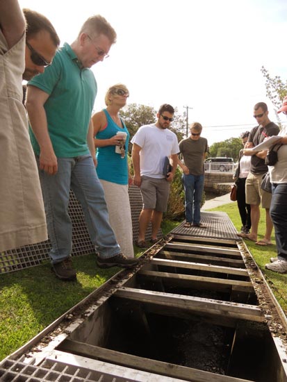
Workshop attendees inspect a newly installed fishway at Argyle Lake in Babylon, NY.

Workshop attendees inspect a newly installed fishway at Argyle Lake in Babylon, NY.

For hundreds of years, humans have manipulated New York’s waterways for their own interests and needs. The establishment of dams, weirs, and culverts have allowed humans to harness water power for mills, create ponds for recreation, and establish essential infrastructure such as roadways. While these changes have benefited people, they have had a negative impact on wildlife, in particular fish like river herring and American eel. These ocean-going fish require access to rivers to complete their life cycles, such as spawning and juvenile development. Impediments on rivers have severely impacted river herring and American eel populations in New York State.

Luckily, there are solutions to moving fish up, over, and through these impassable structures. Fishways, which consist of ladders, lifts, bypasses, and ramps, can be designed and installed at barriers like dams, weirs, and culverts to enable fish to move from one section of river to another. To date, a handful of fishways have been installed throughout New York and the region, but there are still many rivers and creeks containing barriers. Recognizing this need, several partners, including the Long Island Sound Study, Peconic Estuary Program, and Seatuck Environmental Association, decided to organize a workshop to educate those interested in fish passage.

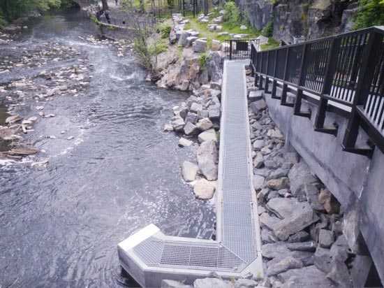
Fishway installed at the 182nd St Dam on the Bronx River in Bronx, NY.

Fishway installed at the 182nd St Dam on the Bronx River in Bronx, NY.

Last month, 45 engineers, biologists, hydrologists, environmental scientists and other practitioners from New York and New England took part in the Fish Passage Workshop at Hofstra University. The workshop was run by Brett Towler and Bryan Sojkowski from the U.S. Fish and Wildlife Service Northeast office. During Day 1 of the workshop, attendees learned about the design, operation, andoversight of fish passage projects. During Day 2 of the workshop, attendees visited a newly installed fishway at Argyle Lake and a future fish passage site at Southards Pond in Babylon, NY.

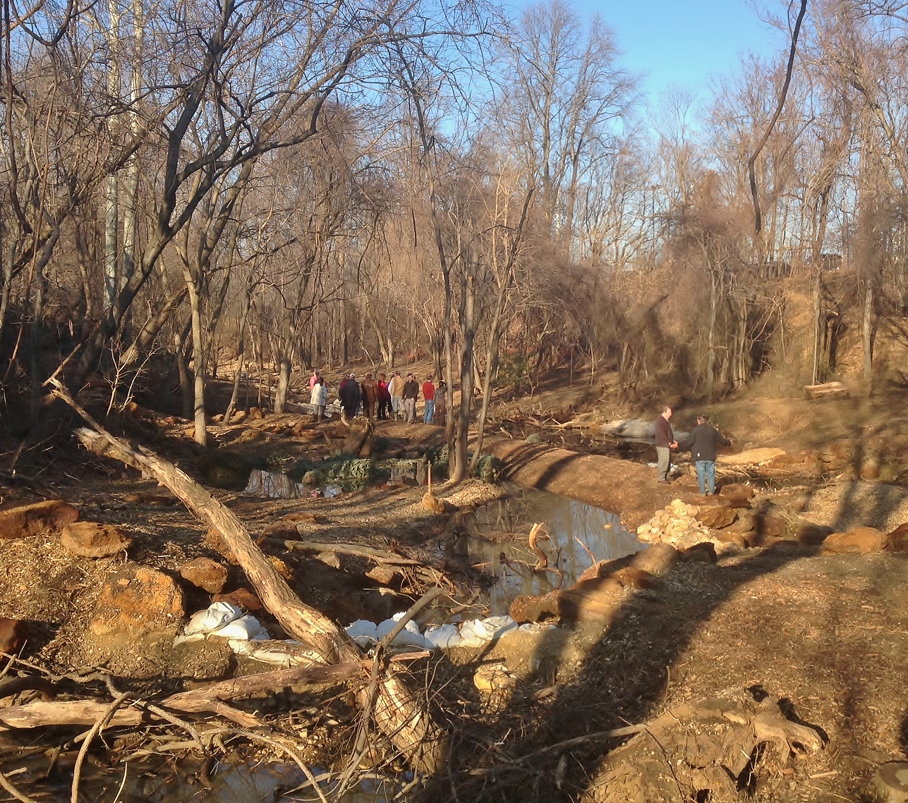
Workshop attendees visit a future fish passage site at Southards Pond in Babylon, NY.

Workshop attendees visit a future fish passage site at Southards Pond in Babylon, NY.

Follow-up surveys will be conducted to see if the workshop attendees used the knowledge that they gained from the workshop to identify fish passage projects in their communities and/or to see if they are in the process of designing, installing, and overseeing fishways on their local creeks and rivers.

About the Authors: 

Victoria O’Neill is the New York Habitat Restoration Coordinator for the Long Island Sound Study. She works for the New England Interstate Water Pollution Control Commission and is housed in the New York State Department of Environmental Conservation’s Bureau of Habitat Protection in East Setauket, NY. 

Amy Mandelbaum is the New York Outreach Coordinator for the Long Island Sound Study. She works for New York Sea Grant in Stony Brook, NY.  

Julie Nace is the New York State Coordinator for the Peconic Estuary Program. She specializes in the implementation of habitat restoration projects, non-point source water pollution control, and education and outreach. 

Mark Tedesco is director of the United States Environmental Protection Agency’s Long Island Sound Office. The office coordinates the Long Island Sound Study. Mr. Tedesco is responsible for supporting implementation of a Comprehensive Conservation and Management Plan for Long Island Sound in cooperation with federal, state, and local government, private organizations, and the public.

Editor's Note: The opinions expressed herein are those of the author alone. EPA does not verify the accuracy or science of the contents of the blog, nor does EPA endorse the opinions or positions expressed. You may share this post. However, please do not change the title or the content. If you do make changes, please do not attribute the edited title or content to EPA or the author.

EPA's official web site is www.epa.gov. Some links on this page may redirect users from the EPA website to a non-EPA, third-party site. In doing so, EPA is directing you only to the specific content referenced at the time of publication, not to any other content that may appear on the same webpage or elsewhere on the third-party site, or be added at a later date.

EPA is providing this link for informational purposes only. EPA cannot attest to the accuracy of non-EPA information provided by any third-party sites or any other linked site. EPA does not endorse any non-government websites, companies, internet applications or any policies or information expressed therein.

Diving into the Sandstorm

A blog post by Sean Sheldrake, an EPA scientific diver and frequent contributor to It All Starts with Science, was recently featured on the Smithsonian Institution’s Ocean Portal blog. We are reposting it again here for you to enjoy. 

By Sean Sheldrake

Ship with a large pipe off the side with a stream of sand coming out.

U.S. Army Corps of Engineers removing a sandbar off Virginia Beach, VA.
U.S. Army Corps of Engineers image

Diving can be a wild ride that evokes more than a little trepidation, especially in the Pacific Ocean’s famously big, cold waves. Waves that are otherwise fun for my weekend surfing can turn a scientific dive into a serious challenge. But then, diving to support the mission of the Environmental Protection Agency (EPA) can be full of surprises. At a seafloor survey site at the mouth of the Chetco River off the Oregon coast, waves transmit so much energy that divers can feel the swells nearly 80 feet down on the seafloor. As divers swim along the bottom, these swells often push them several feet forward, then “suck” them backward several feet.

Such natural water movements not only make diving difficult, but can also drastically alter the underwater terrain. Humans further these changes by digging up sand and sediment from the bottom of a river or ocean and depositing it elsewhere, a process known as dredging. Ports might dredge an area to clean up the seafloor, or make an area deep enough for large ships to navigate. Without it, sandbars would grow to such enormous heights that river entry would be worrisome to even the most experienced captains. Such large sandbars can wreck ships; one was nicknamed the “Graveyard of the Pacific” (PDF) in the early days of Columbia River navigation. And, on one beach I often surf, the wreck of the Peter Iredale remains as an eerie reminder to respect “the bar.”

EPA divers from Atlanta place this instrument in Charleston Harbor in order to monitor currents and better predict sand movement.

EPA divers placed this instrument to monitor currents and better predict sand movement. EPA image

But if you’re going to dig up a bunch of sand, you have to put it somewhere. EPA divers around the country evaluate dredge material disposal sites regularly, where ports deposit literally tons of sand into the ocean. How much? In 2013, more than eight million cubic yards of sediment will be removed from Oregon’s Columbia River alone. This, and many other dredging operations upriver, help move 42 million tons of cargo from Oregon, Washington, and Idaho farms to market each year with as few bumps as possible.

Placing dredged material from a river or harbor into the ocean is not necessarily a problem, as long as it’s a load that is small enough to not overwhelm the creatures that live there, like crabs or sea stars.  For example, if the load just adds several inches of sand to the area, crabs and sea stars can ‘hop’ up above that material. But if several feet were placed all at once, it’s likely that these critters would be buried. Sometimes, new sand can be beneficial to certain ecosystems, such as sandy beaches that have eroded. However, when sand is placed on rocky reefs or other sensitive environments, it can change the habitat. A rocky reef that gets buried in sand can no longer support its vital organisms, such as anemones and urchins.

That’s where the divers come in. EPA’s scientific divers visit and observe dredge deposit sites to make sure there is no damage to marine life on the seafloor—critters like worms, clams, crabs, and other tiny organisms that live in the bottom sediments—as ordered by the Marine Protection, Research, and Sanctuaries Act. To do this, we visit locations before and after dredged sand has been dumped to see if habitat has changed slightly, been dramatically transformed, or remained relatively unchanged since our last visit. For some areas, we might also use remote sensing techniques like sonar to quickly direct divers toward areas that need to be monitored more closely, like those sensitive rocky reefs. If we find the impacts to an area are too severe, the dredge disposal may be moved or future deposits will be stopped altogether in that location.

Because ports continually accumulate sediment—from human dredging, natural erosion and runoff—the cycle of dredging, dumping and observation happens on a regular basis, even twice a year for some sites. All to make sure that ecosystems stay healthy, ports can continue working, and that beachgoers and surfers like me can continue to enjoy them.

Read more about the latest EPA scientific diving.

About the AuthorSean Sheldrake is part of the Seattle EPA Dive unit, and a project manager working on the Portland Harbor cleanup in Oregon.  He serves on the EPA diving safety board, responsible for setting EPA diving policy requirements.   

Editor's Note: The opinions expressed herein are those of the author alone. EPA does not verify the accuracy or science of the contents of the blog, nor does EPA endorse the opinions or positions expressed. You may share this post. However, please do not change the title or the content. If you do make changes, please do not attribute the edited title or content to EPA or the author.

EPA's official web site is www.epa.gov. Some links on this page may redirect users from the EPA website to a non-EPA, third-party site. In doing so, EPA is directing you only to the specific content referenced at the time of publication, not to any other content that may appear on the same webpage or elsewhere on the third-party site, or be added at a later date.

EPA is providing this link for informational purposes only. EPA cannot attest to the accuracy of non-EPA information provided by any third-party sites or any other linked site. EPA does not endorse any non-government websites, companies, internet applications or any policies or information expressed therein.

The Potomac Watershed – From All Sides

By Ellen Schmitt and Susan Spielberger

More often than not, watersheds cross political boundaries.  Take the Potomac River for example.  It drains an area of 14,670 square miles in four states: Virginia, Maryland, West Virginia, Pennsylvania, and the District of Columbia.  As part of the larger Chesapeake Bay Watershed, the Potomac River delivers a significant amount of nitrogen, phosphorus, and sediment to the Chesapeake Bay.

Morning fog over the Potomac River. Photo courtesy of Flickr photographer jm6553 from EPA’s State of the Environment Photo Project

Morning fog over the Potomac River. Photo courtesy of Flickr photographer jm6553 from EPA’s State of the Environment Photo Project

Besides its contribution to downstream nutrient pollution, the Potomac basin itself faces a number of threats to its source water quality. One of these threats is a rapid growth in urban population which accounts for 81% of the basin’s 6.11 million residents, and is expected to grow by more than 1 million people over the next 20 years.

The environmental challenges presented by the Potomac River, as well as other mid-Atlantic waters often require the attention of different EPA programs.   Here’s what two of us do to protect “the Nation’s River” here in EPA, Region 3.

Ellen:

I work in the Drinking Water Branch and we’re working with the Potomac River Basin Drinking Water Source Protection Partnership to protect the river and its tributaries as sources of drinking water.  Protecting the source water in the first place is the best preventative step to providing safe drinking water.   Hand and glove with this are the other usual steps including treatment at water plants, a safe drinking water distribution system, and increasing the awareness of consumers of protecting drinking water sources. This approach makes sense because some substances can’t be removed at water treatment facilities and it’s often much less expensive to treat the water if contaminants are kept out in the first place.  Examples of source water protection activities are: keeping manure from farms out of streams to reduce the potential for pathogens entering the water; having a response plan in the event of a spill of hazardous materials; and working with transportation agencies to reduce the amount of salt spread on the region’s roads during the winter.

The Potomac Partnership is a unique collaboration, comprised of nearly 20 drinking water utilities and government agencies from Maryland, Virginia, West Virginia, Pennsylvania and DC focusing on source water protection activities addressing agriculture, urban run-off and emerging contaminants.

Susan:

I work in the Environmental Assessment and Innovation Division.  In 2010, Congress provided EPA with two million dollars in funding to restore and protect the Potomac Highlands (a part of Appalachia), and EPA selected American Rivers to administer this grant program.  My role in this program is serve as the technical contact for the projects that have been funded – eight of them –  ranging from $150,000 to $300,000, that focus on improving natural resources and socio-economic conditions.

Projects include stream bank restoration in Staunton and Waynesboro, Virginia; land conservation projects in West Virginia and Pennsylvania where parcels with high ecological value are being protected through conservation easements; reclaiming mine land in the Monongahela National Forest by planting  native spruce trees; and constructing a green house/ shade house project in Frostburg, Maryland, on reclaimed mine land.

In selecting projects that will protect and restore the Potomac (as well as other mid-Atlantic waters), we emphasize a strategic approach to conservation – also known as the Green Infrastructure approach.   We emphasize the connectivity of forest “hubs” of high ecological value and their ability to either expand those hubs or connect the hubs together.  This is a more effective way to protect and restore natural systems because it strives to keep important areas intact and to restore ones that are degraded.


For more information about the Potomac watershed, check out this State of the Nation’s River Report from the Potomac Conservancy (PDF).  What kinds of activities are happening in the watershed where you live?  How else could it be approached, from all sides?


About the Authors: Susan Spielberger and Ellen Schmitt both work out of EPA’s Mid-Atlantic office in Philadelphia, PA.  Susan works in the Environment and Innovation Division in the Office of Environmental Information and Assessment, and Ellen works in the Water Protection Division’s Drinking Water Branch.

Editor's Note: The opinions expressed herein are those of the author alone. EPA does not verify the accuracy or science of the contents of the blog, nor does EPA endorse the opinions or positions expressed. You may share this post. However, please do not change the title or the content. If you do make changes, please do not attribute the edited title or content to EPA or the author.

EPA's official web site is www.epa.gov. Some links on this page may redirect users from the EPA website to a non-EPA, third-party site. In doing so, EPA is directing you only to the specific content referenced at the time of publication, not to any other content that may appear on the same webpage or elsewhere on the third-party site, or be added at a later date.

EPA is providing this link for informational purposes only. EPA cannot attest to the accuracy of non-EPA information provided by any third-party sites or any other linked site. EPA does not endorse any non-government websites, companies, internet applications or any policies or information expressed therein.

Cabin Branch: Let the Healing Begin

By Nick DiPasquale

Most of us who live in an urban or suburban setting really don’t know what a healthy stream looks like.  In some cases we can’t even see streams that run under our roads and shopping centers because they’ve been forced into pipes; out of sight, out of mind.

Cabin Branch pre cleanup

In 2005 a major volunteer cleanup removed 40 tons of tires and debris from Cabin Branch. (photo courtesy of Severn Riverkeeper Program)

The remnants of streams we can see have been filled with sediment and other pollution and the ecology of the stream has been altered significantly.  The plants and animals that used to live there have long since departed, their habitat having been destroyed.  This didn’t happen overnight.  The environment is suffering “a death by a thousand cuts.”

I recently got the chance to visit the Cabin Branch stream restoration project, not far from my neighborhood in Annapolis.  The project is being undertaken by the Severn Riverkeeper, and is one of many stream restoration projects taking place throughout the Chesapeake Bay watershed.

Keith Underwood outlines the progress of the Cabin Branch Regenerative Stream Conveyance restoration project for members of the Chesapeake Bay Program and Maryland Department of Natural Resources .  The project was initiated by the Severn Riverkeeper Program. (photo by Tom Wenz, EPA CBPO)

Keith Underwood outlines the progress of the Cabin Branch Regenerative Stream Conveyance restoration project for members of the Chesapeake Bay Program and Maryland Department of Natural Resources . The project was initiated by the Severn Riverkeeper Program. (photo by Tom Wenz, EPA CBPO)

Cabin Branch discharges to the streams and wetlands of Saltworks Creek and the Severn River, which carries the polluted runoff into the Bay.  Aerial photos taken after a modest rain are dramatic testament to a severely damaged ecosystem causing the Severn to run the color of chocolate milk. This same phenomenon is repeated in streams and rivers that run through thousands of communities throughout the watershed.

Polluted runoff is a major source of nutrient and sediment pollution in the Severn River and throughout the Chesapeake Bay Watershed. Projects like the one at Cabin Branch restore the natural habitat , slows the sediment erosion and allows more nutrients to be absorbed into the soil and plants. (photo courtesy of Severn Riverkeeper Program)

Polluted runoff is a major source of nutrient and sediment pollution in the Severn River and throughout the Chesapeake Bay Watershed. Projects like the one at Cabin Branch restore the natural habitat , slows the sediment erosion and allows more nutrients to be absorbed into the soil and plants. (photo courtesy of Severn Riverkeeper Program)

It was gratifying to see the Cabin Branch project first hand – one of many efforts to heal the damage done unknowingly over many decades of development.  Like many projects of this nature, the Severn Riverkeeper Program had to overcome some bureaucratic red tape to get the permits they needed, but their perseverance will be worth the impact in helping clean local waters and the Bay.

The structural features of these projects are designed to safely handle a 100-year storm, while at the same time maximizing baseflow in normal conditions.  The next step will include planting native plants and monitoring the post-restoration flow of nutrients and sediment.  (photo by Tom Wenz, EPA CBPO)

The structural features of these projects are designed to safely handle a 100-year storm, while at the same time maximizing baseflow in normal conditions. The next step will include planting native plants and monitoring the post-restoration flow of nutrients and sediment. (photo by Tom Wenz, EPA CBPO)

Fortunately, we are learning better ways to manage stormwater runoff through low impact development and use of green infrastructure which help to mimic the cleansing functions of nature.   It will take some time before this patient is restored to good health, but we are on the mend.

About the Author: Nick DiPasquale is Director of the Chesapeake Bay Program. Nick has nearly 30 years of public policy and environmental management experience in both the public and private sectors.  He previously served as Deputy Secretary in the Pennsylvania Department of Environmental Protection, Director of the Environmental Management Center for the Brandywine Conservancy in Chadds Ford, Pennsylvania and as Secretary of the Delaware Department of Natural Resources and Environmental Control.

You can also see this post and much more Chesapeake Bay content on the Chesapeake Bay Program Blog.

Editor's Note: The opinions expressed herein are those of the author alone. EPA does not verify the accuracy or science of the contents of the blog, nor does EPA endorse the opinions or positions expressed. You may share this post. However, please do not change the title or the content. If you do make changes, please do not attribute the edited title or content to EPA or the author.

EPA's official web site is www.epa.gov. Some links on this page may redirect users from the EPA website to a non-EPA, third-party site. In doing so, EPA is directing you only to the specific content referenced at the time of publication, not to any other content that may appear on the same webpage or elsewhere on the third-party site, or be added at a later date.

EPA is providing this link for informational purposes only. EPA cannot attest to the accuracy of non-EPA information provided by any third-party sites or any other linked site. EPA does not endorse any non-government websites, companies, internet applications or any policies or information expressed therein.

How’s the Bay Doin’?

By Tom Damm

When the late New York City Mayor Ed Koch wanted to get a sense for, “How’m I doin’?” he’d ask people on the street.

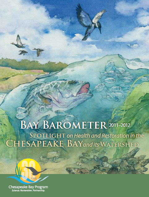
Bay Barometer Cover ImageThe Chesapeake Bay Program takes a more scientific approach when it considers the state of the Bay and its watershed.

It crunches all sorts of statistics and produces an annual update on health and restoration efforts called Bay Barometer.  The latest one is now available.

So how’s the ecosystem doin’?

The science-based snapshot shows that while the Bay is impaired, signs of resilience abound.

A number of indicators of watershed health, like water clarity and dissolved oxygen levels, point to a stressed ecosystem.  But other factors, such as a smaller than normal summertime dead zone and an increase in juvenile crabs entering the fishery, provide a brighter picture.

Recent restoration work and pollution cuts also offer signs of progress for the nation’s largest estuary.

Learn more about Bay Barometer or read the full report.

About the Author: Tom Damm has been with EPA since 2002 and now serves as communications coordinator for the region’s Water Protection Division.

Editor's Note: The opinions expressed herein are those of the author alone. EPA does not verify the accuracy or science of the contents of the blog, nor does EPA endorse the opinions or positions expressed. You may share this post. However, please do not change the title or the content. If you do make changes, please do not attribute the edited title or content to EPA or the author.

EPA's official web site is www.epa.gov. Some links on this page may redirect users from the EPA website to a non-EPA, third-party site. In doing so, EPA is directing you only to the specific content referenced at the time of publication, not to any other content that may appear on the same webpage or elsewhere on the third-party site, or be added at a later date.

EPA is providing this link for informational purposes only. EPA cannot attest to the accuracy of non-EPA information provided by any third-party sites or any other linked site. EPA does not endorse any non-government websites, companies, internet applications or any policies or information expressed therein.

Embarking into the Christina River Basin

By Andrea Bennett

Flowing through rolling hills, forests and farms, small and big towns, the Brandywine, White Clay and Red Clay Creeks, and the Christina River constitute the watershed of the Christina River Basin, which then empties into the Delaware River. This beautiful watershed is historically significant as a site where Revolutionary battles were fought, as well as the area where one of America’s most famous painters, Andrew Wyeth, flourished.  This watershed also provides over 100 million gallons of drinking water per day for over 500,000 people in Delaware, Pennsylvania and Maryland.

Barclay Hoopes Dairy Farm Before and After Restoration

Barclay Hoopes Dairy Farm Before and After Restoration

Many nonprofit and governmental organizations are implementing projects and programs to protect the watershed and its sources of drinking water.  Several years ago, these groups received an EPA Targeted Watershed Grant of $1 million to support the health of the watershed by restoring streams and installing agricultural and stormwater Best Management Practices (BMPs) to reduce runoff flowing into streams and groundwater.

I had the opportunity to see some of these BMPs in action recently on the annual Christina River Basin Bus Tour, sponsored by the Chester County Conservation District (CCCD), the Brandywine Valley Association, the Water  Resources Agency at the University of Delaware, and the Delaware Department of Natural Resources and Environmental Control. As we traveled through the watershed, Bob Struble, executive director of the Brandywine Valley Association, pointed out stream restoration and watershed protection projects.

At the Barclay Hoopes dairy farm, Mr. Hoopes showed us 1,500 feet of stream bank fencing installed to reduce manure loading to White Clay Creek. United Water Delaware and the City of Newark worked with the CCCD to install these fences to help prevent Cryptosporidium (a protozoan that can cause gastrointestinal illness) from entering the water.

We also stopped at the Stroud Water Research Center where we saw a brand new LEED-certified education building – the Moorhead Environmental Complex. The Center manages stormwater run-off through natural landscaping with porous surfaces, a green roof, and rain gardens with native vegetation.  The new building has a plethora of energy efficient technologies, including radiant heating, natural ventilation, solar power, and high efficiency windows.  Wherever possible, the center uses materials that were found locally, sustainably harvested, reclaimed, or recycled, and have low emissions of pollutants.

Kennett Square Golf Course Before and After Restoration

Kennett Square Golf Course Before and After Restoration

We visited the Kennett Square Golf Course and Country Club where Paul Stead,  the Superintendent, gave us a tour of the stream bank and flood plain restoration of the section of Red Clay Creek, which flows through the golf course. Because Mr. Stead educated the club membership about the importance of protecting the watershed, this project was funded not only by a Pennsylvania Department of Environmental Protection Growing Greener Grant, but also by members of the golf club itself. The result is improved flood control, less impact to Red Clay Creek during storm events, and a more scenic golf course.

These are just some of the projects going on right now in the beautiful Christina River Basin.  Not only do they help to protect sources of drinking water, they also ensure that the basin remains a wonderful place to visit. The basin is one of my favorite places to go kayaking, hiking, and birding, and it’s easy to see how the White Clay Creek was designated as a National Wild and Scenic River in 2000.

As I left Myrick Conservation Center that day, it was fitting that I saw a Bald Eagle, a national symbol of America’s environmental treasures.  It’s one more reason to protect the waters of the Christina River Basin, so that eagles, as well as humans, have a clean and safe water resource today and in the future.

About the Author: Andrea Bennett has been with EPA for over twenty years as an Environmental Scientist in the region’s Water Protection Division.  Prior to joining EPA, she conducted ornithological research and produced films. When outside of the office Andrea enjoys birding and playing the mandolin.

Editor's Note: The opinions expressed herein are those of the author alone. EPA does not verify the accuracy or science of the contents of the blog, nor does EPA endorse the opinions or positions expressed. You may share this post. However, please do not change the title or the content. If you do make changes, please do not attribute the edited title or content to EPA or the author.

EPA's official web site is www.epa.gov. Some links on this page may redirect users from the EPA website to a non-EPA, third-party site. In doing so, EPA is directing you only to the specific content referenced at the time of publication, not to any other content that may appear on the same webpage or elsewhere on the third-party site, or be added at a later date.

EPA is providing this link for informational purposes only. EPA cannot attest to the accuracy of non-EPA information provided by any third-party sites or any other linked site. EPA does not endorse any non-government websites, companies, internet applications or any policies or information expressed therein.

Reviving Urban Waters

By Tom Damm

On the grounds of Friends Hospital in northeast Philadelphia a few weeks ago, we got a first-hand look at how funds from EPA’s Urban Waters Program will make a big difference.  This was the first year for the Urban Waters small grant program, and there was keen interest in the $2.7 million that was made available across the country.

Members of the Pennsylvania Horticultural Society took us down a winding path to an area where work will occur to clear overgrown brush, prevent existing flooding and improve the flow of a tributary to Tacony Creek.  It’s one of 10 projects that will be done in coordination with a local environmental group to help restore a watershed on the city’s outskirts.

Drew Becher (President, Pennsylvania Horticultural Society), Julie Slavet (Executive Director, Tookany/Tacony-Frankford Watershed Partnership, Inc.), Barbara McCabe (Director of Stewardship, Philadelphia Parks & Recreation, and William C. Early (Deputy Regional Administrator, U.S. Environmental Protection Agency, Region III) with the Urban Waters small grant “big check” at Friends Hospital in Northeast Philadelphia.

Drew Becher (President, Pennsylvania Horticultural Society), Julie Slavet (Executive Director, Tookany/Tacony-Frankford Watershed Partnership, Inc.), Barbara McCabe (Director of Stewardship, Philadelphia Parks & Recreation, and William C. Early (Deputy Regional Administrator, U.S. Environmental Protection Agency, Region III) with the Urban Waters small grant “big check” at Friends Hospital in Northeast Philadelphia.

Five days later in Morgantown, West Virginia, there was a similar scene as members of Friends of Deckers Creek described to our Regional Administrator, Shawn M. Garvin, how urban waters funds will be used to prepare for the cleanup of polluted water from an abandoned mine.

And last Friday, we toured the Bellemeade neighborhood in Richmond, Virginia, where urban waters funds will help transform a neglected creek into the spark for a community revival.

Other projects in Baltimore and Philadelphia in our region, as well as many others across the country, are underway to help communities unlock the potential of their waterways and the land around them.  That’s what the Urban Waters program is all about.

Many urban waterways have been left a legacy of pollution by sewage, runoff from city streets and contamination from now abandoned industrial facilities.  Healthy and accessible urban waters can help grow local businesses and enhance educational, economic, recreational, employment and social opportunities in nearby communities.

To read about other urban waters projects and perhaps be inspired to take your own actions, visit http://www.epa.gov/urbanwaters/index.html.

About the Author: Tom Damm has been with EPA since 2002 and now serves as communications coordinator for the region’s Water Protection Division.  Prior to joining EPA, he held state government public affairs positions in New Jersey and worked as a daily newspaper reporter.  When not in the office, Tom enjoys cycling and volunteer work.  Tom and his family live in Hamilton Township, N.J., near Trenton.

Editor's Note: The opinions expressed herein are those of the author alone. EPA does not verify the accuracy or science of the contents of the blog, nor does EPA endorse the opinions or positions expressed. You may share this post. However, please do not change the title or the content. If you do make changes, please do not attribute the edited title or content to EPA or the author.

EPA's official web site is www.epa.gov. Some links on this page may redirect users from the EPA website to a non-EPA, third-party site. In doing so, EPA is directing you only to the specific content referenced at the time of publication, not to any other content that may appear on the same webpage or elsewhere on the third-party site, or be added at a later date.

EPA is providing this link for informational purposes only. EPA cannot attest to the accuracy of non-EPA information provided by any third-party sites or any other linked site. EPA does not endorse any non-government websites, companies, internet applications or any policies or information expressed therein.

The Power of Spatial Analysis – Wetland Prioritization

By Walt Foster

My introduction to computers was in 1968, when I was at the Navy’s Numerical Weather Center in Monterey, CA. We forecast weather for the world with 5 computers – 2 of 16KB, 2 of 32 KB and one of 65 KB – which filled an entire building. From then through the early Apple years until now, I’ve always been more interested in what a computer can do, rather than exactly how it does it. When I had the opportunity to found the Region 7 GIS group 25 years ago I jumped at the chance. In those early years, we were enamored of making pretty maps to depict conditions around the region. But, as time went on, I became more aware of, and interested in, the analytical capabilities of the technology.

One of the greatest benefits of GIS technology lies in its use in analyzing and visualizing the distribution of environmental processes that are multidimensional in space and time.  Activities of humans have had a profound effect on the environment, particularly our wetlands which have been cut in half.  The Clean Water Act requires that EPA work to maintain and restore wetlands and their attendant biodiversity and ecosystem services, a serious challenge given the scope and our resources.

EPA Region 7, along with the University of Missouri and EPA’s Office of Research and Development, developed and applied a method for prioritizing watersheds potentially critical for supporting wetland species biodiversity.  This project is called a Synoptic Wetland Assessment.

This synoptic (long-view) approach attaches variables linked with wetland function to 8-digit hydrologic units (HUCs) and then uses those variables in different combinations to rank the HUCs.  The goal was to identify 8-digit HUCs within the four-state region in which actions (restoration and protection) would likely have the most benefits for the conservation of wetland biodiversity.  Five indicators of habitat quality (agricultural density, wetland density, wetland habitat diversity, mean distance between wetland patches, and mean wetland patch size) and two indicators of species sensitivity (Natural Heritage species global rarity score and a modifier to the global rarity score including endemism) were combined in different ways to derive three indices.

Above is a map of the 241 sub-basins throughout our region, with HUCs ranked by priority from high to low according to the aforementioned indicators.  The highest priority sub-basins (those that were ranked highest in terms of restoration and protection potential) occur in clusters throughout the region, with the highest rankings occurring in the Ozark Highlands of Missouri, the Osage Plains in eastern Kansas, the Nebraska Sand Hills, and the Minnesota & Northeast Iowa Morainal, Oak Savannah.

All wetlands within our region are important to protect and restore, but the scope of this challenge is immense.  This project provides a model for helping to prioritize this challenge on a regional scale, and the tools for other scientists to apply the synoptic model at smaller scales (state or watershed scale) to effectively utilize resources.  Restoring our lost and degraded wetlands to their natural state is important to ensure the health of America’s watersheds. If you want to read more about the science of the synoptic wetland assessment model you can check it out here.  You can find out more about EPA’s role in protecting wetlands here.

Walt Foster has been with the GIS program in EPA Region 7 since its inception except for an hiatus during which he served as the NEPA section chief and worked with EPA’s Office of International Affairs on environmental projects in eastern Europe.  More recently he worked on a series of projects with a number of cooperating agencies and NGOs designed to characterize the ecological state of Region 7 and identify priority ecological resources for regional programs to use in their planning and response activities.

Editor's Note: The opinions expressed herein are those of the author alone. EPA does not verify the accuracy or science of the contents of the blog, nor does EPA endorse the opinions or positions expressed. You may share this post. However, please do not change the title or the content. If you do make changes, please do not attribute the edited title or content to EPA or the author.

EPA's official web site is www.epa.gov. Some links on this page may redirect users from the EPA website to a non-EPA, third-party site. In doing so, EPA is directing you only to the specific content referenced at the time of publication, not to any other content that may appear on the same webpage or elsewhere on the third-party site, or be added at a later date.

EPA is providing this link for informational purposes only. EPA cannot attest to the accuracy of non-EPA information provided by any third-party sites or any other linked site. EPA does not endorse any non-government websites, companies, internet applications or any policies or information expressed therein.