Site Page / Remote Sensing and Surveillance

Remote Sensing and Surveillance

Remote sensing is data acquisition of objects or events without making physical contact with the object. Remote sensors can be either passive or active. Passive sensors (receive only, e.g. radiometer) respond to external stimuli and they record natural energy that is reflected or emitted from the Earth's surface. The most common source of radiation detected by aerial passive sensors is reflected sunlight. In contrast, active sensors (transmit/receive, e.g. radar) use internal stimuli to collect data about their target. Underwater remote sensing instruments and technologies are being developed based upon acoustics, fluorescence polarization , in-situ fluorometry, non-dispersive infrared, and in-situ mass spectrometry for deployment with Remotely Operated Vehicles (ROVs)/Autonomous Underwater Vehicles (AUVs) applications.

Remote sensing from an aircraft (including unmanned aerial vehicles [UAVs]) is the most common form of oil spill tracking. Remote sensing from satellites using radar sensors is becoming a viable alternative. The use of visual satellite imagery for monitoring oil spills shows promise. For underwater remote sensing, most oil spills can be accessed using ROVs and/or AUVs, however existing sensor packages need refinement to meet the needs of this environment. Currently a combination of sensors is used for oil spill surveillance, presenting challenges in data fusion and delays in getting the appropriate data to the response community. It is necessary to develop/advance new sensors and real-time data transmission technologies.

Objectives of the Remote Sensing portfolio include identifying & filling gaps in understanding of various remote sensing technologies and their applications in both aerial and underwater sensing platforms, developing a method and procedure for faster/real-time data transmission and processing, and measuring oil layer thickness by various remote sensing technologies including but not limited to satellite and Near Infrared (NIR)/IR.

Image Image
Figure 1. Visible imagery (left) and imagery from the FLIR Systems T650sc Long-wavelength infrared (LWIR) camera (right)
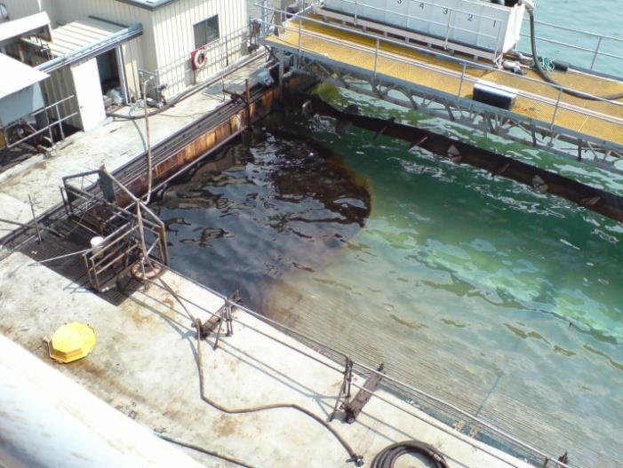
Image Image
Figure 2. Simultaneous visible and LWIR images of oil on water at Ohmsett

Project No. Subject Performing Activity (Researcher)
1079 Deepwater Horizon Lessons Learned - Methodology and Operational Tools to Assess Future Oil Spills NOAA
1065 Development of acoustic methods to measure oil droplet size and slick thickness on ROV and AUV platforms Applied Research Associates (ARA), Inc.
1060 Assessment of USCG Aviation Force's Capability for Airborne Oil Spill Remote Sensing and Reporting United States Coast Guard (USCG) Research and Development Center (RDC)
1058 Remote Sensing Systems to Detect an Analyze Oil Spills on the US Outer Continental Shelf - A State of the Art Assessment Naval Research Laboratory (NRL)
1051 Tagging of Oil Under Ice for Future Recovery URS Group, Inc.
1041 HC-Sentinel: An AUV Glider for High Endurance Subsea Hydrocarbon Detection Woods Hole Oceanographic Institution
1040 Distributed Chemical Sensing for Sub-surface Oil Spill Sensing University of Houston
1039 Oil Leak Detections with a Combined Fluorescence Polarization Instrument and a Wide Band MultiBeam Sonar EIC Laboratories, Inc. and Norbit US, Ltd.
1037 Development of an Autonomous Oil Skimmer (AOS) Alion Science and Technology Corporation
1031 Innovative Technology Enhancements for Measuring Test Parameters at Ohmsett MAR, Inc
1028 Acoustic Tool to Measure Oil Slick Thickness at Ohmsett Applied Research Associates Inc.
1021 Evaluation of Oil in the Water Column Detection Systems US Coast Guard Research & Development Center
1013 Enhanced Oil Spill Detection Sensors in Low-light Environments US Army Research Development and Engineering Command (RDECOM)
1009 Evaluation of Oil Fluorescence Characteristics to Improve Forensic Response Tools U.S. Environmental Protection Agency (EPA) and Center for Offshore Oil, Gas and Energy Research Fisheries and Oceans Canada (COOGER, DFO)
1008 CORN (Coordinated Oil-spill Response Network) Technology Systems, Inc.
1002 Acoustic Assessment of Subsea Chemical Dispersant Efficacy Applied Research Associates, Inc.
1000 Oil Spill Detection and Mapping Under Arctic Sea Ice using Autonomous Underwater Vehicles  Woods Hole Oceanographic Institution
659 Detecting Oil On and Under Sea Ice Using Ground Penetrating Radar: Development of a New Airborne System DF Dickins Associates, LLC and Boise State University, AllosSys Corporation
658 Open Water Multispectral Aerial Sensor Oil Spill Thickness Mapping In Arctic and High Sediment Load Conditions Ocean Imaging Corporation
594 Development of a Portable Multispectral Aerial Sensor for Real-time Oil Spill Thickness Mapping in Coastal and Offshore Waters Ocean Imaging Corporation
588 Detection of Oil on and Under Ice - Phase 3 DF Dickins and Associates and Boise State University
569 Svalbard, Norway Experimental Oil Spill To Study Spill Detection and Oil Behavior in Ice DF Dickens and Associates, SINTEF, Boise State University, The University Center at Svalbard
547 Developing New and Innovative Equipment and Technologies for the Remote Sensing and Surveillance of Oil in and Under Ice - Phase 2 D.F. Dickins and Associates, Ltd.
544 Real-time Detection of Oil Slick Thickness Patterns with a Portable Multispectral Sensor Ocean Imaging Corporation
517 New and Innovative Equipment and Technologies for the Remote Sensing and Surveillance of Oil in and Under Ice DF Dickins Associates, Ltd.
355 Using Satellite Radar Imagery to Detect Leaking Abandoned Wells on the U.S. OCS Advanced Resources International
348 Detection and Tracking of Oil Under Ice DF Dickins Associates Ltd.
311 Oil Spill Containment, Remote Sensing, and Tracking from Deep Water Blowouts Status of Existing and Emerging Technologies PCCI Marine and Environmental Engineering
240 Development of a Frequency Scanning Radiometer to Measure Oil Slick Thickness, Phase II USAF / MIT, Lincoln Laboratory
161 Development of a New Generation Laser Fluorosensor Emergencies Science Division, Environment Canada
157 Development of an Airborne Oil Spill Thickness Sensor Emergencies Science Division, Environment Canada
154 Development of Improved Oil Spill Remote Sensing Techniques Emergencies Science Division, Environment Canada
136 Shipboard Navigational Radar as an Oil Spill Tracking Tool Technology Assessment and Research Branch, Minerals Management Service