
- 12201 Sunrise Valley Drive
- Reston, VA 20192, USA
- 703-648-5953
- 1-888-ASK-USGS
- Employee Directory
- Web Chat
Understanding a changing world and how it affects our natural resources, livelihoods, and communities. Science plays an essential role in helping communities and resource managers understand the local to global implications of change, anticipate the effects of change, prepare for change, and reduce the risks associated with decisionmaking in a changing environment.

Scientists are working to assess both the potential capacities and the potential limitations of the various forms of carbon sequestration and to evaluate their geologic, hydrologic, and ecological consequences.
Learn More
This Image Gallery allows users to see how the surface of the Earth is changing rapidly, at local, regional, national, even global scales, with significant repercussions for people, the economy, and the environment.
Visit GalleryClimate and Land Use Change supports the science community with its long-term observational networks and extensive databases encompassing the fields of climate history, land-use and land-cover change, and carbon and nutrient cycles.
U.S. Climate Resilience Toolkit

Richard Batiuk got to know the Chesapeake Bay in the early 1970s. During visits with his friends and family, they would swim and boat, and fish would practically jump aboard. He was young but knew he wanted to live and work on the bay.

Water users around the country can now view the past and simulated future of hydrologic processes.

The Australian Marree Man is reborn!
Wildfire risk in temperate forests has become a nearly intractable problem that can be characterized as a socioecological “pathology”: that is, a set of complex and problematic interactions among social and ecological systems across multiple spatial and temporal scales. Assessments of wildfire risk could benefit from recognizing and accounting for...

The landscape of the conterminous United States has changed dramatically over the last 200 years, with agricultural land use, urban expansion, forestry, and other anthropogenic activities altering land cover across vast swaths of the country. While land use and land cover (LULC) models have been developed to model potential future LULC change, few...

Current and future breeding ranges of 15 bird and 16 reptile species were modeled in the Southwestern United States. Rather than taking a broad-scale, vulnerability-assessment approach, we created a species distribution model (SDM) for each focal species incorporating climatic, landscape, and plant variables. Baseline climate (1940–2009) was...
Climate and Land Use science is essential to improve understanding of past and present change; develop relevant forecasts; and identify those lands, resources, and communities most vulnerable to Earth system change processes.
Our Science Strategy
Research on Federal trust lands, especially in the mountains of western national parks and forests, addresses long-term ecosystem dynamics associated with climate change and atmospheric deposition of pollutants such as nitrogen. Studies include ecosystem biogeochemistry, nitrogen deposition, forest dieback, and assessment of forest biomes ranging from the Arctic to the desert...

High-severity crown fires in Southwestern dry-conifer forests — resulting from fire suppression, fuel buildups, and drought — are creating large treeless areas that are historically unprecedented in size. These recent stand-replacing fires have reset extensive portions of Southwest forest landscapes, fostering post-fire successional vegetation that can...

Tropical storms and hurricanes wreak havoc with coastal forests where damage can vary with wind speed and approach from isolated treefalls to wide-area blowdowns of whole forests.
 basin")
Critical information predicting condition changes in manatee habitat resulting from the alteration of freshwater flows to estuaries is needed to develop the PSRP Detailed Design and PSRP Operations Plan components and complete consultation under the Endangered Species Act.

The National Park Service (NPS) manages the Nation’s most iconic destinations that attract millions of visitors from across the Nation and around the world. Trip-related spending by NPS visitors generates and supports a considerable amount of economic activity within park gateway communities. USGS economists collaborate with the National Park Service social science program to estimate...

Playas in the Great Plains Landscape Conservation Cooperative (GPLCC) are at risk for both increased sedimentation and reduced inundation due to predicted increased summer temperatures, decreased annual precipitation, and agricultural intensification. Among other benefits, playas provide essential habitat for many wetland-dependent species and are especially important as critical refueling...

Significant damage to coastal communities and surrounding wetlands of the north Atlantic states was caused by Hurricane Sandy in late October 2012, mostly tied to an associated storm surge of record extent and impact.

Information Science staff help the National Office of the National Climate Change and Wildlife Science Centers and individual Climate Science Centers with a variety of project and data management activities, including storing, managing, and distributing datasets; building and maintaining metadata; discovering datasets; and delivering their data and metadata as web services through various...

Long-term monitoring data in the Manatee Individual Photo-identification System (MIPS), developed and coordinated by WARC-Sirenia Project in collaboration with Florida’s Fish and Wildlife Research Institute and Mote Marine Laboratory, are the basis for modeling manatee demography rates....

USGS is committed to meeting the science needs of four Native American Tribes impacted by Hurricane Sandy in New England and New York: the Wampanoag Tribe of Gay Head - Aquinnah on Martha’s Vineyard, MA; the Mashpee Wampanoag Tribe on Cape Cod, MA; the Narragansett Indian Tribe near Charlestown, RI; and the Shinnecock Indian Nation on Long Island....

This project will create a Climate Change Adaptation Plan for the Chitimacha Tribe of Louisiana (Chitimacha), serving as an implementable plan for coastal community adaptation to climate change that can be used as a model in other small communities.

The interior marshes of the Ten Thousand Islands National Wildlife Refuge (TTINWR) are currently negatively impacted by sea level rise through saltwater intrusion from the south which furthers mangrove encroachment into the freshwater marsh.

USGS scientists have been involved for a number of years in the development and use of Structural Equation Modeling (SEM). This methodology represents an approach to statistical modeling that focuses on the study of complex cause-effect hypotheses about the mechanisms operating in systems.

Two recent investigations of climate-change vulnerability for 19 terrestrial, aquatic, riparian, and coastal ecosystems of the southeastern United States have identified a number of important considerations, including potential for changes in hydrology, disturbance regimes, and interspecies interactions.
Cartwright, Jennifer M.; Costanza, Jennifer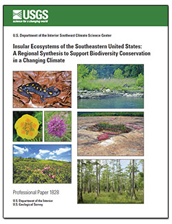
In the southeastern United States, insular ecosystems—such as rock outcrops, depression wetlands, high-elevation balds, flood-scoured riparian corridors, and insular prairies and barrens—occupy a small fraction of land area but constitute an important source of regional and global biodiversity, including concentrations of rare and endemic plant...
Cartwright, Jennifer M.; Wolfe, William J.
Climate change impacts ecosystems in many ways, from effects on species to phenology to wildfire dynamics. Assessing the potential vulnerability of ecosystems to future changes in climate is an important first step in prioritizing and planning for conservation. Although assessments of climate change vulnerability commonly are done for species,...
Costanza, Jennifer; Beck, Scott; Pyne, Milo; Terando, Adam; Rubino, Matthew; White, Rickie; Collazo, JaimeCurrent and future breeding ranges of 15 bird and 16 reptile species were modeled in the Southwestern United States. Rather than taking a broad-scale, vulnerability-assessment approach, we created a species distribution model (SDM) for each focal species incorporating climatic, landscape, and plant variables. Baseline climate (1940–2009) was...
Hatten, James R.; Giermakowski, J. Tomasz; Holmes, Jennifer A.; Nowak, Erika M.; Johnson, Matthew J.; Ironside, Kirsten E.; Van Riper, Charles; Peters, Michael; Truettner, Charles; Cole, Kenneth L.Changes in tree growth rates can affect tree mortality and forest feedbacks to the global carbon cycle. As air temperature increases, evaporative demand also increases, increasing effective drought in forest ecosystems. Using a spatially comprehensive network of Douglas-fir (Pseudotsuga menziesii) chronologies from 122 locations that experience...
Restaino, Christina M; Peterson, David L.; Littell, JeremyWildfire risk in temperate forests has become a nearly intractable problem that can be characterized as a socioecological “pathology”: that is, a set of complex and problematic interactions among social and ecological systems across multiple spatial and temporal scales. Assessments of wildfire risk could benefit from recognizing and accounting for...
Fischer, A. Paige; Spies, Thomas A; Steelman, Toddi A; Moseley, Cassandra; Johnson, Bart R; Bailey, John D.; Ager, Alan A; Bourgeron, Patrick S.; Charnley, Susan; Collins, Brandon M.; Kline, Jeffrey D; Leahy, Jessica E; Littell, Jeremy; Millington, James D A; Nielsen-Pincus, Max; Olsen, Christine S; Paveglio, Travis B; Roos, Christopher I.; Steen-Adams, Michelle M; Stevens, Forrest R; Vukomanovic, Jelena; White, Eric M; Bowman, David M J SThis study is an investigation into the roles of wildfire and changing agricultural practices in controlling the inter-decadal scale trends of suspended sediment production from semi-arid mountainous rivers. In the test case, a decreasing trend in suspended sediment concentrations was found in the lower Salinas River, California between 1967 and...
A.B. Gray, G.B. Pasternack, E.B. Watson, M.A. Goñi, J.A. Hatten, J.A. Warrick
This assessment was conducted to fulfill the requirements of section 712 of the Energy Independence and Security Act of 2007 and to contribute to knowledge of the storage, fluxes, and balance of carbon and methane gas in ecosystems of Alaska. The carbon and methane variables were examined for major terrestrial ecosystems (uplands and wetlands) and...
The historical and pre-settlement relationships between drought and wildfire are well documented in North America, with forest fire occurrence and area clearly increasing in response to drought. There is also evidence that drought interacts with other controls (forest productivity, topography, fire weather, management activities) to affect fire...
Littell, Jeremy; Peterson, David L.; Riley, Karin L.; Yongquiang LiuLuce, Charles H.We present ∼1300 new isotopic measurements (δ 18 O and δ 2 H) from a network of snowpack sites in the Rocky Mountains that have been sampled since 1993. The network includes 177 locations where depth-integrated snow samples are collected each spring near peak accumulation. At 57 of these locations snowpack samples were obtained for 10–21 years and...
Anderson, L., Berkelhammer, M.,and Mast, M.A.
Landsat missions have always been an important component of U.S. foreign policy, as well as science and technology policy. The program’s longstanding network of International Cooperators (ICs), which operate numerous International Ground Stations (IGS) around the world, embodies the United States’ policy of peaceful use of outer space and the...

Changing winter climate extremes are expected to result in the poleward migration of mangrove forests at the expense of salt marshes. Although mangroves and marshes are both highly valued ecosystems, the ecological implications of mangrove expansion have not been fully investigated...


Richard Batiuk got to know the Chesapeake Bay in the early 1970s. During visits with his friends and family, they would swim and boat, and fish would practically jump aboard. He was young but knew he wanted to live and work on the bay.
Water users around the country can now view the past and simulated future of hydrologic processes.
The Australian Marree Man is reborn!

Last month, the Sahara saw a rarity: snow!

In our last EarthView of 2016, you can see the port of Rotterdam grow by 5,000 acres!

Celebrate Indiana's Bicentennial with a Landsat Mosaic Image!

Monitoring drought vital to success of humanitarian relief

In this Landsat EarthView, one glacier in Chile bucks the global trend:

This EarthView from Landsat shows deforestation in Colombia between 1989 and 2016.

This EarthView shows how fossil water is used for agriculture in Saudi Arabia.

The Interior Department’s Climate Science Centers, managed by USGS, are helping the NPS pinpoint the specific impacts of climate change on parks and their cultural and natural resources. Doing so will help managers answer a critical question: which resources will require human intervention to ensure their continued existence?

The Interior Department’s Climate Science Centers, managed by USGS, are helping the National Park Service pinpoint the specific impacts of climate change on parks and their cultural and natural resources. Doing so will help managers answer a critical question: which resources will require human intervention to ensure their continued existence?


Phone: 352-378-8181
Fax: 352-378-4956

Phone: 337-266-8500
Fax: 337-266-8513
Phone: 443-498-5552
Fax: 443-498-5510