Louisiana Water Science Center (LAWSC)
DATA CENTER
INFORMATION CENTER
ABOUT THE LOUISIANA WSC USGS IN YOUR STATE USGS Water Science Centers are located in each state. 
|
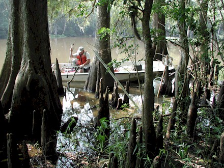
Water Resources of Louisiana“ . . . come in and see what we have for you!” Welcome to the United States Geological Survey web site for water resources in Louisiana. At this site, we present all sorts of useful information regarding one of Louisiana's greatest resources—water. Here you will find both real-time and historical data on many of the rivers, streams, and bayous in the state, as well as groundwater, water-quality, and water-use data. There are project descriptions and reports available that cover a wide variety of water-related topics, ranging from broad-based regional studies to tightly focused, in-depth investigations of specific regions in Louisiana. Many Federal, State, and local agencies as well as individual citizens rely on the data we gather and present here when making decisions regarding everything from ensuring public safety to scheduling recreational activities. So come in and see what we have for you!
Water Use—What Do We Do With All That Water?Water plays a critical role in practically every aspect of our lives. We all know we must have water to survive, but water is also necessary to support farming, industy, power generation, aquaculture, recreation, and much more. In Louisiana, we are blessed with a vast abundance of water. So how is all that water used? Check out our completely new and remodeled Water Use web pages and find out! River Cams—Keeping an Eye on the Amite River BasinFor people who live in the Amite river basin, watching the water levels rise and fall is a way of life. "Watching the river" has traditionally meant keeping up with tables of numbers and graphs available on the internet, television, radio, and newspapers, and knowing what those numbers and graphs represent. Now, in addition to watching the numbers, everyone can literally watch the river at selected locations in real time. WaterAlert—Water Conditions Delivered to YouDo you wish you could keep track of water conditions without having to constantly check our real-time web pages to see if something interesting is happening? Your wish is granted. Hurricane Season—LAWSC has the Louisiana Coast Covered
June 1 marks the beginning of hurricane season. Should storms arrive on the Louisiana coast, the people in coastal communities across the State, along with many Federal, State, and local agencies will need to know how the storms are affecting the coastal and low-lying areas. The USGS maintains an extensive network of coastal gages that provides critical time-sensitive water level and other water and meteorological data in near-real-time. The USGS Louisiana Water Science Center (LAWSC) has created a web page that highlights this coastal network so that it is easy to find and examine the data collected at these locations. The image with this article is the current satellite image of the Gulf of Mexico as seen in the visible spectrum. Clicking the image will take you to the full-sized version. These images come from the NOAA Gulf of Mexico Imagery web page where you can find related imagery, including infrared images and image loops. Hardened Gages—Built to SurviveAlthough the USGS operates and maintains an extensive network of coastal sites, most of these gages are not built to withstand the full fury of a major storm. Here are the ones that are. Mississippi-Atchafalaya Flood 2011
The Aftermath The historic Mississippi River flood may be over, but there is much we can learn from the event. The LAWSC collected a lot of data from sites on the Mississippi River and in the Atchafalaya Basin that should provide us with a better understanding of how major flood events on the Mississippi River and opening the Morganza Floodway and the Bonnet Carré Spillway affect the Atchafalaya Basin, Lake Pontchartrain, and the areas along the lower reaches of the Mississippi River. Some of the web pages for this event will be kept in place to make this information easy to find and use. USGS Responds to Deepwater Horizon Oil SpillThe USGS is one of several Federal agencies that has been mobilized to help with the Deepwater Horizon Oil Spill. We have been charged with the task of gathering scientific data and information on the environmental impacts of the oil spill to affected coastal habitats. Find out more about how we are carrying out this task, and what other Department of the Interior agencies are doing. The Joint Information Center (JIC) is the official site of the Deepwater Horizon Unified Command. Keep up with events surrounding the oil spill through the JIC. Oil Spill Links
USGS Water News in Louisiana
Additional Information and SourcesSources
Information
Streamflow Conditions in Louisiana
|

![]() U.S. Department of the Interior |
U.S. Geological Survey
U.S. Department of the Interior |
U.S. Geological Survey
URL: http://la.water.usgs.gov/
Page Contact Information: Webmaster

