Water Resources of Montana
Welcome to the U.S. Geological Survey (USGS) Web site
for the water resources of Montana. Here you'll find information on
Montana lakes, rivers, and streams. The USGS operates the most
extensive satellite network of stream-gaging stations in the State,
many of which form the backbone of flood-warning systems.
The USGS provides current ("real-time")
stream stage and streamflow,
water-quality,
and groundwater
levels for over 200 sites in Montana. Sign up for our WaterAlert service if you'd like to receive e-mail or text messages when parameters measured continuously at USGS data-collection stations (streamflow for example) exceed levels you define.
USGS Montana Highlights

Hydrologic data collected through water year 2010 and compiled as part of a U.S. Geological Survey study of the water resources of the Smith River watershed in west-central Montana are presented in this report. Tabulated data presented in this report were collected at 173 wells and 65 surface-water sites. Types of data presented in this report include groundwater levels, lithologic and yield information from drillers’ logs, stream stage, streamflow, water temperature, and water quality. The frequency of data collected at a site varied from single miscellaneous field measurements to continuous data collected using data loggers. Summary tables and graphs of data are included in the body of the report and data are included as digital files in appendixes. Figures include location maps of data-collection sites and hydrographs of streamflow. Data collected by the USGS are also stored in the USGS National Water Information System database and are available through the USGS National Water Information System Water Data for Montana Web page at http://waterdata.usgs.gov/mt/nwis/.
This report is online only.

In 2010, the U.S. Geological Survey, in cooperation with the Montana Department of Environmental Quality, initiated a dye-tracer study to determine travel times, streamflow velocities, and longitudinal dispersion rates for the Missouri River upstream from Canyon Ferry Lake. For this study, rhodamine WT (RWT) dye was injected at two locations, Missouri River Headwaters State Park in early September and Broadwater-Missouri Dam (Broadwater Dam) in late August 2010. Dye concentrations were measured at three sites downstream from each dye-injection location. The study area was a 41.2-mile reach of the Missouri River from Trident, Montana, at the confluence of the Jefferson, Madison, and Gallatin Rivers (Missouri River Headwaters) at river mile 2,319.40 downstream to the U.S. Route 12 Bridge (Townsend Bridge), river mile 2,278.23, near Townsend, Montana.
Calculated velocities for the centroid of the dye plume ranged from 0.80 to 3.02 feet per second within the study reach from Missouri River Headwaters to Townsend Bridge, near Townsend. The mean velocity of the dye plume for the entire study reach, excluding the subreach between the abandoned Milwaukee Railroad bridge at Lombard, Montana (Milwaukee Bridge) and Broadwater-Missouri Dam (Broadwater Dam), was 2.87 feet per second. The velocity of the centroid of the dye plume for the subreach between Milwaukee Bridge and Broadwater Dam (Toston Reservoir) was 0.80 feet per second. The residence time for Toston Reservoir was 8.2 hours during this study.

The 1959 Hebgen Lake earthquake caused a massive landslide (Madison Slide) that dammed the Madison River and formed Earthquake Lake. The U.S. Army Corps of Engineers excavated a spillway through the Madison Slide to permit outflow from Earthquake Lake. In June 1970, high streamflows on the Madison River severely eroded the spillway channel and damaged the roadway embankment along U.S. Highway 287 downstream from the Madison Slide. Investigations undertaken following the 1970 flood events concluded that substantial erosion through and downstream from the spillway could be expected for streamflows greater than 3,500 cubic feet per second (ft3/s). Accordingly, the owners of Hebgen Dam, upstream from Earthquake Lake, have tried to manage releases from Hebgen Lake to prevent streamflows from exceeding 3,500 ft3/s measured at the U.S. Geological Survey (USGS) gaging station 0638800 Madison River at Kirby Ranch, near Cameron, Montana.
In response to concerns about minimizing streamflow downstream from Earthquake Lake and the possible armoring of the spillway, the USGS, in cooperation with the Madison River Fisheries Technical Advisory Committee (MADTAC; Bureau of Land Management; Montana Department of Environmental Quality; Montana Fish, Wildlife and Parks; PPL-Montana; U.S. Department of Agriculture Forest Service – Gallatin National Forest; and U.S. Fish and Wildlife Service), conducted a study to determine movement of the Madison River channel downstream from Earthquake Lake and to investigate the potential for bed material movement along the same reach. The purpose of this report is to present information about the lateral and vertical movement of the Madison River from 1970 to 2006 for a 1-mile reach downstream from Earthquake Lake and for Raynolds Pass Bridge, and to provide an analysis of the potential for bed-material movement.

Water quality in the upper Tongue River from Monarch, Wyoming, downstream to just upstream from the Tongue River Reservoir in Montana potentially could be affected by discharge of coal-bed methane (CBM) production water (CBM discharge). Data from two large tributaries, Goose Creek and Prairie Dog Creek, indicate that these tributaries were large contributors to the increase in specific conductance (SC) and sodium-adsorption ratio (SAR) in the Tongue River. However, water-quality data were not available for most of the smaller inflows, such as small tributaries, irrigation-return flows, and CBM discharges. Thus, effects of these inflows on the water quality of the Tongue River were not well documented. Therefore, synoptic water-quality sampling trips were conducted in September 2005 and April 2006 to provide a spatially detailed profile of the downstream changes in water quality in this reach of the Tongue River. The purpose of this report is to describe these downstream changes in water quality and to estimate the potential water-quality effects of CBM discharge in the upper Tongue River.
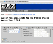
Beginning with water year 2006, the annual water data product took on a new format different from the previous report series. The basic product is a Site Data Sheet that serves to publish all data collected during the water year at any given site in the United States. The 2006, 2007 and 2008 USGS Water Data Reports are available online and improve on the previous online reports with a new interactive feature designed to make site data retrieval easier and more convenient. Access the Water Data Report here
( ) or use the map
() interface. ) or use the map
() interface.
Featured Projects
Coupled Real-time Streambank Piezometer and Gaging Station
Hydrologists from the USGS Wyoming, Montana, and Missisippi Water Science Centers are demonstrating the feasibility and utility of including groundwater level and temperature data from shallow streambank piezometers with existing suites of real-time data collected and transmitted at active gaging stations.
 Find out more Find out more
Lower Tertiary and Upper Cretaceous Aquifer System Groundwater Availability Study
The hydraulically connected aquifers in the regional lower Tertiary and Upper Cretaceous aquifer system are the shallowest—and often most accessible—of the aquifers within the Northern Great Plains aquifer system of the United States and Canada. These aquifers are present in two nationally important energy-producing areas, the Williston and Powder River structural basins, and provide a unique opportunity to study the water-energy nexus within a groundwater context.
Find out more
Of Current Interest
 U.S. Geological Survey scientists received the National Level Silver Medal Award from the U.S. Environmental Protection Agency at a ceremony in Denver, Colo. The scientists are being recognized for their work addressing brine contamination of drinking water supplies on the Fort Peck Indian Reservation in northeastern, Mont. U.S. Geological Survey scientists received the National Level Silver Medal Award from the U.S. Environmental Protection Agency at a ceremony in Denver, Colo. The scientists are being recognized for their work addressing brine contamination of drinking water supplies on the Fort Peck Indian Reservation in northeastern, Mont.
 Groundwater and surface water in many cases are considered separate resources, but there is growing recognition of a need to treat them as a single resource. For example, groundwater inflow during low streamflow is vitally important to the health of a stream for many reasons, including buffering temperature, providing good quality water to the stream, and maintaining flow for aquatic organisms. Groundwater and surface water in many cases are considered separate resources, but there is growing recognition of a need to treat them as a single resource. For example, groundwater inflow during low streamflow is vitally important to the health of a stream for many reasons, including buffering temperature, providing good quality water to the stream, and maintaining flow for aquatic organisms.
USGS Samples for Radioactive Constituents in Groundwater of Southwestern Montana – Project Update and Release of Data - May 3, 2011
 The U.S. Geological Survey (USGS), in cooperation with Jefferson County, recently sampled groundwater in southwestern Montana for uranium and other radioactive constituents. Scientists with the USGS Montana Water Science Center collected 165 groundwater samples from 128 wells in Broadwater, Deer Lodge, Jefferson, Lewis and Clark, Madison, Powell, and Silver Bow Counties. Most of the wells included in the study provide water for human consumption. The objectives of the study were to evaluate the occurrence and concentration of naturally occurring radioactive constituents and the geologic settings and conditions in which elevated concentrations occur. The USGS released preliminary findings to Jefferson County officials on May 3, 2011. The USGS will publish a report describing methods and results later in 2012. Preliminary data. The U.S. Geological Survey (USGS), in cooperation with Jefferson County, recently sampled groundwater in southwestern Montana for uranium and other radioactive constituents. Scientists with the USGS Montana Water Science Center collected 165 groundwater samples from 128 wells in Broadwater, Deer Lodge, Jefferson, Lewis and Clark, Madison, Powell, and Silver Bow Counties. Most of the wells included in the study provide water for human consumption. The objectives of the study were to evaluate the occurrence and concentration of naturally occurring radioactive constituents and the geologic settings and conditions in which elevated concentrations occur. The USGS released preliminary findings to Jefferson County officials on May 3, 2011. The USGS will publish a report describing methods and results later in 2012. Preliminary data.
Find out more
|