Local
forecast by
"City, St" |
|
Search
by city or zip code. Press enter or select the go button to
submit request
|
|
|
Flash Flood Guidance and Drought Information
[Spring Flood Potential] [Flash
Flood Guidance] [Headwater Flood Guidance] [Drought
Info]
Spring Flood Potential Statement
Throughout the winter, the MARFC issues Spring Flood Potential
Statements, which describe the possibility of Spring flooding, based on
current hydrologic conditions.
Flash Flood Guidance
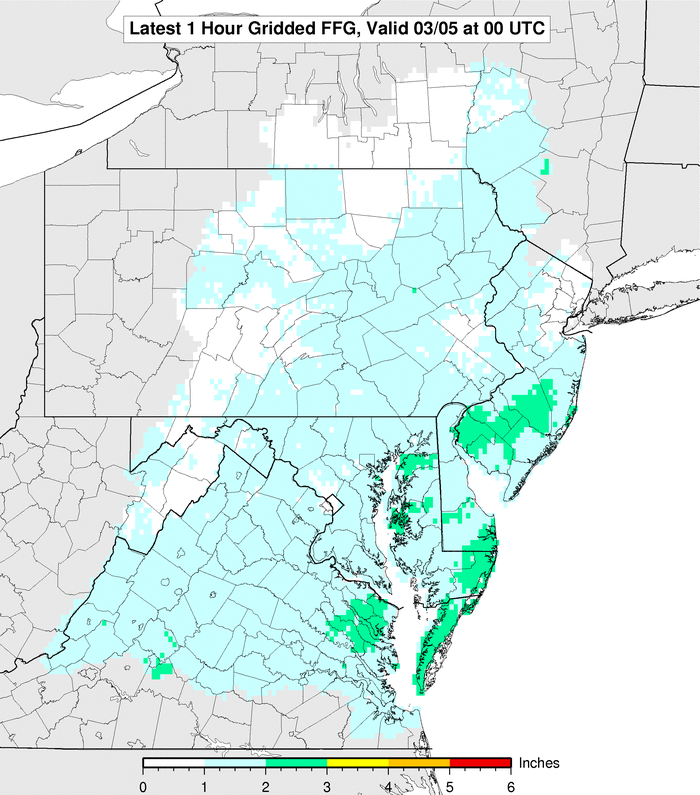
NEW! Gridded Flash Flood
Guidance. The values are computed on a 4km by 4km grid. Finer scale variations due to terrain, urbanized areas, and uneven rainfall patterns are taken into account.
Here are the county average FFG values in text
format:
FYI: Flash Flood Guidance (FFG) provides a general indication
of the amount of rainfall evenly distributed over various durations (in
hours), necessary to cause small streams to overflow their natural banks.
During heavy rainfall, accurate interpretation of the guidance consists
of the combination of rainfall that has already occurred plus any additional
rainfall that can be confidently expected to fall over the same location
in the immediate future.
It should be noted that FFG values represent an estimate
of average soil moisture and stream flow conditions in a given county.
Flooding may occur with less rainfall than indicated in areas where recent
rain has been locally heavier. In addition, during prolonged dry spells,
soils may temporarily have impervious characteristics at the onset of
heavy rain, resulting in extra runoff and possible flooding from lower
rainfall amounts than those indicated by the FFG.
Headwater Flood Guidance
Headwater Flood Guidance depicts the approximate rainfall
evenly distributed over various durations to cause selected streams to
reach official NWS flood stage (may not necessarily coincide with the
natural bank) at U. S. Geological Survey gauging stations. As with Flash
Flood Guidance, these values are intended as general guidance.
[Spring Flood Potential] [Flash
Flood Guidance] [Headwater Flood Guidance] [Drought
Info]
|
|
Popular Links:
River Forecasts, Current Stages,
Precipitation Departure Maps,
Weather,
Radar, F.A.Q.
|
|
NOAA's National Weather Service
Middle Atlantic River Forecast Center
328 Innovation Boulevard, Suite 330
State College, PA 16803
Page Authors: Jason Nolan & Ted Rodgers
Webmaster's E-mail:
marfc.webmaster@noaa.gov
Page last modified:
18-Feb-2010 03:02 PM |
Disclaimer |
Privacy Policy |
| Credits |
About Us |
| Glossary |
Career Opportunities |
|


