- Current Hazards
- Forecasts
- Current Weather
- Radar Imagery
- Climate
- Weather Safety
- Additional Info
- Contact Us
Top News of the Day
|
|
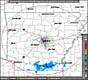
Click on the map below for the latest forecast.
Last maps update: Fri, Feb. 15, 2013 at 6:14:27 am CST


|
|
| Local Item(s) of Interest | |
 |
|
|||
|
|
||||

| Conditions Across Arkansas at 600 AM CST Click Here for More Conditions | |||||||
| Site | Sky/Weather | Temp | DP | RH | Wind | Baro | Remarks |
| FAYETTEVILLE | CLEAR | 33° | 24° | 69% | NW14 | 30.25R | WCI 23 |
| FORT SMITH | CLEAR | 43° | 29° | 57% | N10 | 30.26R | |
| HARRISON | CLEAR | 34° | 23° | 64% | NW5 | 30.21R | WCI 30 |
| MTN HOME | CLEAR | 37° | 26° | 64% | VRB6 | 30.19R | |
| MOUNT IDA | CLOUDY | 42° | 38° | 85% | CALM | 30.19R | |
| JONESBORO | CLOUDY | 46° | 33° | 60% | NW7 | 30.17R | |
| LITTLE ROCK | LGT RAIN | 47° | 35° | 63% | N15 | 30.21R | |
| WEST MEMPHIS | CLOUDY | 44° | 36° | 73% | NW3 | 30.15R | |
| HOT SPRINGS | LGT RAIN | 46° | 34° | 62% | N12 | 30.21R | |
| RUSSELLVILLE | MOCLDY | 44° | 36° | 73% | NW8 | 30.21R | |
| TEXARKANA | MOCLDY | 45° | 34° | 65% | N7 | 30.21R | |
| EL DORADO | CLEAR | 40° | 33° | 76% | N3 | 30.19R | |
| PINE BLUFF | PTCLDY | 43° | 34° | 70% | N7 | 30.19R | |
| MONTICELLO | CLEAR | 46° | 33° | 60% | N5 | 30.17R | |
| Note: In the table above, click on the Site name for conditions the past two days. In the Remarks column, HX is Heat Index...WCI is Wind Chill Index and VSB is visibility. | |||||||
- National Weather Service
- Little Rock, AR Weather Forecast Office
- 8400 Remount Road
- North Little Rock, AR 72118
- (501) 834-0308
- Page Author: LZK Webmaster
- Web Master's E-mail: sr-lzk.webmaster@noaa.gov
- Page last modified: 20-Sep-2011 1:58 PM UTC