News

Media interview a member of the flight crew of NASA's P-3B environmental science aircraft about the DISCOVER-AQ air quality survey mission

NASA Airborne Science: Studying our Environment

News media, social media followers and educators learn about NASA's airborne Earth and environmental science program, briefed on current and upcoming ...

Read More
The brightness, or "intensity," and polarization of reflected light provide different information about the elements that make up a scene, apparent in this set of images collected by the Airborne Multiangle SpectroPolarimetric Imager (AirMSPI)

PODEX Experiment to Reshape Future of Atmospheric Science

David Starr, project scientist of the PODEX experiment, discusses a new class of instruments that could reshape the next generation of atmospheric sci...

Read More
Technicians at NASA's Langley Research Center in Hampton, Va., prepare a B200 aircraft for the DISCOVER-AQ air pollution measurement mission in California.

NASA Working to Improve Air Quality Knowledge

Residents in Calif.'s San Joaquin Valley will see some unusual air traffic over their region in January and February of 2013 -- two NASA aircraft will...

Read More
The view from a Global Hawk

NASA Chases Climate Change Clues

Starting this month NASA will start the first flights of the Airborne Tropical TRopopause EXperiment (ATTREX).

Read More
A Digital Mapping System (DMS) mosaic of Arctic sea ice

IceBridge Data Brings New Twist to Sea Ice Forecasting

Sea ice thickness data gathered in April 2012 by NASA's Operation IceBridge has been used in seasonal sea ice forecasts for the first time.

Read More
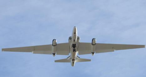
NASA ER-2 806

ER-2 806 on Flight Status; Science Missions Slated

After a maintenance period that included several upgrades, the high-altitude aircraft is ready for new series of Earth and space science missions.

Read More
NASA P-3B In Flight

NASA to Showcase Airborne Science for Social Media

NASA's P-3B, other science aircraft and several airborne Earth science missions to be focus of Jan. 25 event at NASA's Dryden Flight Research Center.

Read More

About the Airborne Science Program

The Airborne Science Program within the Earth Science Division is responsible for providing aircraft systems that further science and advance the use of satellite data. The primary objectives of this program are to:

  • Conduct in-situ atmospheric measurements with varying vertical and horizontal resolutions
  • Collect high-resolution imagery for focused process studies and sub-pixel resolution for spaceborne calibration.
  • Implement "sensor web" observational strategies for conducting earth science missions including intelligent mission management, and sensor networking.
  • Demonstrate and exploit the capabilities of uninhabited and autonomous aircraft for science investigations
  • Test new sensor technologies in space-like environments
  • Calibrate/validate space-based measurements and retrieval algorithms

To meet these observing objectives, we need a suite of sustained, ongoing platforms and sensors on which investigators can rely from year to year; from these known capabilities the Science Mission Directorate can develop observing strategies. However, an ongoing capability will be resource-constrained and eventually technology-constrained, so that not all observing requirements will be met with the limited core capability. Therefore the program will facilitate access to other platforms or sensors on a funds-available, as-needed basis, to accommodate unique and/or occasional requirements. The program will also look constantly for new, evolving technologies to demonstrate their applicability for Earth science. Depending on the success of the demonstrations and the observing needs, the core capability is expected to evolve and change over time. The speed and extent of change will be balanced against the need for established, known capabilities for long-term planning.