
- ABOUT
- NEWS & EVENTS
- GRANTS & FUNDING
- RESOURCES
- COPS BOLO Series
- COPS Library - RIC
- COPS Media Center
- Community Policing Topics
- Community Policing Self Assessment Tool
- Congressional Resources
- Core Community Policing Resources
- FOIA
- Geography and Public Safety Newsletter
- The National Law Enforcement Officers Memorial Fund
- Vets to COPS Resources
- COPS Hiring Program Resources
- TRAINING
- CAREERS
- ACCOUNT ACCESS


![]() Sign up to receive Geography and Public Safety e-mail updates
Sign up to receive Geography and Public Safety e-mail updates
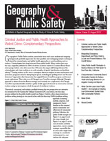 |
Volume 3 Issue 2 | September 2012 In this issue of Geography and Public Safety, we examine the use of GIS in the public health sector and how this use can enhance public safety. This issue will review the Milwaukee Homicide Review Commission; an illustration of a comprehensive community based information system to reduce youth and gang violence in Los Angeles County; and crime mapping news section. |
||
 |
Volume 3 Issue 1 | October 2011 Volume 3, Issue 1 of the Geography and Public Safety newsletter seeks to promote the broader use of GIS by law enforcement. It highlights ways in which community policing, problem solving, community outreach, and partnerships can be enhanced by GIS. While mapping for the purpose of “putting cops on the dots” remains a core focus of GIS in law enforcement, more needs to be said about the versatility of GIS and how it can be deployed to improve effectiveness and efficiencies across all law enforcement functions. Featured articles include a lead article about the “full spectrum” use of GIS by police as well as one about the Dallas Police Department’s innovative use of GIS to define Targeted Area Action Grids (TAAGs) to enhance community outreach focused on residential and business burglaries. |
||
 |
Volume 2, Issue 4 of the Geography and Public Safety newsletter highlights a developing field of study in policing and anaylsis, Predictive Policing. This issue will discuss the inaugural Predictive Policing Symposium, which brought together researchers and practioners to discuss the concepts involved in predictive policing. Included, is a discussion of NIJ's Geospatial Technical Working Group and experimenting with hot spots analysis using prediction in Minneapolis.
|
||
Follow this link for archived Geography and Public Safety Newsletters
COPS Library - RIC
COPS Media Center
Community Policing Topics
Congressional Resources
Core Community Policing Resources
FOIA
Geography and Public Safety Newsletter
Vets to COPS Resources
TRAINING
Community Policing Training
COPS Grantee Training and Technical Assistance
Combating Dog Fighting Training
Ethics and Integrity Training
Homicide Prevention Training
Police Training Officer (PTO) Training
Tribal and Alaskan Native Training
Youth Safety Training
Tribal Training
Upcoming Training Initiatives
CAREERS
ACCOUNT ACCESS