Up until the early 1990’s, nautical chart compilation at the Coast Survey was largely a manual process. Cartographers used drafting pens, protractors, compasses, and dividers to hand correct master copies of all of our charts. Lithographers would then take these master copies and transfer them to full size negatives, one for each color, which would then be used to photo-lithographically print the paper chart. The entire chart making process was highly skilled and extremely labor intensive.
In 1994, Coast Survey began a program to electronically scan the negatives used to print its entire suite of paper charts. These electronic bit mapped images could now be manipulated on a PC in a Computer Aided Design (CAD) environment. The first use of this technology was rather rudimentary and only useful for simple revisions, but several innovative cartographers within NOAA advanced this technique to an efficient, full scale chart production system. Cartographers now could make complete new editions on digital files that could be plotted out directly as negatives, one step closer to printing.
With charts now captured in a digital format they became a catalyst for creating new products for chart users. Raster Navigational Charts (RNCs) were developed for use with real time Differential GPS (DGPS). The Raster Chart Display System became a powerful new navigational tool. In the mid-1990’s, Coast Survey developed a Cooperative Research and Development Agreement (CRADA) with Maptech, a private company. NOAA made its raster files available to Maptech, who in turn geo-referenced the images and sold them to the boating public. |

Cartographer performing manual chart compilation |

Cartographer performing digital compilation on a NOAA raster chart |
Coast Survey and Maptech recognized that boaters needed not only raster charts, but they also needed regular chart updates. The efficiency of a digital charting system allowed Coast Survey to develop a weekly raster chart update service. Upon receiving chart corrections from weekly USCG Local Notice to Mariners and NGA’s U.S. Notice to Mariners, cartographers from the Marine Chart Division’s Update Service Branch updated charts immediately. Updated raster chart files were made available on a weekly basis to Maptech. Maptech developed raster-differencing algorithms that allowed update digital “patches” to be generated and e-mailed to subscribers. A boater could purchase a suite of raster charts on CD from Maptech, and then receive these weekly updates by e-mail.
The same updated raster files serve as the engine for NOAA’s Print on Demand (POD) paper charts. Up-to-date raster chart files are made available to a private partner, Oceangrafix. When a paper chart is ordered from a national chart agent, Oceangrafix prints a POD paper chart from the most recent raster file. The paper chart is shipped overnight to the ordering agent. Using this system, mariners can now purchase paper charts already updated with the latest Notice to Mariners corrections. |
|
In the 1990’s the international hydrographic community, including Coast Survey, recognized that raster charts were not the optimum electronic charting data product in the long term. Raster charts are bit mapped images and computers cannot discriminate one pixel from another. A database of charted features, with each feature being geo-referenced and fully attributed, would be an integral part of a new, more powerful electronic charting system. Attributed charting information would allow the computer to recognize dangerous situations ahead of time and issue warnings to the mariner.
The Electronic Navigational Chart (ENC) is a vector database of chart features being built to the International Hydrographic Organization’s S-57 standard. NOAA is exclusively responsible for production and authorization of ENC data in U.S. waters. In order for an electronic chart to gain type approval as an ECDIS (Electronic Chart Display and Information System), it must be fueled by ENC data. However, ENC data is not only for ECDIS use. ENCs can fuel any Electronic Charting System that reads the S-57 format. Today, the Coast Survey continues to build its ENC suite with over 600 ENC cells and updates now available for free download. |
 |
|
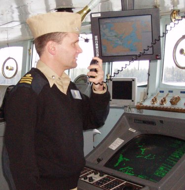
NOAA Corps Officer on bridge of ship using an Electronic Navigational Chart |
|