|
|
The Sagebrush Assessment Project conducted research on habitats for species of conservation
concern in the sagebrush ecosystem. The Project’s focus was on landscape research
in sagebrush-dominated ecoregions in the western United States (see map, below).
Work included:
- Identifying regional assessment procedures that can be used efficiently and credibly
to evaluate multiple species of conservation concern in sagebrush ecoregions;
- Developing methods by which trade-offs between managing for single versus multiple
species can be addressed systematically and defensibly at regional scales for land
use planning;
- Completing a prototype regional assessment in the Great Basin Ecoregion of Nevada,
Utah, and California, including follow-on validation research;
- Conducting research in support of, and subsequently completing, a regional assessment
of the Wyoming Basins Ecoregion and adjacent areas of Wyoming, Montana, Idaho, Utah,
and Colorado; and
- Providing guidance regarding use of the procedures and results for effective multi-species
planning at regional scales for ecosystem management.
Participants:
U.S. Geological Survey, Biological Resources Division, Snake River Field Station,
Boise, ID1
USDA Forest Service, Pacific Northwest Research Station, La Grande, OR2
USDA Forest Service, Rocky Mountain Research Station, Reno, NV3 , and
Boise, ID4
Oregon State University, Eastern Oregon Agricultural Research Station, Burns, OR5

Sagebrush in the shadow of the
Independence Mountains, north of Elko, Nevada. USGS
- Steven T. Knick, Research Ecologist1
- Michael J. Wisdom, Research Wildlife Biologist2
- Mary M. Rowland, Wildlife Biologist2
- Lowell H. Suring, Wildlife Biologist4
- Linda Schueck, Computer Analyst1
- Cara Meinke, Wildlife Biologist1
- Richard F. Miller, Plant Community Ecologist5
- Robin J. Tausch, Supervisory Range Scientist3
- Matthias Leu, Research Ecologist1
- Barbara C. Wales, Wildlife Biologist2
Products:
Documents:
This project was supported by SAGEMAP. Products from this Project are also
available in the Great Basin Bibliography  and data layers that were used in the analyses are available from the SAGEMAP Data queries.
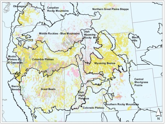 Sagebrush-dominated ecoregions in the western
United States (sagebrush cover types shown in various shades of yellow, pink,
and blue-grey). USGS
Sagebrush-dominated ecoregions in the western
United States (sagebrush cover types shown in various shades of yellow, pink,
and blue-grey). USGS
|

