NOAA > NWS > CPHC Home Page > Hurricane Awareness Week > Storm Surge
Hurricane Awareness Week

Storm Surge
"The greatest potential for loss of life related to a hurricane is from the storm surge." - Brian Jarvinen, National Hurricane Center
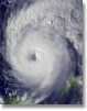
 Storm surge is simply water that is pushed toward the shore by the force of the winds swirling around the storm. This advancing surge combines with the normal tides to create the hurricane storm tide, which can increase the mean water level 15 feet or more. In addition, wind driven waves are superimposed on the storm tide. This rise in water level can cause severe flooding in coastal areas, particularly when the storm tide coincides with the normal high tides. Storm surge is simply water that is pushed toward the shore by the force of the winds swirling around the storm. This advancing surge combines with the normal tides to create the hurricane storm tide, which can increase the mean water level 15 feet or more. In addition, wind driven waves are superimposed on the storm tide. This rise in water level can cause severe flooding in coastal areas, particularly when the storm tide coincides with the normal high tides.
| The level of surge in a particular area is also determined by the slope of the continental shelf. A shallow slope off the coast (right, top picture) will allow a greater surge to inundate coastal communities. Communities with a steeper continental shelf, as in Hawaii, (right, bottom picture) will not see as much surge inundation, although large breaking waves can still present major problems. Storm tides, waves, and currents in confined harbors severely damage ships, marinas, and pleasure boats. |
 |
 |
One tool used to evaluate the threat from storm surge is the SLOSH model. Emergency managers use this data from SLOSH to determine which areas must be evacuated for storm surge. The links below provide some altered photos that show how the intensity of the storm (as given by the Saffir-Simpson Hurricane Scale) affects the possibility of flooding from storm surge at two locations. Storm surge also affects rivers and inland lakes, potentially increasing the area that must be evacuated. You can see some of these effects by looking at simulated storm surge pictures for Brunswick, GA, New Orleans, LA, Brooklyn, NY, Wrightsville Beach, NC and Manteo, NC.
In general, the more intense the storm, and the closer a community is to the right-front quadrant, the larger the area that must be evacuated. The problem is always the uncertainty about how intense the storm will be when it finally makes landfall. Emergency managers and local officials balance that uncertainty with the human and economic risks to their community. This is why a rule of thumb for emergency managers is to plan for a storm one category higher than what is forecast. This is a reasonable precaution to help minimize the loss of life from hurricanes.
Wave and current action associated with the tide also causes extensive damage. Water weighs approximately 1,700 pounds per cubic yard; extended pounding by frequent waves can demolish any structure not specifically designed to withstand such forces.
 The currents created by the tide combine with the action of the waves to severely erode beaches and coastal highways. Many buildings withstand hurricane force winds until their foundations, undermined by erosion, are weakened and fail. The currents created by the tide combine with the action of the waves to severely erode beaches and coastal highways. Many buildings withstand hurricane force winds until their foundations, undermined by erosion, are weakened and fail.
In estuaries and bayous, intrusions of salt water endanger the public health and send animals, such as snakes, to flee from flooded areas and take refuge in urban areas.
ADDITIONAL SAFETY INFORMATION
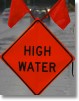
STORM SURGE SAFETY ACTIONS
- Minimize the distance you must travel to reach a safe location; the further you drive the higher the likelihood of encountering traffic congestion and other problems on the roadways.
- Select the nearest possible evacuation destination, preferably within your local area, and map out your route. Do not get on the road without a planned route, or a place to go.
- Choose the home of the closest friend or relative outside a designated evacuation zone and discuss your plan with them before hurricane season.
- You may also choose a hotel/motel outside of the vulnerable area.
- If neither of these options is available, consider the closest possible public shelter, preferably within your local area.
- Use the evacuation routes designated by authorities and, if possible, become familiar with your route by driving it before an evacuation order is issued.
- Contact your local emergency management office to register or get information regarding anyone in your household whom may require special assistance in order to evacuate.
- Prepare a separate pet plan, most public shelters do not accept pets.
- Prepare your home prior to leaving by boarding up doors and windows, securing or moving indoors all yard objects, and turning off all utilities.
- Before leaving, fill your car with gas and withdraw extra money from the ATM.
- Take all prescription medicines and special medical items, such as glasses and diapers.
- If your family evacuation plan includes an RV, boat or trailer, leave early. Do not wait until the evacuation order or exodus is well underway to start your trip.
- If you live in an evacuation zone and are ordered to evacuate by state or local officials, do so as quickly as possible. Do not wait or delay your departure, to do so will only increase your chances of being stuck in traffic, or even worse, not being able to get out at all.
- Expect traffic congestion and delays during evacuations. Expect and plan for significantly longer travel times than normal to reach your family's intended destination.
- Stay tuned to a local radio or television station and listen carefully for any advisories or specific instructions from local officials. Monitor your NOAA Weather Radio.
|