Central Operations & Regional Nodes
The Metop-2 AVHRR SST image above shows the development of a Tehuantepec eddy generated by winds blowing from the Gulf of Mexico through the mountain gap in Mexico to the Gulf of Tehuantepec located on the Pacific coast of Mexico. The wind generates currents which form a large anticyclonic eddy. Upwelling is also noted and over the next few days, the eddy will move westward. Larger Image
VIIRS ocean color data products are being processed by NOAA CoastWatch on an Experimental basis. Two types of processing are currently available; those processed by the Integrated Data Processing System (IDPS) and those from NASA SeaDAS. These products are being evaluated to determine the best suited for NOAA applications. Data products can be obtained from the following links: Browse HDF
VIIRS ocean color data products are being processed by NOAA CoastWatch on an Experimental basis. Two types of processing are currently available; those processed by the Integrated Data Processing System (IDPS) and those from NASA SeaDAS. These products are being evaluated to determine the best suited for NOAA applications. Data products can be obtained from the following links: Browse HDF
| Central Operations | Regional Nodes |
|---|---|
| Regional and global SST, winds, and ocean color products and data streams | Local data, products, and service specific to region |
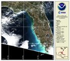
Featured Image
 News
News
VIIRS data availability
More Information
Applications
More Information
News
MOBY Deployment 251 data is now available on the CoastWatch webserver. [OCT 2012]
VIIRS data is now available on the CoastWatch webserverfor Gulf of Mexico and Hawaii as an Experimental product. [OCT 2012]
