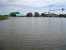
Maximum discharge, high-water, water-quality, and other flood-related
data collected since the 1960's for major floods in Iowa are available in
the following reports. The topics include flood profiles, state and regional, flood magnitudes
and frequencies, flood inundation mapping, streambed erosion and flood plain
deposition, and flood transport of nutrients, sediment, and contaminants.
Also listed are several reports on Midwest floods outside of Iowa.
Note: To view publications, Adobe Reader is required.
Flood Profile Reports
Northeast Iowa Basins
| Year |
Citation |
Abstract |
PDF |
| 2010 |
Flood of June 8-9, 2008, Upper Iowa River, Northeast Iowa: U.S. Geological Survey Open-File Report 2010-1087, 17 p. with app |
 |
 |
| 2006 |
Flood of May 23, 2004, in the Turkey and Maquoketa River Basins, Northeast Iowa: U.S. Geological Survey Open-File Report 2006-1067, 35 p. |
|
|
| 1996 |
Floods of July 12, 1972, March 19, 1979, and June 15, 1991, in the Turkey River Basin, northeast Iowa: U.S. Geological Survey Open-File Report 96-560, 55 p. |
|
|
Maquoketa River Basin
| Year |
Citation |
Abstract |
PDF |
| 2012 |
Floods of July 23-26, 2010, in the Little Maquoketa River and Maquoketa River Basins, Northeast Iowa: U.S. Geological Survey Open-File Report 2011-1301, 45 p. with appendix |
|
|
| 2004 |
Flood of June 4-5, 2002, in the Maquoketa River Basin, East-Central Iowa: U.S. Geological Survey Open-File Report 2004-1250, 29 p. |
|
|
| 1973 |
Flood of August 2, 1972, in the Little Maquoketa River basin, Dubuque county, Iowa: USGS Open-file report 73-1072004 |
|
|
Wapsipinicon River Basin
| Year |
Citation |
Abstract |
PDF |
| 2001 |
Floods of July 19-25, 1999, in the Wapsipinicon and Cedar River Basins, northeast Iowa: U.S. Geological Survey Open-File Report 01-13, 45 p. |
|
|
| 2000 |
Floods of May 17-20, 1999, in the Volga and Wapsipinicon River Basins, northeast Iowa: U.S. Geological Survey Open-File Report 00-237, 36 p. |
|
|
| 1971 |
Floods in the Wapsipinicon River Basin, Iowa: U.S. Geological Survey Open-File Report, 52 p. |
|
|
Iowa/Cedar River Basin
| Year |
Citation |
Abstract |
PDF |
| 2010 |
Floods of May 30 to June 15, 2008, in the Iowa and Cedar River Basins, Eastern Iowa: U.S. Geological Survey Open-File Report 2010-1190, 99 p. with Appendixes |
|
|
| 2004 |
Flood of June 4, 2002, in the Indian Creek Basin, Linn County, Iowa: U.S. Geological Survey Open-File Report 2004-1074, 31 p |
|
|
| 1994 |
Flood of June 17, 1990, in the Clear Creek Basin, east-central Iowa: U.S. Geological Survey Open-File Report 94-78, 21 p. |
|
|
| 1981 |
Floods in the English River Basin, Iowa: U.S. Geological Survey Open-File Report 81-67, 61 p. |
|
|
| 1977 |
Floods in the Big Creek Basin, Linn County, Iowa, U.S. Geological Survey Open-File Report 77-209, 35 p. |
|
|
| 1973 |
Floods in the Iowa River Basin upstream from Coralville Lake, Iowa: U.S. Geological Survey Open-File Report 73-106, 75 p. |
|
|
| 1970 |
Flood of March 3, 1970, on Old Mans Creek, Johnson County, Iowa: U.S. Geological Survey Open-File Report 70-293, 9 p. |
|
|
| 1970 |
Flood profile study, Morgan Creek, Linn County, Iowa: U.S. Geological Survey Open-File Report 70-295, 16 p. |
|
|
| 1970 |
Flood profile study, Hoosier Creek, Linn County, Iowa: U.S. Geological Survey Open-File Report 70-294, 18 p. |
|
|
| 1968 |
Flood of June 7, 1967, in the Wapsinonoc Creek Basin, Iowa: U.S. Geological Survey Open-File Report, 21 p. |
|
|
| 1967 |
Floods on Otter Creek in Linn County, Iowa: U.S. Geological Survey Open-File Report 67-195, 22 p. |
|
|
| 1963 |
Cedar River Basin floods: Iowa Highway Research Board Bulletin No. 27, 59 p. |
|
|
Skunk River Basin
| Year |
Citation |
Abstract |
PDF |
| 2012 |
Flood of August 11–16, 2010, in the South Skunk River Basin, central and southeast Iowa: U.S. Geological Survey Open-File Report 2012–1202, 27 p. with appendix. |
|
|
| 1996 |
Floods of June 17, 1990, and July 9, 1993, along Squaw Creek and the South Skunk River in Ames, Iowa, and vicinity: U.S. Geological Survey Open-File Report 96-249, 34 p. |
|
|
| 1978 |
Floods in the Skunk River Basin, Iowa: U.S. Geological Survey Open-File Report 79-272, 80 p. |
|
|
| 1976 |
Flood of June 27, 1975 in city of Ames, Iowa: U.S. Geological Survey Open-File Report, 56 p. |
|
|
| 1968 |
Flood profile study, Squaw Creek, Linn County, Iowa, U.S. Geological Survey Open-File Report, 13 p. |
|
|
Des Moines River Basin
| Year |
Citation |
Abstract |
PDF |
| 1997 |
Flood of July 9-11, 1993, in the Raccoon River Basin, west-central Iowa: U.S. Geological Survey Open-File Report 97-557, 117p. |
|
|
| 1992 |
Floods of 1986 and 1990 in the Raccoon River Basin, west-central Iowa: U.S. Geological Survey Open-File Report 92-94, 144 p. |
|
|
| 1980 |
Floods in the Raccoon River Basin, Iowa: U.S. Geological Survey Open-File Report 80-162, 110 p. |
|
|
| 1979 |
Supplement to floods in the upper Des Moines River Basin, Iowa: U.S. Geological Survey Open-File Report 79-1486, 6 p. |
|
|
| 1970 |
Floods in the upper Des Moines River Basin, Iowa: U.S. Geological Survey Open-File Report 70-296, 49 p. |
|
|
Western Iowa River Basins
| Year |
Citation |
Abstract |
PDF |
| 1996 |
Flood of May 19, 1990, along Perry Creek in Plymouth and Woodbury Counties, Iowa: U.S. Geological Survey Open-File Report 96-476, 39 p. |
|
|
| 1986 |
Floods in the Floyd River Basin, Iowa: U.S. Geological Survey Open-File Report 86-476, 61 p. |
|
|
| 1973 |
Floods in the Rock River Basin, Iowa: U.S. Geological Survey Open-File Report 74-1047, 74 p. |
|
|
| 1967 |
Floods in Rock River Basin: U.S. Geological Survey Open-File Report 67-36, 28 p. |
|
|
| 1966 |
Little Sioux River Basin floods: U.S. Geological Survey Open-File Report 67-196, 60 p. |
|
|
Nishnabotna River Basin
| Year |
Citation |
Abstract |
PDF |
| 1998 |
Nishnabotna and East Nishnabotna Rivers, southwest Iowa: U.S. Geological Survey Open-File Report 99-70, 15 p. |
|
|
| 1991 |
Floods in the Nishnabotna River Basin, Iowa: U.S. Geological Survey Open-File Report 91-171, 118 p. |
|
|
Southern Iowa River Basins
| Year |
Citation |
Abstract |
PDF |
| 1997 |
Floods of September 15-16, 1992, in the Thompson, Weldon, and Chariton River Basins, south-central Iowa: U.S. Geological Survey Open-File Report 97-122, 68 p. |
|
|
| 1986 |
Floods in south-central Iowa: U.S. Geological Survey Open-File Report 85-100, 95 p. |
|
|
Statewide or Regional floods
| Year |
Citation |
Abstract |
PDF |
| 2010 |
Floods of May and June 2008 in Iowa. USGS Open-File Report 2010-1096,. |
|
|
| 2008 |
Flooding in the United States Midwest, 2008: USGS Professional Paper 1775,. |
|
|
| 1995 |
Propagation and composition of the flood wave on the upper Mississippi River, 1993 , USGS Circular 1120-F |
|
|
| 1995 |
Flood volumes in the upper Mississippi River basin, April 1 through September 30, 1993, USGS Circular 1120-H |
|
|
| 1993 |
Flood Discharges in the Upper Mississippi River Basin, 1993: USGS Circular 1120-A |
|
|
| 1993 |
Precipitation in the upper Mississippi River basin, January 1 through July 31, 1993, USGS Circular 1120-B |
|
|
| 1991 |
National water summary 1988-89: hydrologic events and floods and droughts: USGS Water-Supply Paper 2375. |
|
|
| 1970 |
Floods of March-May 1965 in the Upper Mississippi River Basin, USGS Water Supply Paper 1850-A |
|
|
| 1970 |
Floods of April-May 1969 in Upper Midwestern United States, USGS Open-file report 70-I |
|
|
| 1958 |
Floods of June 1954: USGS Water-Supply Paper 1370-A |
|
|
| 1955 |
Floods of 1952 in the Basins of the Upper Mississippi River and Red River of the North, USGS Water-Supply Paper1260-C |
|
|
| 1955 |
Floods of April 1952 in the Missouri River Basin, USGS Water-Supply Paper 1260-B |
|
|
Flood Magnitude and Frequency
| Year |
Citation |
Abstract |
PDF |
| 2003 |
Main-Channel Slopes of Selected Streams in Iowa for Estimation of Flood-Frequency Discharges. |
|
|
| 2001 |
Techniques for estimating flood-frequency discharges for streams in Iowa, U.S. Geological Survey Water-Resources Investigations Report 2000-4233. |
|
|
| 1997 |
Effects of the 1993 Flood on the Determination of Flood Magnitude and Frequency in Iowa - Floods in the Upper Mississippi River Basin 1993. |
|
|
| 1993 |
Estimating design-flood discharges for streams in Iowa using drainage-basin and channel-geometry characteristics. |
|
|
Flood Inundation Mapping
| Year |
Citation |
Abstract |
PDF |
| 1996 |
Delineation of flooding within the upper Mississippi River Basin-flood of June 18 through August 4, 1993, in Des Moines and vicinity, Iowa: U.S. Geological Survey Hydrologic Investigations Atlas HA735-D, 2 sheets, scale 1:24,000. |
|
|
| 1996 |
Delineation of flooding within the upper Mississippi River Basin-flood of June 19-July 31, 1993, in Davenport, Iowa, and vicinity: U.S. Geological Survey Hydrologic Investigations Atlas HA735-C, 1 sheet, scale 1:24,000. |
|
|
| 1995 |
Delineation of flooding within the upper Mississippi River Basin-flood of June 29-September 18, 1993, in Iowa City and vicinity, Iowa: U.S. Geological Survey Hydrologic Investigations Atlas HA735-B, 1 sheet, scale 1:24,000. |
|
|
| 1955 |
Floods of April 1952 in the Missouri River basin, 1955, U.S. Geological Survey Water Supply Paper 1260-B, p.49-302. |
|
|
| 1955 |
Floods of 1952 in the basins of the upper Mississippi River and Red River of the North, 1955. U.S. Geological Survey Water Supply Paper 1260-C. p. 303-529. |
|
|
Streambed Erosion and Floodplain Deposition
| Year |
Citation |
Abstract |
PDF |
| 1996 |
Flood-Plain and Channel Aggradation at Selected Bridge Sites in the Iowa and Skunk River Basins, Iowa. |
|
|
| 1995 |
Potential-Scour Assessments and Estimates of Maximum Scour at Selected Bridges in Iowa. |
|
|
Flood Transport of Nutrients, Sediment, and Contaminants.
| Year |
Citation |
Abstract |
PDF |
| 2011 |
Nutrient and Sediment Concentrations and Corresponding Loads during the Historic June 2008 Flooding in Eastern Iowa |
|
|
| 2008 |
Flood-Plain Study of the Upper Iowa River in the Vicinity of Decorah, Iowa |
|
|
| 2000 |
Water-quantity and water-quality aspects of a 500-year flood - Nishnabotna River, southwest Iowa, June 1998: USGS WRIR 00-4025 |
|
|
| 1997 |
Organochlorine compounds in a sediment core from Coralville Reservoir, Iowa: 1997, U.S. Geological Survey Factsheet FS-129-97, 4p. |
|
|
Additional Reports
| Year |
Citation |
Abstract |
PDF |
| 2010 |
Floods of May and June 2008 in Iowa. U.S. Geological Survey Open-File Report 2010-1096, 10 p. |
|
|
| 2010 |
Flooding in the United States Midwest, 2008: U.S. Geological Survey Professional Paper 1775, 64 p. |
|
|
| 2010 |
100-Year Flood-It's All About Chance, U.S. Geological Survey General Information Product 106 Poster |
|
|
| 2003 |
Large Floods in the United States: Where They Happen and Why: U.S. Geological Survey Circular 1245. |
|
|
| 2003 |
The Great Flood of 1993 on the Upper Mississippi River-10 Years Later, U.S. Geological Survey Fact Sheet 2004-3024 |
|
|
| 2000 |
Volumes of recent floods and potential for storage in upland watershed areas of Iowa. |
|
|
| 1993 |
Estimating design-flood discharges for streams in Iowa using drainage-basin and channel-geometry characteristics. |
|
|