Short-lived Tropical Depression Four-E formed from the same tropical wave
that spawned Tropical Depression Two in the Atlantic basin. Satellite
images show the wave crossing Central America between 30 June and 1 July and
then moving westward across the eastern Pacific. The thunderstorm activity
associated with the wave became somewhat concentrated with some cyclonic
turning on early 6 July when the system was located about 1200 miles
southwest of Cabo San Lucas, Mexico. Advisories were initiated at 2100 UTC
on that day, but the depression weakened rapidly and it was dissipating 18
to 24 hours later. The track is presented in
Table 1 and Fig. 1.
Table 1.
Best track for Tropical Depression Four-E, 6-7 July, 2000.
Date/Time
(UTC) | Position |
Pressure
(mb) |
Wind Speed
(kt) | Stage |
| Lat. (°N) | Lon. (°W) |
| 6 / 1200 | 12.8 | 120.0 | 1007 | 25 | tropical depression |
| 6 / 1800 | 12.9 | 120.9 | 1008 | 25 | " |
| 7 / 0000 | 13.0 | 121.9 | 1008 | 25 | " |
| 7 / 0600 | 13.1 | 122.9 | 1008 | 25 | " |
| 7 / 1200 | 13.2 | 124.2 | 1009 | 20 | dissipating |
| |
| 6 / 1200 | 12.8 | 120.0 | 1007 | 25 | minimum pressure |
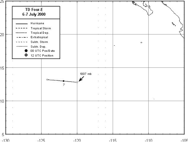
Figure 1.
Best track for Tropical Depression Four-E, 6-7 July, 2000.
![[NCEP Logo]](graphics/ncep.gif)
