|
|
|
Metadata
|
|
ID
|
ELUS91-1
|
|
Also Known As
|
ELUS91-1
E-1-91-NR
91031
|
|
Abstract
|
University of North Carolina. Chief Scientists: Rob Thieler,
Bill Cleary. Data (navigation) of field activity ELUS91-1
(E-1-91-NR) in North Carolina Wrightsville Beach from
09/16/1991 to 09/19/1991
|
|
Organization
|
University of North Carolina
|
|
Chief Scientist
|
Rob Thieler
Bill Cleary
|
|
Platform
|
Elusive
|
|
Area of Operation
|
North Carolina Wrightsville Beach
|
|
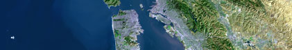
Location map
|

|
|
Bounding Coordinates
|
34.40000
-77.75000 -77.40000
34.20000
|
|
Dates
|
09/16/1991 (JD 259) to 09/19/1991 (JD 262)
|
|
Analog Materials
|
No analog holdings.
|
|
Index map

|
|
|
Crew
|
|
Rob Thieler
|
Chief Scientist, Duke
|
|
Bill Cleary
|
Chief Scientist, UNC, Wilmington
|
|
Dave Nichols
|
Electronics Technician, Navigation, USGS Woods Hole
|
|
Dan Aspenleiter
|
Captain, NOAA-NURC-UNCW
|
|
Dave Nichols
|
ET, Nav, USGS Woods Hole
|
|
Andrew Shepard
|
Science dir, diver, NURC
|
|
Glenn Taylor
|
Divemaster, NURC
|
|
|
Equipment Used
|
|
|
Purpose
|
|
|
Publications
|
|
Cruise Report exists at Woods Hole
|
|
|
Got Help?
|
For ELUS91-1, we would appreciate any information on -- activity type, analog materials, contract, days at sea, dive count, funding, information specialist, information to be derived, kms of navigation, national plan, NGDC Info, notes, owner, ports, project, project number, scanned materials, seismic description, station count, station description, submersible, summary, tabulated info.
|
|