USGS Recreation
|
|
|
|
|
|
|
|
|
|
|
|
|
|
|
|
|
|
|
|
|
|
|
|
|
|
|
|
|
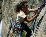
Climbing: Rocks and Mountains |
| Current News and Developing Issues Affecting Climbing Activities | Current news and developing issues affecting climbing and climbing health and safety |
| Beyond the National Parks: A Recreational Guide to Public Lands in the West | Published by the Smithsonian Institution Press - For those of us who like to venture off the beaten path, this book is a must-have. It’s filled with the best-kept secrets about 175 unique public land sites throughout the West, with several eastern sites included for good measure ... take a peek. |
| Canadian Rockies Mountaineering | Yamnuska is a leading mountain school and mountain guide service in N. America. They specialize in guide and instruction in mountaineering, rock climbing, ice climbing and ski mountaineering. |
| Caves | What are caves ? Information on Cave of the Bells, Onyn Cave, Kartchner Caverns and Colossal Cave in Arizona(USDA Forest Service). |
| Caves Biota | Video clips of Hoosier National Forest and Indiana Karst Conservacy. bats, cave and karst ecology, levels of cave adaptation, northern cave fish, cave salamanders and more (a broad band connection is recommended) |
| Crater Lake - Getting to the Bottom of Things | News Release |
| Current Activity of US Volcanoes | Seismic activity is monitored in real time for numerous volcanic areas. |
| Digital Orthophoto Quadrangles | A digital orthophoto quadrangle (DOQ) is a computer-generated image of an aerial photograph in which image displacement caused by terrain relief and camera tilts has been removed. It combines the image characteristics of a photograph with the geometric qualities of a map. |
| Earthquake Hazards Program: | Provides and applys relevant earthquake science information and knowledge for reducing deaths, injuries, and property damage from earthquakes through understanding of their characteristics and effects and by providing the information and knowledge needed to mitigate these losses. Earthquakes pose significant risk to 75 million Americans in 39 States. |
| Elevations and Distances in the U.S. | Gives elevations of features and distances between points in the United States. volcanic areas. |
| Forest and Rangeland Ecosystem Science Center | The USGS Forest and Rangeland Ecosystem Science Center provides research and technical assistance in support of sound management and conservation of biological systems in the western United States. |
| Geology of National Parks: | The 3-D tours feature National Parks, Seashores, Preserves and National Monuments. |
| Geomagnetism Program | Learn about the Earth's magnetic field which is both expansive and complicated. It is generated by electric currents that are deep within the Earth and high above the surface. All of these currents contribute to the total geomagnetic field. |
| Geology in the Parks | Our National Parks are the showcases of our nation’s rich geological heritage. This presentation is structured to inform and entice virtual and future park visitors with a non-technical approach to geology. We present the first page of any topic, including field trip stops, at the most basic level. You will find more detail as you work your way through each site. We have organized our pages into two categories: general geology topics and individual parks, and have included a link to the National Park Service Park Geology Tour site. |
| Grand Canyon Monitoring and Research Center | Measures effects of Glen Canyon Dam operations on the resources along the Colorado River from Glen Canyon Dam to Lake Mead. |
| Landslides, Debris Flows, and Rock Falls | Landslide hazards occur in many places around the world and include fast-moving debris flows, slow-moving landslides, and a variety of flows and slides initiating from volcanoes. |
| Landslide Hazards Program | Landslides constitute a major geologic hazard because they are widespread, occur in all 50 states and U.S. territories, and cause $1-2 billion in damages and more than 25 fatalities on average each year. |
| Landslide Information Center | The NLIC prepares press releases and tracks USGS investigative activities related to major landslide events. |
| Lava Safely - Common Sense is Not Enough | The volcano undergoes many changes that can be unpredictable and life threatening. |
| Maps on Demand | Limited printing of digitally supported U.S Geological Survey maps and reports. |
| Microsoft Terraserver | Ever wonder what an aerial view of your climbing area might look like? Terraserver is one of the world's largest online databases, providing free public access to a vast collection of maps and aerial photographs of the United States. |
| Mines, Mills, and Quarries - USGS Photographic Library | The U.S. Geological Survey (USGS) Central Regional Library maintains a collection of over 400,000 photographs taken during geologic studies of the United States and its territories from 1868 to the present |
| Mount Rainier, Armchair Tour | Photographic Tour of Mount Rainier ... in 12 stops learn about the geology and history of Mount Rainier, and view the peak from spots you may never have seen before |
| Mount Rainier National Park's Official Homepage | Mount Rainier, the most heavily glaciated peak in the contiguous United States, offers an exciting challenge to the mountaineer. This 14,410 foot active volcano is successfully climbed each year by thousands of people. |
| Mount St. Helens - General Slide Set. | Fifty images with captions, created by Lyn Topinka ... this slide set covers pre-eruption, May 18, 1980, aftermath, monitoring, dome growth, drainage erosion, hazards. |
| Mount St. Helens - Points of Interest | A Travel "Tour" of Mount St. Helens Volcano ... use to plan your next trip, or just sit back and take an "armchair tour" of over 30 places around Mount St. Helens. |
| National Atlas of the United States | Complete range of traditional maps and features enabling you to create your own map to explore the great outdoors and locate access points for your climbing destinations. |
| National Geologic Map Database | Locate maps showing the types of rocks in an area, their ages and structure, and a description of the geologic history from USGS, State geological surveys, professional societies, universities and other sources. |
| National Park Service Maps | National Park Service Maps for the nation. |
| North Cascades -Climbing (NPS) | Rock and weather conditions are both severe in the North Cascades. Just getting to the peaks challenges many mountaineers. Hazards of unfamiliarity confront even seasoned climbers on their first North Cascades climbs. |
| Recreation.gov | The Recreation One-Stop initiative is intended to enhance customer satisfaction with recreational experiences on public lands. It will improve access to recreation-related information generated by the Federal government, streamline the systems used to manage that information, and increase the sharing of recreation-related information among government and non-government organizations. |
| Recreation News | Online magazine covering feature cover destinations and activities within a day or weekend drive of Baltimore or Washington, D.C. Focus is on Maryland, Virginia, West Virginia, Delaware, Pennsylvania and North Carolina. |
| State Parks, Wildlife Departments and Recreational Facilities in Your Area | Pick the State of your choice for ideal climbing and recreation facilities |
| Terra Web | Terrestrial Remote Sensing Flagstaff Field Center- USGS |
| Volcanic Activity | Obtain updates of activity, current hazards assessments, and accessibility information. Make a virtual visit through photos, maps, graphics, and images. Learn about past eruptions, debris flows, and earthquakes, the geologic history, and geographic setting for volcanoes throughout the world. Links to other websites on your destination. |
| Volcanic Air Pollution- A Hazard in Hawaii | Noxious sulfur dioxide gas and other pollutants emitted from Kilauea Volcano on the Island of Hawai`i react with oxygen and atmospheric moisture to produce volcanic smog (vog) and acid rain. |
| Volcano Hazards? | Volcanoes give rise to numerous geologic and hydrologic hazards. |
| Volcanoes of the World | Descriptions, maps, items of interest, publications and useful links from the Cascades Volcano Observatory |
| Wyoming Rare Plant Field Guide | Rare Plants of Wyoming: Species Descriptions with photos and geographic locations. |

![]()
![]() U.S. Department of the Interior
U.S. Department of the Interior
U.S. Geological Survey
URL: http://recreation.usgs.gov/climbing.html
Page Contact Information: Webmaster
Page Last Modified: Thursday, 11-Sep-2008 12:03:32 EDT
