|
|
|
Metadata
|
|
ID
|
F-1-90-HW
|
|
Abstract
|
Chief Scientists: Monty Hampton, Rob Kayen. Geophysical
data (Gloriasidescan, 2channelairgun, 10khz, 3dot5khz,
gravity, magnetics, expendablebatthermograph, GPS,
integratednavigation, LoranC, RhoRho) of field activity
F-1-90-HW in Hawaii from 01/03/1990 to 01/28/1990
|
|
Project/Theme
|
Geological Long-Range Inclined Asdic (GLORIA)
|
|
National Plan
|
Resources
|
|
Chief Scientist
|
Monty Hampton
Rob Kayen
|
|
Activity Type
|
Geophysical
|
|
Platform
|
Farnella
|
|
Area of Operation
|
Hawaii
|
|
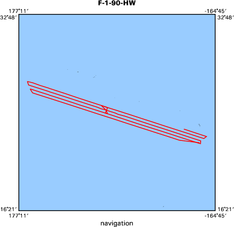
Location map
|

|
|
Bounding Coordinates
|
27.43530
178.00230 -165.56400
22.20560
|
|
Ports
|
leave Honolulu, HI
arrive ?
|
|
Dates
|
01/03/1990 (JD 003) to 01/28/1990 (JD 028)
|
|
Analog Materials
|
list
|
|
Index map
|
|
|
Crew
|
|
Monty Hampton
|
Chief Scientist, USGS Western Region
|
|
Rob Kayen
|
Chief Scientist, USGS Western Region
|
|
|
Equipment Used
|
|
Gloriasidescan
|
|
2channelairgun
|
|
10khz
|
|
3dot5khz
|
|
gravity
|
|
magnetics
|
|
expendablebatthermograph
|
|
GPS
|
|
integratednavigation
|
|
LoranC
|
|
RhoRho
|
|
|
Notes
|
|
|
NGDC Overview
|
|
! Converted to time format with year at start.
|
|
!
|
|
DATA COLLECTION OVERVIEW (use NGDC GEODAS CD to retrieve data)
|
|
|
|
MCG Data Collection ID --- F190HW
|
|
Institution Data Collection ID --- FARN0190
|
|
NGDC ID --- 06780058
|
|
Funding --- USGS
|
|
Project, Cruise & Leg --- MV FARNELLA CRUISE 1, 1990.
|
|
Study region --- +28.00000,+22.00000,+178.00000,-165.00000
|
|
Chief Scientist(s) --- DR J.B. WILSON, IOSDL
|
|
Name of vessel --- MV FARNELLA (surface ship)
|
|
Date field data collection started --- 01/05/90 HONOLULU, USA
|
|
Date field data collection ended --- 01/24/90 HONOLULU, USA
|
|
Parameters surveyed ---
|
|
Bathymetry: surveyed, contained in data file
|
|
Magnetics: surveyed, contained in data file
|
|
Gravity: surveyed, contained in data file
|
|
High-resolution seismics: (unspecified)
|
|
Deep penetration seismics: (unspecified)
|
|
Format --- (I1,A8,F5.2,4I2,F5.3,F8.5,F9.5,I1,F6.4,F6.1,I2,i1,3F6.1,I1,F5.1,F6.0,F7.1,F6.1,F5.1,A8,4I1)
|
|
Date of data input to NGDC --- 04/25/94
|
|
Contributing institution --- NATURAL ENVIRONMENT RESEARCH COUNCIL
|
|
Country --- UNITED KINGDOM
|
|
|
|
Navigation instrumentation --- GPS
|
|
Position determination method --- SATELLITE
|
|
|
|
Bathymetry instrumentation --- IOS MK3 10KHZ ECHO-SOUNDER
|
|
Additional forms of bathymetric data --- ANALOG RECORDS
|
|
General rate of bathymetry in file --- 2.0 minutes
|
|
General collection rate of bathymetry --- (unspecified)
|
|
Assumed sound velocity --- (unspecified)
|
|
Bathymetric datum code --- No correction applied (sea level)
|
|
Bathmetry interpolation scheme --- (unspecified)
|
|
|
|
Magnetics instrumentation --- (unspecified)
|
|
Additional forms of magnetics data --- (unspecified)
|
|
General rate of magnetics in file --- 2.0 minutes
|
|
General collection rate of magnetics --- (unspecified)
|
|
Magnetic sensor tow distance --- (unspecified)
|
|
Magnetic sensor depth --- (unspecified)
|
|
Two sensor horizontal separation --- (unspecified)
|
|
Residual magnetics reference field --- (unspecified)
|
|
Method of applying residual field --- (unspecified)
|
|
|
|
Gravity instrumentation --- (unspecified)
|
|
Additional forms of gravity data --- (unspecified)
|
|
General rate of gravity in file --- 2.0 minutes
|
|
General collection rate of gravity --- (unspecified)
|
|
Theoretical gravity formula --- (unspecified)
|
|
Reference system --- (unspecified)
|
|
Corrections applied --- (unspecified)
|
|
Starting land tie --- (unspecified)
|
|
Ending land tie --- (unspecified)
|
|
|
|
Seismic instrumentation --- (unspecified)
|
|
Formats of seismic data --- (unspecified)
|
|
|
Publications
|
|
Hampton, Monty A., 1990, Case studies of U.S. Geological Survey's mapping activities
|
|
in the islands' Exclusive Economic Zone, in Lockwood, Millington, and McGregor, Bonnie A., eds.,
|
|
Proceedings of the 1989 Exclusive Economic Zone symposium on Mapping and research; Federal-
|
State partners in EEZ mapping: U.S. Geological Survey Circular 1052, p. 106-112.
|
|
|
Kayen, Robert E., Hampton, Monty A., Wilson, John B., and Bishop, Derek G., 1990, Cruise report;
|
|
GLORIA survey of part of the Hawaiian Exclusive Economic Zone, F1-90-HW: U.S. Geological
|
Survey Open-File Report 90-0345, 74 p.
|
|
|
Kayen, R.E., Torresan, M.E., Dadisman, S.V., Clague, D.A., Drake, D.E., Gutmacher,
|
|
C.E., Hampton, M.A., Marlow, M.S., Moore, J.G., Normark, W.R., Pickthorn, L.G., Shor, S.,
|
|
Denlinger, Roger P., Holcomb, Robin T., Holmes, Mark L., Lipman, P.W., Belderson, R.H.,
|
|
Jacobs, C., Searle, Roger C., Wilson, J.B., and Rothwell, R.G., 1990, GLORIA side-scan
|
|
sonar imagery of the Hawaiian Islands exclusive economic zone: American Geophysical
|
Union Eos, Transactions, v. 71, no. 43, p. 1580.
|
|
|
Binard, N., Moore, J.G., Normark, W.R., and Holcomb, R.T., 1993, Comparison of features
|
|
identified by swath-sonar mapping (GLORIA) and their 3.5 kHz echo-sounding features on
|
|
the Hawaiian Ridge: American Geophysical Union Eos, Transactions, v. 74, no. 43, Supplement,
|
p. 342.
|
|
|
Got Help?
|
For F-1-90-HW, we would appreciate any information on -- contract, days at sea, dive count, funding, information specialist, information to be derived, kms of navigation, organization, owner, project number, purpose, scanned materials, seismic description, station count, station description, submersible, summary, tabulated info.
|
|