

Activities > Vegetation
[ || Soil Moisture || Geology & Soil Texture || Biological Soil Crusts || Fire || Vegetation Dynamics || Soil Compaction || Wind Erosion || Climate || Repeat Photography || Land Use History || Spatial Modeling || ]
Vegetation Dynamics
 |
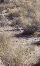
The general perception of the Mojave Desert is one of an unchanging ecosystem with perennial vegetation that is thousands of years old. This perception contributes to the idea that once disturbed, Mojave Desert vegetation will not recover without active human intervention. In addition, plant communities (plants of similar habitat that are grouped together and used for classifying and mapping desert vegetation) are commonly considered to be not that sensitive to climatic fluctuations. Therefore, change in this ecosystem is typically attributed to human landuse factors.
The purpose of this activity is to understand the natural dynamics of vegetation in the Mojave Desert and how vegetation recovers from disturbance. This nderstanding will allow us to quantitatively define and spatially describe the vulnerability and recoverability of desert perennial vegetation in the Mojave Desert. Studies will use various techniques to analyze natural change.
Methodology
Techniques will include the following:
• Use repeat photography of a variety of sites throughout the Mojave in conjunction with repeated measurement of vegetation in plots designed to capture the effects of climatic fluctuations on a variety of vegetation types
• Compare vegetation recovering in a dated disturbance to nearby ambient vegetation
• Conduct process studies of ecosystem attributes, such as seed dispersal
• Analyze and reformulate vegetation maps, which will enable scaling data and transfer of results between regions of the desert
Studies for this RVDE activity encompass four phases.
• Phase 1—Remeasure perennial vegetation on the Beatley plots. Using Beatley's original methods, remeasure as many of the existing plots as is feasible. Resulting data will be evaluated to determine if they are adequate to address questions about the long-term stability of perennial vegetation assemblages. • Phase 2—Remeasure annual vegetation on an annual basis in selected undisturbed plots and in all plots where disturbance was part of Beatley's original sample design. • Phase 3—Remeasure rodent populations, with particular emphasis on plots where disturbance recovery from fire was the focus of the plot design. • Phase 4—Analyze recovery in perennial vegetation in plots where burns and other severe disturbances were part of the original plot design. Other permanent plot measurements (for example, the Becamp plots) will be incorporated where feasible.
Natural Vegetation Change
The principle study area for natural vegetation change is the Nevada Test Site. The Nevada Test Site was withdrawn from typical land use management in 1951 and had little or no grazing over much of its area prior to that time. In 1963, Janice C. Beatley established 68 permanent vegetation plots to study natural change in typical desert plant associations in the northeastern Mojave Desert. Along with measurement of perennial vegetation, Beatley measured environmental variables, desert annual vegetation, and rodent populations. These plots, 66 of which still exist, comprise the most long-term ecological data available for the Mojave Desert and are an ideal platform to address the effect of climatic fluctuations on dynamics of the Mojave Desert ecosystem.
Products
Webb, R.H., Esque, T.C., Medica, P.A., DeFalco, L.A., and Murov, M.A., 2001, Monitoring of ecosystem dynamics in the Mojave Desert: The Beatley permanent data: U.S. Geological Survey Fact Sheet 040-01, 4 p.
Mojave Desert Ghost Towns and Mining Sites — USGS website
Vegetation Recovery from Disturbance
Restoration of severely disturbed lands is a pressing problem for land managers in the Mojave Desert. Active restoration requires millions of dollars of work, and there is no guarantee of success; many past reclamation projects have failed. Natural recovery, where severely disturbed lands are allowed to recover with no human intervention and minimal additional disturbance, could be a viable mechanism for restoration of severely disturbed lands in the Mojave Desert. Ghost towns and other historical disturbances, where little or no post-abandonment disturbance has occurred, provide exceptional analogs for natural recovery.

The purpose of this study is to quantitatively define natural recovery of perennial vegetation in the Mojave Desert, both by measurement of the amount of recovery at selected sites and by collation of known recovery amounts reported in the scientific literature. Quantitative characterization of temporal rates of recovery and application of these functions to vegetation-recovery maps (spatial-temporal modeling) will provide information to land managers that they can use for landuse assessments, revegetation planning, and compliance monitoring.
In addition, this information can be used to further develop a general model of plant succession in the Mojave and to develop hypotheses of vegetation change that can be tested against the confounding influence of global climate change.
The objective of this study is to quantitatively define the recovery of perennial vegetation using several recovery benchmarks:
• Visual recovery (ability to recognize a disturbance from a distance)
• Recovery of total cover of perennial vegetation
• Recovery of density of perennial vegetation
• Recovery of species composition
Methodology
Dated disturbances such as ghost towns, roads, or pipeline right-of-ways were measured to develop quantitative projections of recovery of vegetation cover and density and species composition after a variety of disturbances. By statistically examining dated disturbance data compiled from field work and literature with respect to total vegetation response and individual species response, transfer functions can be developed to define recovery rates. The rate of recovery may vary by the type of vegetation assemblage in which the disturbance occurs, the size and type of disturbance, the surficial geology and topography of the site, and climatic events. Each of these parameters is investigated.
Products
Steiger, J.W., and Webb, R.H., 2000, Recovery of perennial vegetation in military target sites in the eastern Mojave Desert, Arizona: U.S. Geological Survey Open-File Report 00-355, 28 p.
Webb, R.H., Steiger, J.W., and Turner, R.M., 1987, Dynamics of Mojave Desert shrub vegetation in the Panamint Mountains: Ecology, v. 68, p. 478-490.
Recovery Processes
Recovery of severely disturbed ecosystems in the Mojave Desert is affected by the species composition of nearby vegetation, climate history, and seed dispersal mechanisms. Seeds of typical perennial species are dispersed through wind, gravity, and transport by insects and/or rodents. Rodent dispersal is particularly important for species with large seeds because the animals cache seeds, effectively planting them. Because rodents and arthropods consume seeds as well as cache them, the fate of seeds is an important determinant of recovery as well. Germination/establishment is species-specific and climatically driven.
Periodic wet periods, which typically are associated with El Niño events in the Mojave Desert, may result in a large cohort in a good year with many years between cohorts. The combination of seed dispersal, consumption by animals, and favorable climatic conditions likely drives the initial establishment of perennial vegetation following disturbance, and quantitative knowledge of these processes is essential to modeling of the recovery process.
The objectives of this research are the following:
• Determine seed dispersal mechanisms for common Mojave Desert species through a combination of literature review and active research
• Conduct research on the dispersal and fate of seeds transported by rodent and arthropod populations
• Determine cohort age and age-stand distributions for common Mojave Desert assemblages (particularly blackbrush)
• Quantitatively define the probabilities and processes that lead to establishment of common dominant species
Methodology
RVDE scientists studied seed dispersal mechanisms and establishment frequency of species involved in the recovery of burned blackbrush stands on the Nevada Test Site and in the northeastern Mojave Desert, primarily on the alluvial aprons surrounding the Spring Mountains near Las Vegas. This work included age-dating of blackbrush seedlings using newly developed stem-ring counts and measurements; use of radio-labeled seeds to determine dispersal mechanisms and seed fate; trapping of rodents to determine species compositions of individuals involved in the recovery process; literature reviews to determine past work; and remeasurement of perennial vegetation in selected plots recovering from historical fires.
Mapping Vegetation Dynamics
Vegetation in the Mojave Desert responds to disturbance in ways that can be characterize temporally and spatially. Prediction of vegetation dynamics and recoverability requires maps of vegetation distribution of suitable resolution and accuracy. Vegetation maps exist for the east Mojave in California (the Central Mojave Vegetation Map) and for the Nevada Test Site (the Nevada Test Site Vegetation Map). These maps can be used for preliminary modeling of vegetation recoverability and dynamics, and these maps can be modified to be even more applicable to the spatial-temporal modeling of vegetation dynamics. Vegetation mapping for the remainder of the Mojave is still needed.
 |
The objectives for this research are the following:
• Develop quantitative models of vegetation recovery based on existing literature and measured dated disturbances
• Determine how the two existing vegetation maps can be modified for the best use for modeling vegetation dynamics and recovery
• Develop prototype maps of vegetation recovery for the Mojave National Preserve and the Nevada Test Site
• Develop plans to map vegetation for the remainder of the Mojave Desert that is adequate for ecosystem-wide modeling of vegetation dynamics and recovery
Methodology
To create the prototype maps of vegetation recoverability for the Mojave National Preserve and the Nevada Test Site, the transfer functions developed from quantitative examination of measured dated disturbances will be applied to maps of vegetation assemblages for both areas. This requires reworking the plot data for both the Central Mojave Vegetation Map and the Nevada Test Site Vegetation Map to reflect vegetation assemblages suitable for modeling. Distribution of the assemblages will be correlated with available maps of environmental variables such as surficial geology, aridity indices, soil moisture, and derived satellite imagery (if available) and will be statistically analyzed. The assemblage distributions will be modified as appropriate. The results will determine techniques suitable for ecoregion-wide vegetation dynamics mapping.
Products
Webb, R.H., Esque, T.C., Medica, P.A., DeFalco, L.A., and Murov, M.A., 2001, Monitoring of ecosystem dynamics in the Mojave Desert: the Beatley permanent data: U.S. Geological Survey Fact Sheet 040-01, 4 p.

Thomas, K.A., Franklin, J., Keeler-Wolf, T., and Stine, P., 2004, (ArcInfo), U.S. Geological Survey Technical Report.
The Central Mojave Vegetation Map displays vegetation and other land cover types in the eastern Mojave of California. Map labels represent alliances and groups of alliances as described by the National Vegetation Classification. The nominal minimum mapping unit is 5 hectares. A primary land cover type and a secondary type label each map unit where applicable. In addition, the source of data for labeling each map unit is also identified in the attribute table for each map unit. Data were developed using field visits, 1:32,000 aerial photography, SPOT satellite imagery, and predictive modeling. These data were developed as part of the Department of Defense Legacy funded Mojave Desert Ecosystem Program.
Thomas, K.A., Franklin, J., Keeler-Wolf, T., and Stine, P., 2005, Central Mojave vegetaion database: U.S. Geological Survey Fact Sheet 2005-3098, 4 p.
[ || Overview || Activities || Products || Photo Gallery || Glossary || Links || Feedback || Sitemap || ]
| [ USGS Home | Biology | Geography | Geology | Water | Contact Us | Ask USGS | Search ] |
| U.S. Department of the Interior | | U.S. Geological Survey | | National Mapping Information 345 Middlefield Road, Menlo Park, CA 94025, USA URL: http://mojave.usgs.gov/rvde/activ_vege.html Maintainer: Web Team WRG Sites: Hawaii Data Clearinghouse | | Crater Lake | | Lake Tahoe Last modified: Wednesday, 16-Jun-2004 15:53:02 EDT (alv) Privacy Statement || Disclaimer || FOIA || Accessibilty || Feedback || Search/Links |