A catalog of NASA images and animations of our home planet
Skip Navigation (key s)
.
Home
Terms of Use
Frequently Asked Questions
Browse By:
Satellite
Sensor
Collections
Country
U.S. State
GCMD Topic
All Categories
»
GCMD Topics
»
Land Surface
»
Topography
»
Relief
MISR Sees the Sierra Nevadas in …
SRTM Anaglyph: Fiji Islands
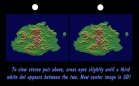
SRTM Stereo Pair: Fiji Islands
Tectonic Map of North Pole
Tectonic Map of South Pole
Radar Image with Color as Height: …
Perspective View with Radar Image …
Perspective View with Radar Image …
Mount St. Helens Flyover
SRTM Perspective View with Landsat …
SRTM Stereo Pair: Bhuj, India, Two …
Front Range of the Rockies
Sredinnyy Khrebet, Kamchatka …
Salt Lake City, Utah, Perspective …
Perspective View: San Diego, …
Western United States Beyond the …
Sort By: Data Date
↑
↓
Visualization Date
↑
↓
ID
↑
↓
« ‹ 1 › »
Subcategories