Featured Topic
 Help Track Invasive Species! Help Track Invasive Species!
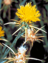
Enhance summer hikes by helping to keep invasive plants, animals, and diseases out of ecosystems where they don't belong. Volunteers are needed to record data about invasive kudzu, giant hogweed, yellow star thistle, snakehead fish, feral cats, and more. This is a great summer assignment for students! Find information at these USGS-sponsored sites:
Invasive Plant Atlas of New England
Invasive Plant Atlas of the Mid-South
The Cactus Moth Monitoring and Detection Network
Purple Loosestrife Volunteers
Invaders of Texas Citizen Science Program
Maui County Report a Pest
Featured Topics Archive |
USGS Educational Resources For Primary Grades Grades K-6
USGS Educational Resources For Secondary Grades Grades 7-12
USGS Educational Resources For Undergraduate Education Community Colleges and Universities
USGS Resources For California's Education Standards (K-12)
This Web site links selected online resources to an established list of Science and History-Social Science content standards for California.
Schoolyard Geology
Activities and examples of ways to turn a "field trip" through your own schoolyard into a rich geologic experience.
USGS Teacher Packets
Originally created as printed products, each teacher packet contains a teacher guide, materials, and activities covering volcanoes, maps, geologic age, fossils, caves, or ecosystems. Suitable for K-12, as indicated.
The "GIS Lab"
Lessons, data, and information about using Geographic Information Systems (GIS) and spatial analysis in education.
The "GPS Class"
Lessons and information about using Global Positioning Systems (GPS) in education.
USGS Publications
Search database of over 69,000 USGS maps, books, and other publications.
USGS Store
Use the USGS Store to browse and purchase paper maps and other products that are popular with educators. Just enter the Store and click on "Education Products" (teacher discounts are available). Also download free digital topographic maps by clicking on "Map Locator".
USGS Photo and Image Collections
A comprehensive list of USGS photos and images for public use.
Ask USGS
Can't find the information you need? Send your question to Ask USGS or call 1-888-ASK-USGS (1-888-275-8747). For questions related to geology only, receive a personal response from a USGS scientist by contacting Ask-A-Geologist.
|
 USGS Podcast Series USGS Podcast Series
USGS CoreCast audio files (4-15 minutes long) address topics ranging from natural hazards to human health and wildlife disease. Short on time but big on science? Listen to very brief audio files at USGS CoreFacts.
Educational Videos and Animations
A collection of USGS videos and animations covering a wide range of science.
Videotaped Lectures
A compilation of USGS videotaped lectures.
Find A Map!
Links to popular USGS map resources and map databases, including the: The National Map, and The National Atlas.
Our Changing Planet
Think that geography is just memorizing state capitals? With these USGS resources and lessons, you'll be investigating our changing planet!
Careers in Science
Web resources and videos about USGS Science and Careers.
Internships, Employment Opportunities, and Research Grants
See what opportunities are available for undergraduate and graduate students, and faculty to participate in USGS science.
NAGT-USGS Cooperative Field Training Program
Thirty-four student interns have been placed in the 2009 National Association of Geoscience Teachers (NAGT)-USGS Cooperative Summer Field Training Program. Take a look at the exciting projects in which these students will be participating.
|
USGS Education Resources for Teachers
Incorporate USGS science in lesson-planning with help from this convenient handout.
New site from the NBII
Visit the National Biological Information Infrastructure (NBII) Kids page to create an animal coloring book, learn about invasive species, read stories about interesting animals, play nature games, test your knowledge of the natural world, and more cool stuff!
Price Increase
Effective March 15, 2009, there will be a $2.00 increase in the price for many USGS paper maps. Teacher discounts will still be available.
Reduced Price on Lewis and Clark Poster
Lewis and Clark: A Legacy of Science is now available from the USGS Store for only $5 plus $5 shipping. This beautiful reproduction of the Lewis and Clark route is matched by a modern map of the same area. Product #113605.
Track Alaska Walruses
USGS scientists attached satellite radio-tags to 17 walruses in Alaska during March. The radio-tags will provide estimates of walrus locations for 6 to 8 weeks. Watch their progress!
USGS Attends 2009 NSTA National Conference
The USGS participated in the 2009 National Science Teachers Association (NSTA) National Conference held in New Orleans, Louisiana on March 19-21, 2009.
|

