
- Home
- About S&T
- Taxa/Organisms
- Ecosystems
- Issues
- Methods & Tools
- Reports & Publications
- Location
- Search
Publisher: USGS | Science Center: Fort Collins Science Center (FORT, Ft. Collins) | Format: URL
www.fort.usgs.gov — This web resource is a compilation of research projects related to Energy, Land Use, and Sagebrush Ecosystems. Investigators at the USGS Science Centers (FORT and FRESC), and Central Regional Office have brought biological and ecosystem research and mapping expertise to a partnership with the Bureau of Land Management, Wyoming Game and Fish More...

May 21 2009 | Publisher: USGS | Format: URL
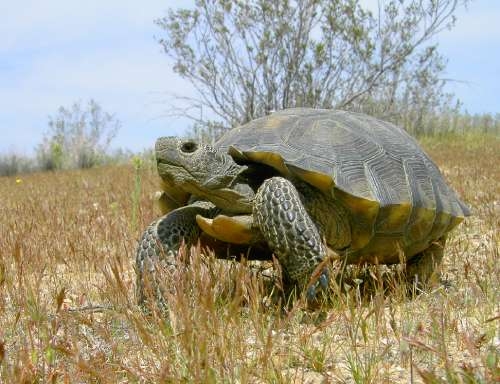
pubs.usgs.gov — A new tool provides land managers with a predictive model for mapping the potential distribution of desert tortoise habitat and to evaluate different land-use issues the tortoises face at a landscape scale. The model incorporates an extensive amount of field data for desert tortoises, as well as environmental data related to landscape attributes, More...
July 2007 | Publisher: Other (Ecological Society of America (ESA) Journal) | Format: URL
www.esajournals.org — Periodic wildfire maintains the integrity and species composition of many ecosystems, including the Mediterranean-climate shrublands of California. However, human activities alter natural fire regimes, which can lead to cascading ecological effects. Increased human ignitions at the wildland-urban interface (WUI) have recently gained attention, but More...

February 2006 | Publisher: USGS | Science Center: Pacific Island Ecosystems Research Center (PIERC, Honolulu) | Format: .PDF
biology.usgs.gov — A success story of how Kanaha Beach Park once degraded with overuse, invasive species, vehicle traffic, and litter was restored into a cleaner and safer place for people and native wildlife.

Publisher: USGS | Format: URL
chesapeake.usgs.gov — USGS Chesapeake Bay Activities provides information on the science activities and research by the U.S. Geological Survey to provide integrated science to support effective ecosystem conservation and restoration in the Chesapeake Bay watershed. This website links to features and publications to provide an understanding and management of the Bay More...
Publisher: USGS | Format: URL
burnseverity.cr.usgs.gov — This project addresses the need to quantify fire effects over large, often-remote regions and long time intervals, reflecting collaborative efforts to bring previous research into operational implementation for fire managers and scientists. The project focuses on National Park Service Units and adjoining lands throughout the U.S., combining More...
Publisher: USGS | Science Center: Fort Collins Science Center (FORT, Ft. Collins) | Format: .PDF
www.fort.usgs.gov — Migratory birds face many changes to the landscapes they traverse and the habitats they use. Wind turbines and communications towers, which pose hazards to birds and bats in flight, are being erected or proposed across the United States and offshore. Human activities can also destroy or threaten habitats critical to birds during migratory passage, More...
Publisher: USGS | Format: URL
biology.usgs.gov — This website addresses some of these questions for several regions of North America, conveying the importance of a historical context for understanding ongoing changes in land cover and land use. It also aims to inspire scientists, educators, and science administrators to contribute to the development of a comprehensive land-use history of North More...

Publisher: USGS | Science Center: Western Fisheries Research Center (WFRC, Seattle) | Format: URL
wfrc.usgs.gov — There are approximately 500,000 abandoned mines in the western US. Collectively, these mines pollute rivers, streams, and western reservoirs with millions of tons of metals annually that degrade aquatic habitat and water used by humans for drinking, recreation, and irrigation. However, there is great potential in decreasing or eliminating the flow More...
Publisher: USGS (San Diego Field Station) | Science Center: Western Ecological Research Center (WERC, Sacramento) | Format: URL
www.werc.usgs.gov — The Pacific iguanas of the Fijian and Tongan archipelagos are a biogeographic enigma in that their closest relatives are found only in the New World, separated by 8,000 km of ocean. The Pacific iguanas have been dramatically affected by human activities; two species were eaten to extinction after human arrival in the Pacific some 2,800 years ago. More...
Publisher: USGS | Science Center: Northern Rocky Mountain Science Center (NRMSC, Bozeman) | Format: URL
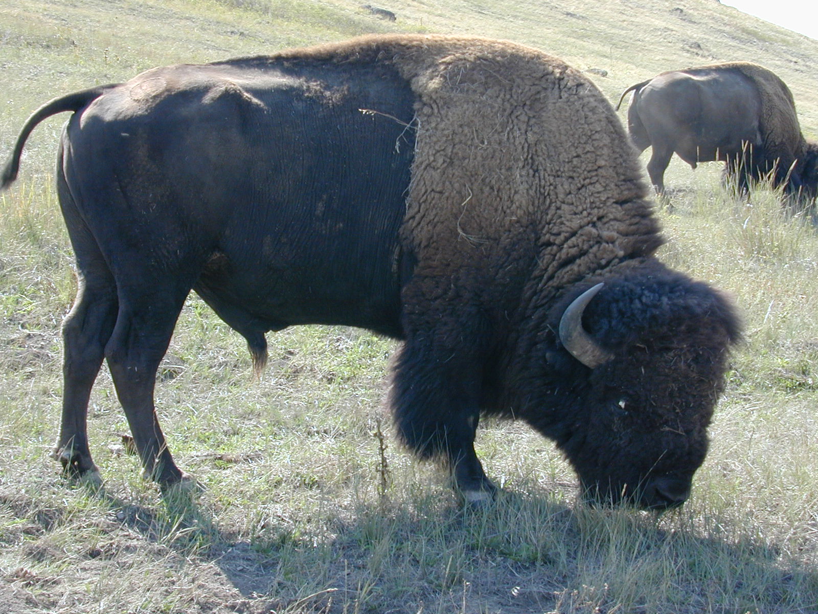
www.nrmsc.usgs.gov — A study overview related to the role of the National Bison Range in the long-term management of Federal bison herds. This research will provide the data necessary to assess the impacts of management actions implemented under the new management plan, and examine the plan`s underlying assumptions regarding demographic responses of the Yellowstone More...
Publisher: USGS | Science Center: Northern Rocky Mountain Science Center (NRMSC, Bozeman) | Format: URL
www.nrmsc.usgs.gov — To devise credible strategies for managing human-wildlife conflicts, managers need information about the importance of specific areas to particular species. In the Greater Yellowstone Area, for example, development of low-elevation areas seriously threatens vital ungulate winter ranges, with obvious implications for both ungulates and their More...

