


|
|
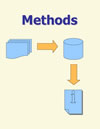
Stream Temperature Modeling |
|
|
Air Temp Based Model |
|
|
Spatial Statistical Model |
|
|
Multiple Regression Model |
|
|
|
|
|
|
|
|
|
|
|
|
|
|
Contacts |
|
|
About the Rocky Mountain Research Station |
|
AWAE Program Headquarters Boise, ID 83702 (208) 373-4340
(970) 295-5923 |
|
|
|
|
|
Rocky Mountain Research Station Home > Science Program Areas > Air, Water and Aquatics > Boise Lab Stream Temperature Modeling > Multiple Regression Stream Temperature Model
Stream Temperature Modeling
multiple regression Stream Temperature Model
|
|
||||||||||||
|
|
|||||||||||||


 Maps
Maps
Rocky Mountain Research Station
- Air, Water and Aquatic Environments Sciences Program
Last Modified:
Thursday, 19 March 2009 at 14:27:19 EDT