| site map |  | contact us |
|
|
| Climate / Records |
|
- daily & monthly - sunrise / sunset - storm stats |
| Hazardous Weather |
|
- Watches / Warnings - hazardous wx outlook - report severe weather ! - Nat'l Hazards Assessment - [ MORE... ] |
|
- select products... - current conditions - forecasts - maps - satellite images - NEXRAD radar - rainfall resources - [ MORE... ] |
| Aviation Weather |
|
- TAFs - METARS - [ MORE... ] |
| Climate / Records |
|
- daily & monthly - sunrise / sunset - storm stats - archived info |
| Lakes / Rivers |
| . |
| NOAA Weather Radio |
| . |
| Fire Weather |
| . |
| Tropical Weather |
| . |
| Preparedness Info |
| . |
| Education / Outreach |
| . |
| About Us |
| . |
| FAQs & Misc. |
| . |
| Additional Links |
| . |
|
Disclaimer:
Data found on this page are preliminary. For official historical records contact the National Climatic Data Center. |
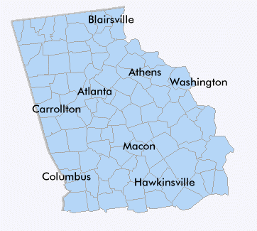
| Monthly Normals for Selected Sites |
|---|
| Athens |
| Atlanta |
| Blairsville (Union County) |
| Carrollton (Carroll County) |
| Columbus |
| Hawkinsville (Pulaski County) |
| Macon |
| Washington (Wilkes) |
| Clickable Map |
|---|
|
|
|
|
Some data presented on this page are courtesy of... |
 Back to home page