Current Hazards Middle Tennessee Graphical HWO Severe Wx Mode National Current Conditions Observations COOP Program Satellite Images Rivers & Lakes AHPS Precip Analysis Drought Information Radar Imagery Nashville HPX | HTX | GWX Nationwide Weather Forecasts Activity Planner Middle Tennessee Aviation Air Quality Graphical Fire Weather Climate Local National More... Tropical Weather Tropical Weather Hurricane Center Weather Safety Storm Ready Preparedness SKYWARN Weather Radio Additional Info About Our Office About the NWS Education Research Storm Summaries Tornado Database Product Guide SWAW 2009 WWAW 2008 Contact Us NWS Nashville
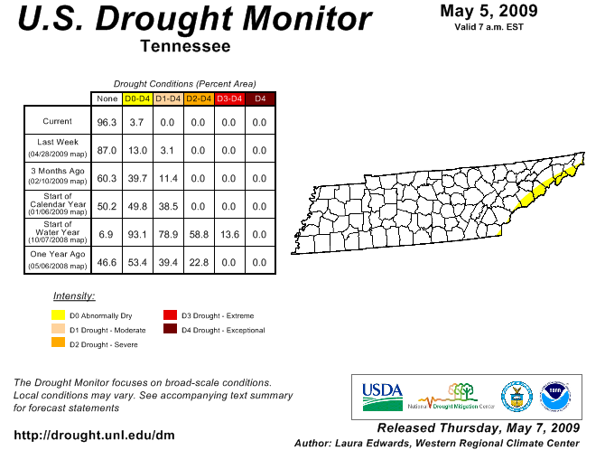
Drought Indices Drought Information Statement U.S. Drought Monitor Drought Classifications Palmer Drought Index Crop Moisture Index Soil Moisture Index Soil Moisture Anomaly Keetch-Byram Drought Index Current Fire Danger Standardized Precipitation Indices Drought Impact Reporter (Report your drought impacts here!)
Rainfall Analysis Observed Precipitation Last 24 Hours Observed Precipitation Last 7 Days Observed Precipitation Last 14 Days Percent of Normal Precipitation This Month Percent of Normal Precipitation This Year Precipitation Needed To End Drought
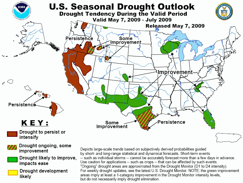
Outlook Information 6 to 10 Day Outlook 8 to 14 Day Outlook One Month Outlook Three Month Outlooks Drought Outlook
USGS Information Current Nationwide Streamflow Information Current Statewide Streamflow Information Current Statewide Drought Watch Information 7 Day Below Normal Streamflow Information 14 Day Below Normal Streamflow Information 28 Day Below Normal Streamflow Information TVA Information Tennessee River Basin Stream Flows Tennessee River Basin Precipitation Information
Additional Drought Related Information NOAA Drought Information Center National Climatic Data Center State Drought Agency Tennessee Department of Environment and Conservation University of Tennessee Extension Tennessee Fire Prevention

 National Weather Service Forecast Office
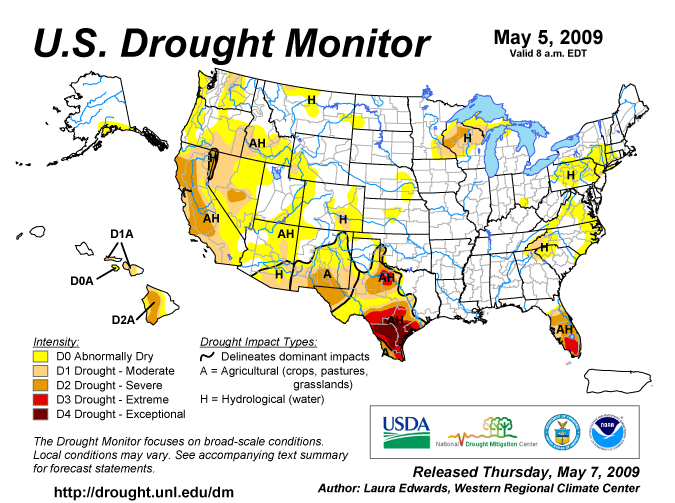