Where You Live
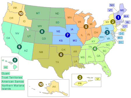
At this time, the ROE mainly presents information at the scales of the entire nation or by the EPA Regions (see map below). However, EPA is exploring ways to present the ROE information at finer scales in future updates.
To use the Regional map, start by clicking on your own state (inside 1 of the 10 EPA Regions), and you will be taken to the PDF from that region of states with EPA 2008 ROE Indicators. For more current or detailed indicator information, find that indicator on the ROE Dynamic Web site A to Z list.
- ROE: Indicators Presenting Data for EPA Region 1 (PDF) (106 pgs, 14 MB, about PDF)
- ROE: Indicators Presenting Data for EPA Region 2 (PDF) (112 pgs, 15.5 MB, about PDF)
- ROE: Indicators Presenting Data for EPA Region 3 (PDF) (111 pgs, 15 MB, about PDF)
- ROE: Indicators Presenting Data for EPA Region 4 (PDF) (109 pgs, 15 MB, about PDF)
- ROE: Indicators Presenting Data for EPA Region 5 (PDF) (99 pgs, 13.6 MB, about PDF)
- ROE: Indicators Presenting Data for EPA Region 6 (PDF) (117 pgs, 15.8 MB, about PDF)
- ROE: Indicators Presenting Data for EPA Region 7 (PDF) (94 pgs, 13 MB, about PDF)
- ROE: Indicators Presenting Data for EPA Region 8 (PDF) (94pgs, 13 MB, about PDF)
- ROE: Indicators Presenting Data for EPA Region 9 (PDF) (116 pgs, 15.5 MB, about PDF)
- ROE: Indicators Presenting Data for EPA Region 10 (PDF) (115 pgs, 15.5 MB, about PDF)
Reports by EPA region:
Please contact roe@epa.gov for more assistance.